





A wheel of low pressure is forecast to roll over Florida beginning Sept. 18 with widespread rainfall for the state and the potential for severe thunderstorms carrying hail.
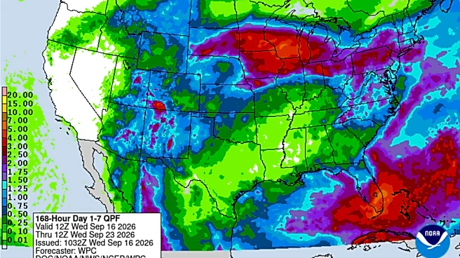
The Weather Prediction Center is expecting as muchas four inches of rain in parts of South Florida through the weekend, reducing to about two inches through the Treasure Coast and Central Florida with even less in North Florida and the Panhandle.
Thelow pressureis moving from from the Atlantic to the Gulf where AccuWeather is giving it minimal chances to form into a subtropical or tropical storm.
National Hurricane Center forecasts showed nothing developing in that area as of early Sept. 16 and was only watching a spot several hundred miles east of Bermuda that will not affect
the U.S. The next names on the 2026 hurricane listare Fay, followed by Gonzalo.
An atmospheric mechanism called a Rex Block is responsible for the clockwise spin in the upper atmosphere that is expected to incite showers and thunderstorms through the weekend. It happens when high pressure sits north of an area of closed off low pressure — causing a stall in overall flow patterns at 18,000 feet overhead.
AccuWeather senior meteorologist Isaac Longley said in this case the high pressure is cutting the upper level area of low pressure off from the jet steam and then pushing it south.
"It's going to be a fairly stormy weekend because of that," Longley said. "That is a trigger mechanism for the showers and thunderstorms to develop."
National Weather Service forecasters in Miami are predicting an 80% chance of rain for much of South Florida each day beginning Friday and lasting through the weekend.
In Central Florida, only "slightly above normal" rain chances are expected each day through the weekend, while the Tallahassee area and spots further west in the Panhandle have a 20 to 40% chance of showers.
"It's not necessarily going to be a washout for everyone, but there will be more noticeable widespread showers and thunderstorms except in the Panhandle where it will be spotty," Longley said.
Will Florida get any temperature relief from the storms?

Meteorologist Matt Devitt noted the upper-level low pressure that will move over Florida will also drop temperatures in high in the atmosphere 8 to 10 degrees colder than normal.
"As a result, it creates greater instability and lower freezing levels, leading to more hail (and larger) along with frequent lightning and heavy rain," he said in a social media post. "In short... storms will likely have an additional 'kick' to them into the weekend."
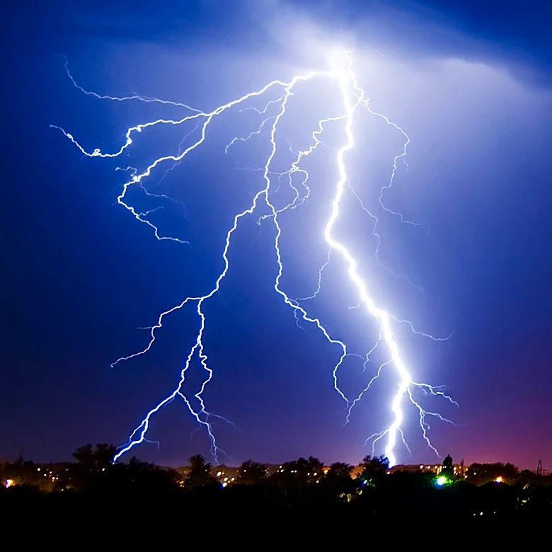
Especially cold upper air temperatures can also trigger lighting as ice particles form and collide. The collision transfers electrons and separates electrical charges with negatively charged ice falling toward the bottom of the cloud, where it can discharge lighting to Earth.
Six people have been killed by lightning in Florida this year, including the Sept. 8 death ofMatthew Jenkins, who was struck while walking on a path in Celebration at about 6:25 p.m.
Kimberly Miller is a journalist for the USA TODAY NETWORK FLORIDA. She covers weather, the environment and critters as the Embracing Florida reporter. If you have news tips, please send them to kmiller@pbpost.com. You can get all of Florida’s best content directly in your inbox each weekday by signing up for the free newsletter, Florida TODAY, at palmbeachpost.com/newsletters.
This article originally appeared on Palm Beach Post: Get ready for stormy Florida weekend with 'additional kick' of lightning