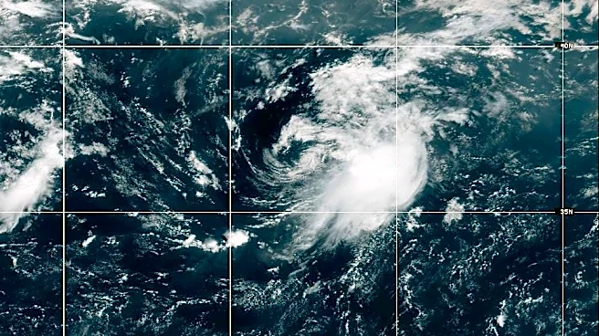




A churn of showers and thunderstorms that bullied off the coast of Africa on Aug. 24, was quickly given a high chance of developing into a tropical cyclone, potentially making it the firstlong-winded Cabo Verde storm of the year.
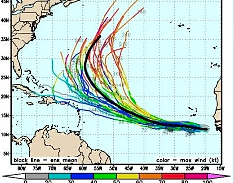
Climatologically, if something forms, it would more than likely turn out to sea, squirted north between a drooping jet stream and the clockwise swoosh of the Bermuda High, said AccuWeather lead hurricane forecaster Alex DaSilva.
But if it stays weak, the system would be guided by the lower-level trade winds, shuttling it west closer to the Lesser Antilles, Puerto Rico and the southeastern Bahamas in about 10 days.
And there’s always a chance it could dissolve as its recent predecessors did when faced with the challenge
of wind shear and drier air, although DaSilva said both elements have lessened in pockets giving an ambitious system room to grow.
What are the chances a potential named storm could impact Florida?
“There are several Google models that are near the East Coast that keep it weak until near the Bahamas and then develop it rapidly,” DaSilva said. “Given the pattern, it’s going to be hard for anything to just come driving into Florida but it’s definitely something we want to keep an eye on.”
As of early Tuesday, the area of low pressure dubbed Invest 96L was a few hundred miles south-southeast of the Cabo Verde Islands with a 70% chance of becoming at least a tropical depression over 48 hours.
The National Hurricane Center said conditions are amenable for gradual development and that a tropical depression is likely to form during the next few days. The environment couldbecome less conducivefor development by the weekend.
The center is also watching another area, Invest 95L, that is a couple hundred miles east-northeast of Bermuda and is moving north at 15 to 20 mph.
That system has a 40% chance of development over 48 hours and “could become a short-lived tropical depression or storm later today before encountering increasingly hostile conditions tonight and Wednesday,” NHC forecasters wrote.
The next names on the 2026 hurricane list are Dolly and Edouard.
If 96L survives, FOX Weather hurricane specialist Bryan Norcross said several computer simulations are forecasting it to become a hurricane with a track north of the Caribbean where wind shear has been its strongest all season.

“That wouldn’t be until next week, so it’s nothing to think too hard about at this point,” Norcross said in his Hurricane Intel column.
Andy Hazelton, a scientist at the University of Miami's Cooperative Institute for Marine and Atmospheric Studies, said late Monday there were discrepancies in the forecast between the traditional physics-based weather models and newer AI models.
Traditional models more aggressively developed the system, while AI models were less enthusiastic “in the short term.”
For example, Hazelton noted the American or GFS model made 96L into a hurricane that curves away from the Caribbean. The AI version of GFS predicted a weaker system that takes it into the Caribbean.
“The general steering flow suggests this hopefully won’t be a threat to the Continental United States, but it’ll be worth watching, particularly if it waits to develop and doesn’t gain much latitude over the next few days,” Hazelton said in his blog.
What is the date of peak hurricane season?
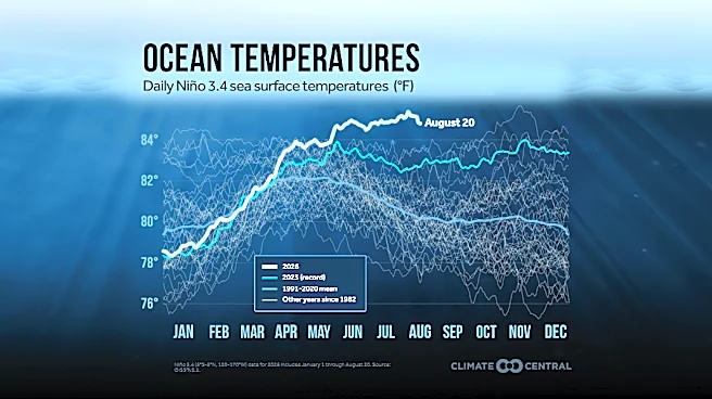
The Atlantic basin is five days into the peak of hurricane season, a time when summer-warmed sea surface temperatures, a dwindling of dry Saharan dust and more frequent tropical waves off Africa combine to heighten activity.
Hurricane season reaches a pinnacle Sept. 10 before starting to taper off into mid-October. Hurricane season runs through Nov. 30.
This year, the season is well behind in activity with the fourth named storm typically forming by Aug. 15 and the first hurricane forming by Aug. 11. The average date for the season’s first major hurricane is Sept. 1.
It’s also woefully lagging in other benchmarks, including experiencing just 4.5 named storm days, when the average is 18.5, according to Colorado State University. The Accumulated Cyclone Energy (ACE) this season is just 3.1 when the average is 24.9.
ACE is a measure of storm strength and longevity.
“A lot of people may have tuned this season out and then suddenly you have something on your doorstep,” DaSilva said. “There’s nothing immediate happening but it’s still hurricane season.”
Kimberly Miller is a journalist for the USA TODAY NETWORK FLORIDA. She covers weather, the environment and critters as the Embracing Florida reporter. If you have news tips, please send them to kmiller@pbpost.com. You can get all of Florida’s best content directly in your inbox each weekday by signing up for the free newsletter, Florida TODAY, at palmbeachpost.com/newsletters.
This article originally appeared on Palm Beach Post: Florida hurricane experts watching Invest 96L as it creeps west