

An ambitious El Niño is ripening to something the world has never experiencedbefore and to such an extreme there’s not even a name for it.
The periodic climate pattern that crushes tropical cyclones in the Atlantic basin during hurricane season is forecast to reach historic levels with water temperatures warming to such a sizzle the official meteorological superlatives of “strong” and “very strong” are expected to be surpassed.
A forecast issued Sept. 10 by the Climate Prediction Center confirms the deepening El Niño with a prediction that during the months of October through December there is a 75% chanceits virility will “exceed the strength of previous El Niño events dating back to 1950.”
El Niño strength is measured by warming sea surface temperatures
in the equatorial Pacific Ocean.
Lindsey Long, a meteorologist with the center’s El Niño forecast team, said the current record El Niño of 1982-1983 set ocean temps to a simmering 2.4 degrees Celsius (about 4.3 degrees Fahrenheit) above normal.
This fall’s El Niño is forecast to hit 2.7 degrees Celsius (4.8 Fahrenheit) above normalduring October through December, Long said.
“Officially ‘strong’ and ‘very strong’ goes up to 2.5 and we don’t have anything above that,” Long said. “Internally we’ve talked about adding a new category. It’s led to some interesting discussions on what it would be called.”
Informally, meteorologists have referred to this year’s event as a “super” El Niño.
In 2015, now retired NASA climatologist Bill Patzert nicknamed the hearty 2015-2016 El Niño "Godzilla"to characterize its strength.
This year, Colorado State University hurricane researcher Phil Klotzbach called the building climate pattern a “Jurassic El Niño.”
A recent New York Timesheadline called it the “Super Godzilla Monster El Niño.”
“To me, the biggest stories of the year have been the record high shear and the extreme subsidence,” Klotzbach said.
How does a super El Niño impact the Atlantic hurricane season?
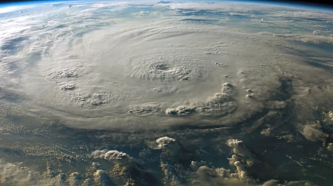
The strength of El Niño correlates with its impact on hurricane season, with a stronger pattern creating more hurricane-shredding wind shear and prolonged periods of atmospherically calm, sinking air, or subsidence, in the Atlantic.
That’s been evident this hurricane season with just five weak and short-lived tropical storms forming and no hurricanes despite the ultimate peak of the season being Sept. 10.
But while El Niño is a benefit during hurricane season, it can also increase global temperatures, raise sea-levels along coastlines as warmer water expands, and make Florida winters stormier, wetter and more prone to tornadoes.
What is the difference between El Niño and La Niña?
El Niño forms when slack east to west flowing trade winds allow warm water that has been pushed toward Asia to slosh back east to South America. That movement shifts rainfall and thunderstorm patters, putting the subtropical jet stream in a better position to cut the tops of Atlantic hurricanes with strong scissoring winds called wind shear.
The opposite happens during La Niña when the trade winds strengthen, pushing warm water west and allowing cooler water to upwell in the Pacific. Westerly winds wane leaving the Atlantic more accommodating to tropical cyclones because of less wind shear.
“El Niño was expected. But the persistent, hostile shear is getting remarkable,” said FOX 35 in Orlando meteorologist Noah Bergren in a social media post Wednesday, Sept. 9.
Long said one of the reasons this El Niño could be so fierce was the longer-term La Niña that finally faded this past spring after pushing warm water west for more than a year.
There were also a series of strong westerly wind bursts that triggered oceanic Kelvin waves — broad undulating valleys and peaks in the ocean that move warm water east, heating the subsurface ocean temperatures and fueling warmer sea surface temperatures.
Long said the growing brawn of El Niño hasn’t surprised her because she’s been watching it deepen since spring.
“It’s an interesting case,” Long said. “It’s always exciting when you see something abnormal.”
Kimberly Miller is a journalist for the USA TODAY NETWORK FLORIDA. She covers weather, the environment and critters as the Embracing Florida reporter. If you have news tips, please send them to kmiller@pbpost.com. You can get all of Florida’s best content directly in your inbox each weekday by signing up for the free newsletter, Florida TODAY, at palmbeachpost.com/newsletters.
This article originally appeared on Palm Beach Post: This year's El Niño is so powerful it may need a new category