



Florida is weeks deep into the peakof the 2026 hurricane season but there's been no hurricanes and nothing is brewing in an Atlantic basin predicted to stay largely barren through mid-month.
A Colorado State University tropical cycloneforecast through Sept. 15 has given a rare 97% chance for below normal activity during a time when the atmosphere is typically the most fertile for storms.
There is a 3% chance of near-normal activity and “effectively no chance” of above normal activity.
CSU hurricane researcher Phil Klotzbach, who is the lead writer for the two-week forecasts that are issued duringwhat is typically the height of hurricane season, called the lack of activity very unusual.
“There is zero model signal for anything in the next two weeks,”
he said. “The base state across the Atlantic is quite tropical-cyclone unfavorable.”
The average Aug. 11 date for thefirst Atlantic hurricane is long past. The average date for the season’s first major hurricane is Sept. 1.
The latest date that a hurricane has formed in the satellite era is Sept. 11 when Hurricane Gustave was born in 2002 and Hurricane Humberto formed in 2013.
Why has the Atlantic hurricane season been so quiet in 2026?
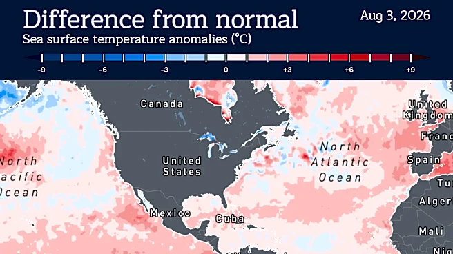
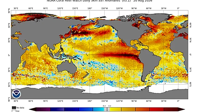
A key culprit in this year’s hurricane drought is the deepening El Niño climate pattern, which is sending a firehose of wind shear through the Caribbean to kill embryonic systems and hobble those that do find a fleeting purchase.
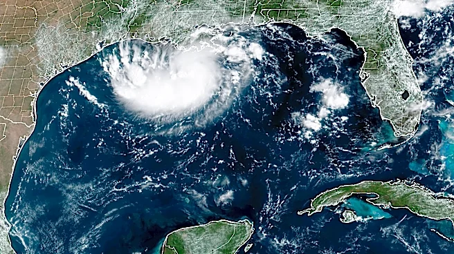
So far, five named storms have formed, including Tropical Storm Edouard, which made landfall Sept. 1 in Louisiana near the border with Texas with 60 mph winds.
But most lasted a day or less with only Tropical Storm Bertha making it much past the 24-hour mark with its 4.5-day lifespan. Edouard lasted 1.25 days.
Despite the short-lived systems, three made landfall in the U.S., which is the average for landfalling storms per season, noted Weather Underground co-founder Jeff Masters.
“With the season less than half over, we’ve already had three landfalls: Arthur, Bertha and Edouard,” said Masters, who writes for Yale Climate Connection’s Eye on the Storm blog. “One of these, Arthur, was a billion-dollar storm.”
Arthur lived for about 12 hours but brought torrential rains and flooding to parts of Texas and Louisiana. AccuWeather estimates Arthur’s damage at between $4-6 billion including property damage and financial losses from extended power outages.
AccuWeather is highlighting an area around Florida for a small chance of potential tropical trouble moving into Labor Day weekend. Forecasters there say a spot in the northeastern Gulf of Mexico, now referred to as the Gulf of America by the U.S. Government, that stretches into the Atlantic up to North Carolina could produce a slow-forming system.
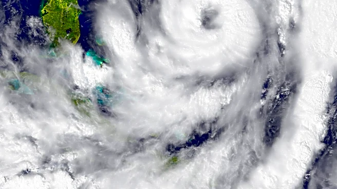
"There are pockets of moisture and energy scattered about the eastern Gulf and across Florida this week," said AccuWeather lead hurricane forecaster Alex DaSilva in a Sept. 2 post. "Wind shear is relatively low in this region compared to the harsh wind shear that led to Dolly's downgrade hours after it formed last week."
What are the next names for the 2026 Atlantic hurricane season?
The next name on the 2026 hurricane list is Fay, followed by Gonzalo.
As of Sept. 2, many meteorologists said they are expecting a quiet Atlantic for the near future and the National Hurricane Center has nothing identified on its seven-day tropical weather outlook.
“Disturbances moving off Africa don’t have a chance in the current atmospheric environment,” said FOX Weather hurricane specialist Bryan Norcross. “So for now, even with the peak of hurricane season eight days away, there’s nothing to watch.”
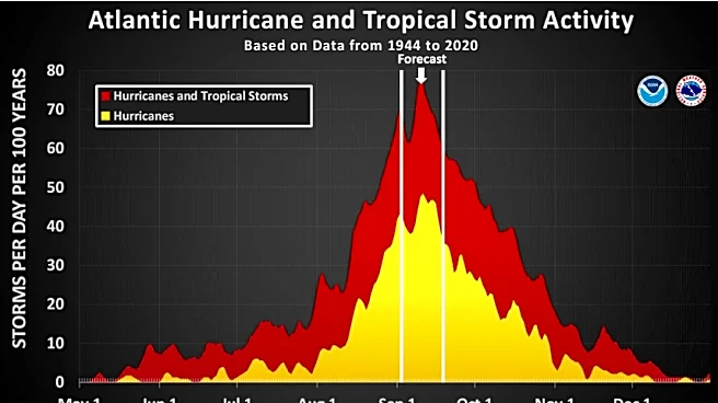
The timing for peak hurricane season coincides with the height of summer-warmed waters in the main runway between Africa and the Caribbean and a dip in the amount of storm-choking Saharan dust. Tropical waves that move off Africa during peak season find a more amenable atmosphere than earlier in the season when waters are cooler and the air is dustier.
This is typically when the big Cabo Verde storms form, mustering strength as they march west.
Colorado State University reduced its number of named storms expected to form between June 1 and Nov. 30 to nine from an original tally of 13 that it predicted in April.
Klotzbach said the only sign of tropical activity may come in the second half of September as the globe-trotting pulse of energy called the Madden Julian Oscillation moves into a more favorable position. The next CSU two-week forecast will be released Sept. 16.
Kimberly Miller is a journalist for the USA TODAY NETWORK FLORIDA. She covers weather, the environment and critters as the Embracing Florida reporter. If you have news tips, please send them to kmiller@pbpost.com. You can get all of Florida’s best content directly in your inbox each weekday by signing up for the free newsletter, Florida TODAY, at palmbeachpost.com/newsletters.

This article originally appeared on Palm Beach Post: Florida's peak hurricane season is here, so why is the Atlantic silent?