



A hurricane devouring El Niño is fiercer and stronger and gaining momentum with increasing odds that it will be a record breaker.
An updated forecast issued Aug. 13 by the Climate Prediction Center says there is a 69% chance of a “historic event” happening that would surpass the strength of previous El Niños dating back to 1950.
The forecast also notes there is a 90% chance of a “very strong” El Niño occurring during the fall and winter months into 2027.
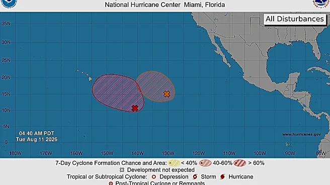
The prediction comes even as the Atlantic basin sparks to life withTropical Storm Cristobalforming Wednesday before quickly fizzling to a tropical depression in the far-off central subtropics. Two other areas are being watched for potential development.
As of early Thursday, the National Hurricane
Center was giving a tropical wave dubbed Invest 92L between the Lesser Antilles and the west coast of Africa an 80% chance of development over the next two days as it makes its way west. Another area behind, which was designated Invest 94L it has a 50% chance over seven days of becoming a tropical cyclone.
Both will wrestle with shredding wind shear ripping through the Caribbean as a result of the already formidable El Niño.
“If you rank July sea surface temperature departures from average, July2026 was ranked second in the historical record going back to 1950. July 1997 is number one,” said Michelle L’Heureux, a physical scientist at NOAA’s Climate Prediction Center who leads the team monitoring El Niño. “It’s clear that the current El Niño is already significant.”
The 1997-1998 El Niño was considered one of the strongest on record.
What is El Niño and how does it affect Atlantic hurricanes?
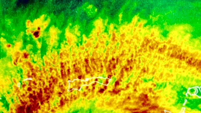
El Niño forms when warmer water temperatures shift thunderstorm and upper-air patterns creating wind shear through the tropical Atlantic that works to crush fledgling tropical cyclones or disrupt those trying to strengthen.
A very strong event would be designated if Pacific sea surface temperatures are 2 degrees Celsius or 3.6 degrees Fahrenheit warmer than normal.
During the 2015-2016 "Godzilla" El Niño, water temperatures peaked at 2.37 degrees Celsius (4.26 Fahrenheit) warmer than normal.
Colorado State University's seasonal hurricane forecast considered the growing El Niño in a recent update to its storm prediction. CSU's prediction is for nine named storms, which is the lowest since its 2015 forecast when it predicted eight named storms. With Arthur, Bertha and Cristobal already taken, that leaves six named storms through the end of hurricane season Nov. 30 for the forecast to hold true.
The next names on the 2026 hurricane list are Dolly and Edouard.
Despite 2015's brawny El Niño, 11 named storms formed including Hurricane Joaquin, which grew to a Category 4 and killed 33 people on the cargo ship El Faro near Crooked Island in the Bahamas.
Thursday’s El Niño report also notes that deeper subsurface ocean temperatures in the Pacific were 10 degrees Celsius (about 18 degrees Fahrenheit) warmer than normal.
“What the subsurface temperatures mean is that there is plenty of room for this El Niño to grow further from where we are now,” L’Heureux said.
Kimberly Miller is a journalist for the USA TODAY NETWORK FLORIDA. She covers weather, the environment and critters as the Embracing Florida reporter. If you have news tips, please send them to kmiller@pbpost.com. You can get all of Florida’s best content directly in your inbox each weekday by signing up for the free newsletter, Florida TODAY, at palmbeachpost.com/newsletters.
This article originally appeared on Palm Beach Post: El Niño update: Pattern increasing, could hit historic levels by winter