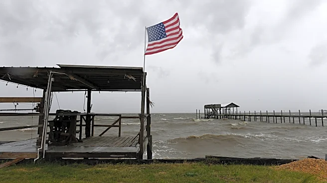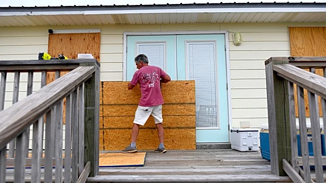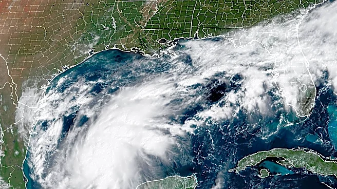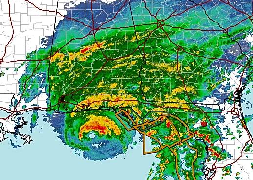



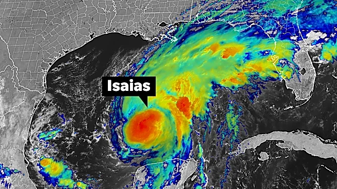
The promised storm-toppling wind shear appeared in the end, hammering down Hurricane Isaias winds from a Cat 3 terror to a 105-mph Category 2 stormat landfallbut with a sweep of storm surge already locked in as the widening cyclone reached the coast.
Isaias continued its multi-day lean to the leftof the forecast path, making landfall near Destin around 8:30 p.m. CT, Oct. 9 with winds gusting to 116 mph before speeding hastily north. A Panama City Beach water level gauge measured 5.59 feet above mean higher high water — an approximation of the ocean’s incursion in that area and a possible runner-up to storm surge from 1995’s Opal.
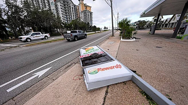
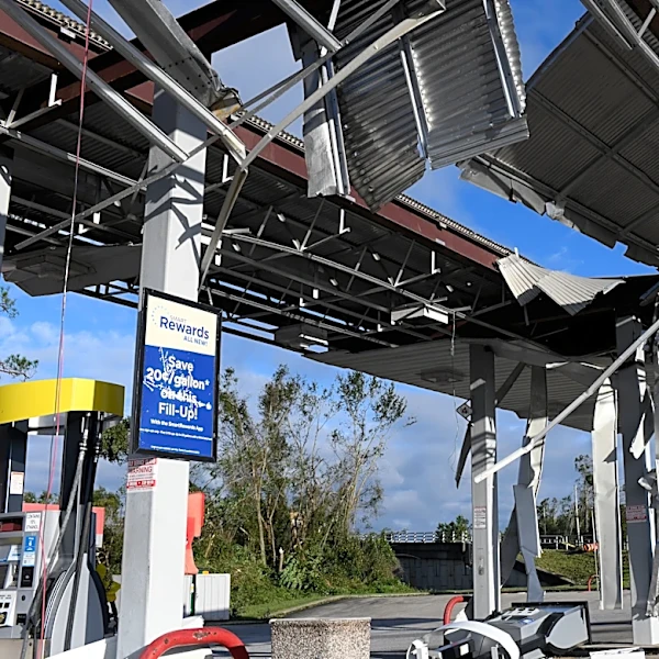
About 480,000 Florida residentswere without powerearly Oct. 10 and it will be days before Isaias’s ruin will be accurately
counted.
How many deaths were a result of Hurricane Isaias?
But state officials reported having no requests for search and rescue teams to be deployed, all state-owned bridges were opened, Interstate 10 was cleared of debris and there was just two unconfirmed deaths.
Escambia County Sheriff Chip Simmons said one person died in the Pensacola area from a fallen tree.
According to the Emergency Management Agency in Birmingham, Alabama, another person was killed in the city also from a tree that fell on a house overnight.
"All in all we had a significant storm, there's obviously damage, obviously debris, but in terms of some of the other storms we've had where we had to really mobilize massive search and rescue and bring people out of perilous situations, fortunately that has not been something asked of us and I get the sense from talking with local officials it’s something they've been able to handle," said Gov. Ron Desantis in a Saturday morning briefing.
And meteorologists said the forecasts for the first hurricane of the 2026 Atlantic season were generally on target although a nailbiter at the end as National Hurricane Center experts grappled with when wind shear would ultimately start to tear at the storm. It had just a six hour window that could make the difference between a Cat 2 and Cat 3 hurricane reaching the coast.
"There are a lot of moving parts," said Michael Fischer, an assistant professor in the University of Miami's Department of Atmospheric Sciences at the Rosenstiel School of Marine, Atmospheric and Earth Science. "The sea surface temperatures are really warm and raise the ceiling on how strong a storm can get and those warm temperatures can offset the harmful effects of shear."
A look at the timeline of Hurricane Isaias
Earlier on Oct. 9 as Isaias was gaining strength, NHC forecasters said because the wind shear was moving in the same direction as the storm, they didn't think it would do the same damage as if it was rubbing against the storm.
The shear was screaming at 35 mph to 46 mph, enough to dull intensification, and they did seem to being having an impact, but that impact was only to hold Isaias's 120 mph winds steady instead of allowing them to explode.
Late in the afternoon on Friday an Air Force hurricane hunter flew through the storm and found maximum wind speeds that would translate to a Category 4 storm at the surface.
"This is becoming increasingly concerning," Fischer said as he read the measurement aloud during an interview with USA Today.
FOX Weather hurricane expert Bryan Norcross was broadcasting live when the measurement came through.
"I'm really set back, I'm seeing 136 knot winds at aircraft level and that translates to 130 mph at the surface," he said on air. "Dry air is trying to eat away at the left side of (Isaias) but it's not doing it."
Four hours ahead of landfall, the persistent shear started to make a difference. NHC forecasters acknowledged the impressive flight-level measurement of 136 knots but said there had been a sharp drop off of wind speeds at the surface.
The shear was knocking Isaias off balance.
Meteorologists warn to focus on the impacts not the category of storm, but it’s human nature to home in on the more tangible. A category can be easier to grasp than what 9 feet of storm surge looks like or a foot of rain or a nighttime tornado.
“I don’t think we’ll ever break the public from the category,” said Brian LaMarre, Inspire Weather meteorologist and former Tampa area NWS meteorologist. “The category will not tell you the storm surge level or about tornadoes or where there will be inland flooding.”
What are the affected areas from Hurricane Isaias?

LaMarre praised the Isaias forecast that predicted rains of up to 10 inches in isolated areas, and storm surge of between 6 to 9 feet in the hardest hit areas.
As much as 12 inches of rain was measured in 24 hours in northern Walton County with 9.67 inches falling in three hours.
The storm surge in Panama City Beach nears what was predicted and higher amounts could be recorded in post storm investigations.
LaMarre said the storm came in slightly ahead of schedule by a few hours.
“But that’s just splitting hairs,” he said.
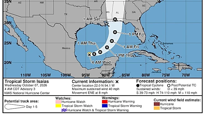
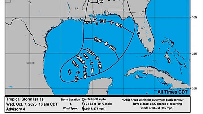
From the very first advisory for Tropical Depression Nine on Tuesday, Oct 6 the forecast had it headed toward the Gulf Coast as a hurricane. An area from eastern Louisiana through the western Florida Panhandle was covered by the ghostly white cone of uncertainty.
The direct path remained on the eastern side of the cone, which was insight from Google DeepMind’s artificial intelligence model and supported by NHC forecasters.
DeepMind debuted operationally in 2025, and meteorologists were impressed by its performance.
“Google DeepMind has been just as promising this year,” Fischer said. “Forecasters have a range of tools and Google would arguably be the most important.”
Kimberly Miller is a journalist for the USA TODAY NETWORK FLORIDA. She covers weather, the environment and critters as the Embracing Florida reporter. If you have news tips, please send them to kmiller@pbpost.com. You can get all of Florida’s best content directly in your inbox each weekday by signing up for the free newsletter, Florida TODAY, at palmbeachpost.com/newsletters.
This article originally appeared on Palm Beach Post: Final hours wind shear kept Hurricane Isaias from being bigger disaster