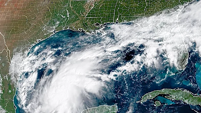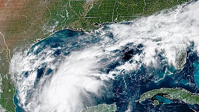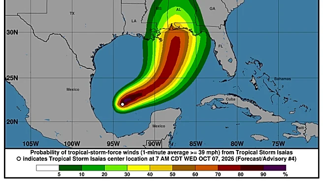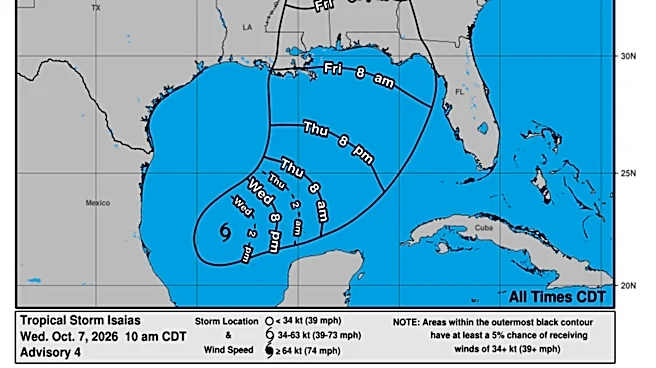



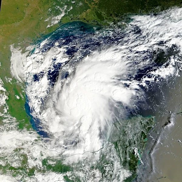
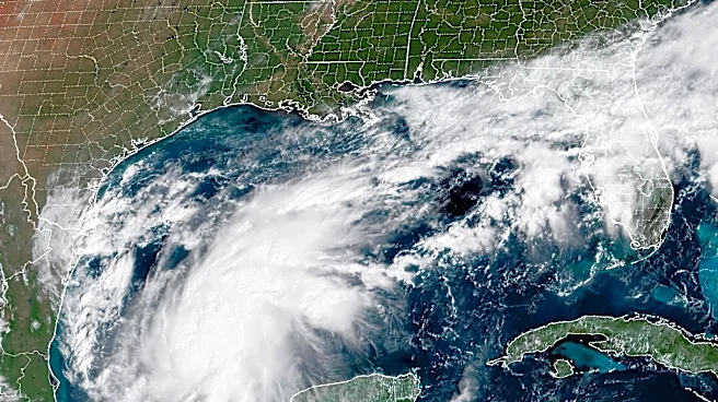
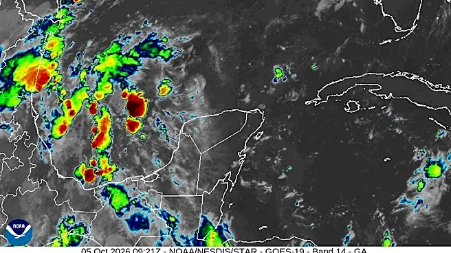
Hurricane Isaiasis bullying toward the Gulf Coast with fears of far-reaching nighttime tornadoes increasing and hurricane warningspushing deep inland. It is forecast to reach a high-end Category 2 hurricane ahead of landfall.
Will Palm Beach County feel any effects from Isiaias?
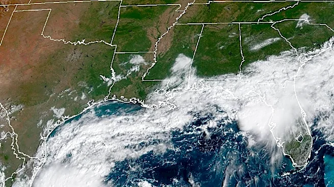
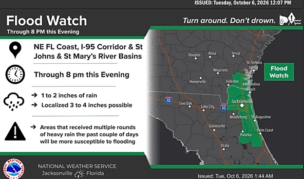
Our area is not expected to feel direct effects from Hurricane Isaias, according to the latest forecast. The county will see more rain and thunderstorms, with locally heavy downpours and some flooding possible, especially around Lake Okeechobee and along the east coast. Also expect higher tides and a potential for minor coastal flooding along the coast.
But that wetter weather pattern is associated with a stalled frontal boundary, not Isaias itself, according to the National
Weather Service.
Isaias was upgraded to a hurricane late Wednesday night
Isaias was upgraded from a tropical storm to a Category 1 hurricane late Wednesday, Oct. 7, following a fly through by an Air Force Reserve hurricane hunter that launched a dropsonde into itscorkscrew thunderstormsand found a minimum central pressure of 982 in its dark eye.
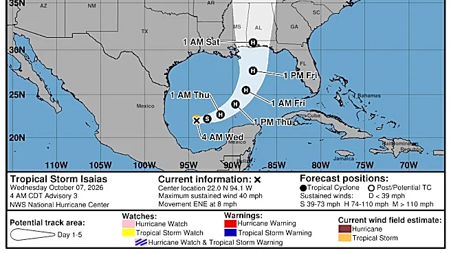
The storm is expected tomake landfallFriday night between eastern Mississippi and just west of Panama City Beach as a Category 1 or 2 hurricane with National Hurricane Center meteorologists noting in overnight predictions they are sticking to the maximum wind speeds forecast by models.

A slicing wind shear is expected to begin fighting the storm Friday and it is predicted to slow from it's peak 110 mph whipsaw to 105 mph ahead of landfall and possibly slower but will still bring "life-threatening storm surge, damaging hurricane force-winds to the Florida Panhandle and the southern reaches of Alabama and Mississippi."
Major Category 3 hurricane wind speeds start at 111 mph, putting Isaias right at that threshold.
"The system is forecast to remain a dangerous hurricane through landfall," wrote NHC senior hurricane specialist Brad Reinhart.
By early Saturday, Isaias should be a 60-mph tropical storm west of Montgomery, Alabama.
Hurricane warnings, which alert to the onset of tropical storm-force winds within 36 hours, paint the coast from Gulfport, Mississippi to Mexico Beach, Florida and inland in the western Florida Panhandle to the Alabama border. A storm surge warning is in effect from the mouth of the Mississippi River to Steinhatchee, Florida with up to 7 feet of surge forecast along Florida's western Panhandle.
"Gusty winds are expected well inland given the anticipated expansion of the wind field and fast forward speed of the storm," Reinhart wrote.
That means downed trees that could take out power lines and crush homes.

Hurricane Isaias could bring tornadoes to areas far outside the cone
Hurricanes are notorious for thrashing areas far from there spiraling centers with Tornadoes. Milton in 2024 has tornadoes strung out 100 miles from its center. Hurricane Ivan in 2004, which made landfall near where Isiais is headed, was called a "prodigious" tornado producer by the NHC with 117 tornadoes that strung from Florida to Virginia and killed at least eight people. Hurricane Frances, which made landfall on Florida's east coast Hutchinson Island in 2004, produced 101 tornadoes, according to the NHC post mortem on the storm.
Particularly vulnerable is the right front quadrant of the storm where forward motion, raging winds and friction with land or a front can instigate tornadoes.
"The tornadoes could start in the outer bands before landfall, especially on the right hand side," said Rick Knabb, former National Hurricane Center director and hurricane expert for The Weather Channel. "That risk could go a long way east of where the center comes ashore."
But Knabb said he is most concerned about the flooding rainfall forecasts and storm surge potential, which is forecast to reach 5 to 7 feet from Pensacola to about Port St. Joe.
"There could be a combination of rain induced flooding and saltwater flooding. If there is an evacuation, we need to get everybody out."
Isaias was an 80 mph hurricane as of 5 a.m. Oct. 8 heading east-northeast at 9 mph. Hurricane force winds extended 15 miles from its center with tropical storm force winds reaching out up to 90 miles.
It is being steered by an westward sidling Bermuda High and a dip in the jet stream that is forecast to latch onto it and help pull it north.
Florida emergency manager ousted ahead of peak hurricane season
Isaias is being managed by at the state emergency level by Florida's Department of Transportation secretary Jared Perdue after Kevin Guthrie left his position in August. Guthrie, who was a veteran of multiple storms and led the emergency division since 2021, resigned or was asked to resign after he chose to become a running mate to Jay Collins in his failed campaign for Governor.
Gov. Ron DeSantis said Florida "won't miss a beat" this storm season after the resignation and that he didn't think politics and emergency management mixed.
But emergency managers haven't been tested this season yet with just three tropical storms — Arthur, Bertha and Edouard — impacting the U.S. since the June 1. DeSantis declared a state of emergency late Tuesday for 25 counties from westernmost Escambia into the Big Bend region in preparation for impacts of storm surge, dangerous winds and flooding rainfall.
With nearly two days before landfall there was still some waffling on whether Isaias would peak at the forecast 110-mph Category 2 threshold or take notch it up to 111, which would make it a major Category 3 hurricane.
AccuWeather lead hurricane forecaster Alex DaSilva said he expects Isaias to remain a Cat 2 at landfall, although weaken some as it nears the shore. He too worried about overnight tornadoes that may catch people sleeping.
"These aren't the big wedge tornadoes you see in the Plains. They can develop very, very quickly and give less lead time," DaSilva said. "We want people to prepare and be able to act on warnings quickly."
Pensacola resident Christian Wagley wasn't overly concerned about Isaias. His home is hurricane hardened and he's not in an evacuation zone.
He lived through Ivan's Cat 3 landfall, which chopped the Interstate 10 bridge into pieces and turned coastal Pensacola homes to pulpy ruin. Then came Sally in 2020, which landed just across the Alabama border as a Category 2 storm with 24.8 inches of rain measured at the Naval, Air Station Pensacola.
"It's a painful experience but it's made Florida a much stronger state," Wagley said.
Kimberly Miller is a journalist for the USA TODAY NETWORK FLORIDA. She covers weather, the environment and critters as the Embracing Florida reporter. If you have news tips, please send them to kmiller@pbpost.com. You can get all of Florida’s best content directly in your inbox each weekday by signing up for the free newsletter, Florida TODAY, at palmbeachpost.com/newsletters.
This article originally appeared on Palm Beach Post: Hurricane Isaias could intensify but will Palm Beach County feel it?