






The highest tides of the year are expected to join forces with repeat rains and wind-stoked surf through the weekend, upping the potential for freshwater and saltwater floodingalong Florida’s east coast.
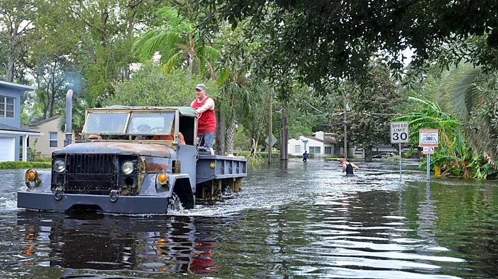
On their own, the annual autumn appearance of so-called king tides — bloated summer-warmed water combined with the cosmic alignment of the sun, Earth and moon — are enough to turnstreets to streams along the Intracoastal Waterway.
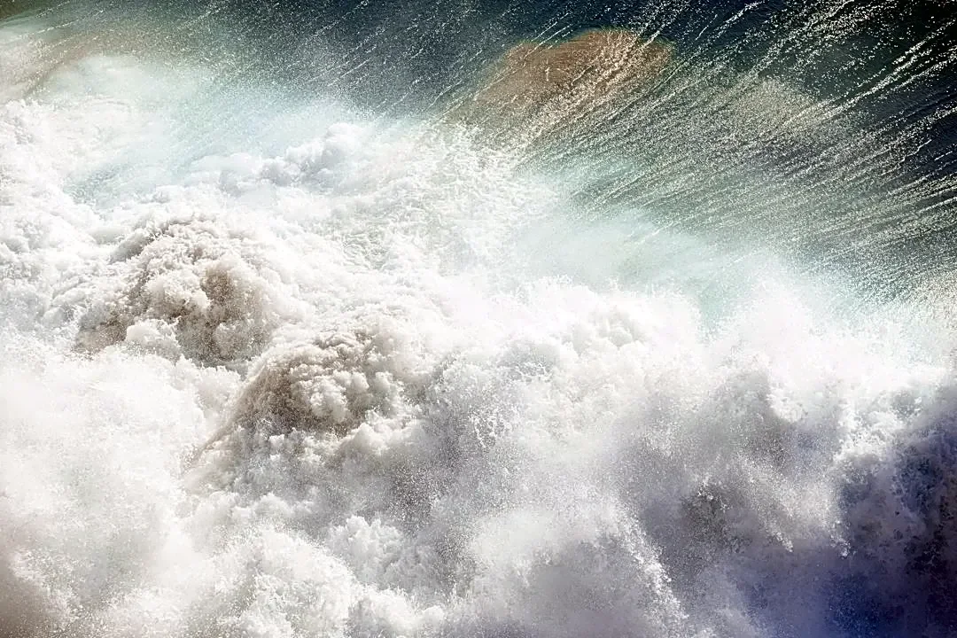
But the addition of heavy rain beginning Oct. 23, east to northeast winds gusting up to 40 mph and towering ocean waves could exacerbate water woes.
Pounding surf ramming water into porous inlets from Miami to Jacksonville means even more swollen tides and less room for rainfall to drain.
“The biggest thing is the wind,
and wind direction is timed with the king tides themselves. Getting this set up is not totally unusual but this one will be going on for several days in a row and that’s a little unusual,” said AccuWeather senior meteorologist Dan Pydynowski. “The worst is probably going to be Saturday, Sunday and Monday.”
The National Weather Service in Miami is forecasting the highest chances for rainon Saturday and Sunday at 70% and 80% respectively. An accumulation of as much as 3 to 6 inches is possible Friday through Monday for coastal areas in Palm Beach, Broward and Miami-Dade counties. Worst case scenario values could be more than 10 inches if showers dawdle or stall over a specific area.
Wind gusts of between 30 mph and 40 mph are possiblewith sustained winds reaching 21 mph Saturday and up to 26 mph on Sunday.
Some areas in Florida will be dry; others will have multiple rounds of heavy downpours
“Everything is coming together into one this weekend,” said Miami-based National Weather Service meteorologist Chuck Caracozza about the trio of weather features. “If you get multiple rounds of heavy downpours, that can create a quick 2 to 4 inches in an hour.”
Most of the Gulf Coast of Florida, including the Panhandle, are expected to stay largely dry through the weekend.
Pensacola through Lake City is forecast to have clear sunny skies with nighttime ow temperatures in the upper 50s and highs in the mid-70s. Offshore winds gusting to 25 mph Saturday should help keep king tides at bay along the coast.
Jacksonville will resemble the rest of the east coast with rain chances increasing Friday night and coastal hazards including rip currents, high surf, beach erosion and “abundant onshore flow.”

“Confidence is growing for moderate tidal flooding and coastal flood watches/warnings may be needed,” NWS meteorologists in Jacksonville wrote in their Wednesday forecast.
Craig Pollack, lifeguard supervisor for the Town of Palm Beach, said his guards have already had to close the beach at least once this week when high surf pushed water up to the seawall.
“Our beach accesses were getting wet. There was basically no beach to sit on,” Pollack said. “We haven’t had to move the towers yet. We’ll just play it by ear.”
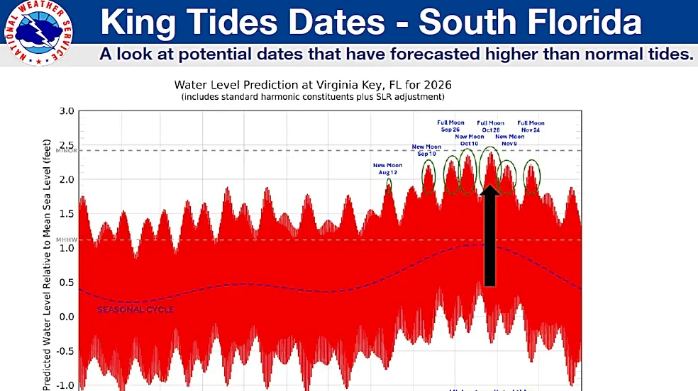
King tide season usually begins in September with the highest water levels tied to full and new moons.
October’s full hunter’s moon peaks early Monday, Oct. 26 with the best viewing happening on Sunday at sunset if skies are clear. The full moon is also just two days from perigee — the moon’s closest approach to Earth during its orbit.

Earth’s coziness with its only natural satellite can exacerbate king tides with a stronger gravitational pull.
The highest predicted tide at Virginia Key in Miami is forecast for Oct. 27 at 10:30 a.m., said Brian McNoldy, a senior researcher at University of Miami’s Rosenstiel School for Marine, Atmospheric and Earth Science.
McNoldy said a warmer world has also spiked king tides with as much as 6.5 inches of sea level rise in the Miami area since the 1983 to 2001 baseline sea level data was collected that is used to measure tides by NOAA.
Most coastal areas in Palm Beach County see some amount of king tide flooding. The Lake Trail in the town of Palm Beach regularly fills with water during fall's new and full moons. Delray Beach deploys temporary flood barriers on its most vulnerable streets, according to its website. At Ocean Inlet Park near Boynton Beach, a small shark was spotted swimming in the parking lot in October 2025 as king tides overwhelmed asphalt.
“We’re just going to have a lot of easterly and northeasterly flow day after day,” Pydynowski said about the upcoming weekend. “That usually funnels in a lot of moisture so there will be the on and off rain throughout the weekend as well.”
Some rain may be welcome. Although much of the drought in Florida has receded, there are still areas in Tampa Bay, Central Florida and the Everglades that are in severe drought. Severe drought is level 2 on a four-tier scale used by U.S. Drought Monitor.
Kimberly Miller is a journalist for the USA TODAY NETWORK FLORIDA. She covers weather, the environment and critters as the Embracing Florida reporter. If you have news tips, please send them to kmiller@pbpost.com. You can get all of Florida’s best content directly in your inbox each weekday by signing up for the free newsletter, Florida TODAY, at palmbeachpost.com/newsletters.
This article originally appeared on Palm Beach Post: A perfect-storm type of soaked weekend looms for Florida's east coast