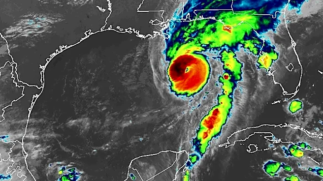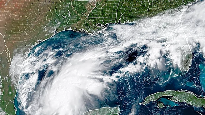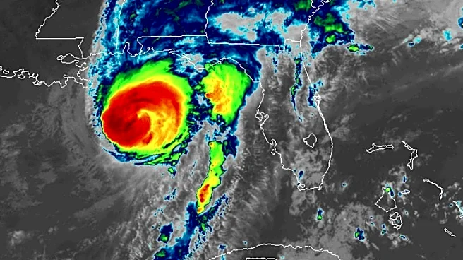








The promised storm slicing wind shear appeared in the end, hammering down Hurricane Isaias winds from a Cat 3 terror to a 105 mph Category 2 storm at landfall but witha sweep of storm surge already locked in as the widening cyclone reached the coast.
Isaias continued its lean to the left of the forecast path making landfallnear Destin around 9:30 p.m. and sped north with gusty winds to 116 mph. A Panama City Beach water level gauge measured 5.59 feet above mean higher high water — an approximation of the ocean's incursion in that area and a possible record to top storm surge from 1995's Opal.
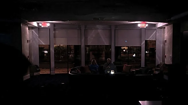
It won't be until after sunrise that the extent of damage is known. Tens of thousands of residents were without electricity early Saturday including 127,620
in Florida's westernmost Escambia County, according to Florida Power and Light, which services parts of the western Panhandle. Santa Rosa County had 79,450 residents waking up in the dark. About 49,000 residents in Okaloosa County and 17,000 in Walton County were without electricity.
"In Hurricane Milton, you had 4.2 million restorations within a 72-hour period but the response might not be instantaneous and there could be some time when you are without electricity," Gov. Ron DeSantis warned Friday. "We have what we need in place to respond to this storm."
The storm maintained 85 mph hurricane-force winds well into landfall and 50 miles west-northwest of Panama City but lost its tropical characteristics by 2 a.m. as it neared Montgomery, Alabama packing 65 mph sustained winds.
As of 5 a.m. Saturday, Oct. 10, post-tropical cyclone Isaias was 25 miles south of Montgomery moving north at 14 mph with maximum sustained winds of 35 mph and the National Hurricane Center ceased its forecasts for the system whose path was mostly clear throughout the week but whose intensity was a nail biter to the end.
"There are a lot of moving parts," said Michael Fischer, an assistant professor in the University of Miami's Department of Atmospheric Sciences at the Rosenstiel School of Marine, Atmospheric and Earth Science. "The sea surface temperatures are really warm and raise the ceiling on how strong a storm can get and those warm temperatures can offset the harmful effects of shear."
Wind gusts of 102 mph were measured at Pensacola City Hall, according to the National Weather Service. The Tallahassee office of the NWS reported wind gusts as high as 91 mph at Choctaw Beach near Destin. Panama City Beach measured a gust of 83 mph.
As much as a foot of rain was being reported by the Mobile office of the NWS between Pensacola and east to Santa Rosa Beach with "significant wind damage" reported in Pensacola.
Earlier on Friday as Isaias was gaining strength, NHC forecasters said because the wind shear was moving in the same direction as the storm, they didn't think it would do the same damage as if it was rubbing against the storm.
The shear was screaming at 35 mph to 46 mph, enough to dull intensification, and they did seem to being having an impact, but that impact was only to hold Isaias's 120 mph winds steady instead of allowing them to explode.
Late in the afternoon Friday an Air Force hurricane hunter flew through the storm and found maximum wind speeds that would translate to a Category 4 storm at the surface.
"This is becoming increasingly concerning," Fischer said at the time.
FOX Weather hurricane expert Bryan Norcross was broadcasting live at the time.
"I'm really set back, I'm seeing 135 not winds at aircraft level and that translates to 130 mph at the surface," he said on air. "Dry air is trying to eat away at the left side of (Isaias) but it's not doing it."
Tornado threats remain Saturday through the southeast. About 4.8 million people from Tallahassee to Charleston, South Carolina, are in the "slight" risk range for severe thunderstorms, which is a level 2 on a 5-tier scale.
There are also concerns that remained Saturday for excessive rainfall through the Florida Panhandle including a rare "high" level in the crook of the Big Bend.
The last October major hurricane to take a track into Pensacola was Category 3 Opal in 1995. Category 5 Michael made landfall in 2018 on Oct 10, wiping out Mexico Beach east of Pensacola.
In other months, Dennis in July 2005 hit Pensacola as a Category 3, preceded by Cat 3 Eloise in September 1975, which landed east of Destin.
Kimberly Miller is a journalist for the USA TODAY NETWORK FLORIDA. She covers weather, the environment and critters as the Embracing Florida reporter. If you have news tips, please send them to kmiller@pbpost.com. You can get all of Florida’s best content directly in your inbox each weekday by signing up for the free newsletter, Florida TODAY, at palmbeachpost.com/newsletters.
This article originally appeared on Palm Beach Post: Power out for tens of thousands in Florida after Cat 2 Isaias makes landfall