







As rounds of rain and thunderstorms continue to sweep across the region, bringing bursts of heavy rainfall, frequent lightning and booming thunder, some may be wondering why the storms seem stronger and more intense than usual.
High levels of moisture in the atmosphere are allowing thunderstorms to unleash heavy rainfall in a short period of time, while warm temperatures are helping fuel additional storm activity, Jason Grzywacz, a meteorologist with the National Weather Service, said.
A flood watch is in effect for El Paso and parts of Southern New Mexico from noon Tuesday, Sept. 22, through 7 p.m. Wednesday, Sept. 23, as abundant moisture moves into the region, bringing scattered to widespread showers.
While additional scattered showers and thunderstorms
are expected through Friday, quieter weather will prevail for the weekend, with showers and thunderstorms returning late Monday, Sept. 28.
Evening and nighttime storms are a common pattern during the monsoon season, which runs from June 15 to Sept. 30, and are the months the area typically sees the most rainfall.

While the storms may seem unusually intense, Grzywacz said this type of activity is fairly typical during the monsoon season and may stand out more because recent years have been drier than normal.
“What we’ve experienced over the last two or three weeks is probably more normal for what we’d expect,” he said, adding that regular monsoon totals in El Paso are four to five inches of rain.
In 2025, monsoon rain total was 5.78 inches in El Paso, but in 2024 the Sun City recorded only 3.15 inches of rain and 2023 there was 2.69 inches of rain during monsoon.
Upcoming storms could bring the region closer to its normal monsoon rainfall totals, although the amount of rain forecast from the latest system is on the extreme side, he said.
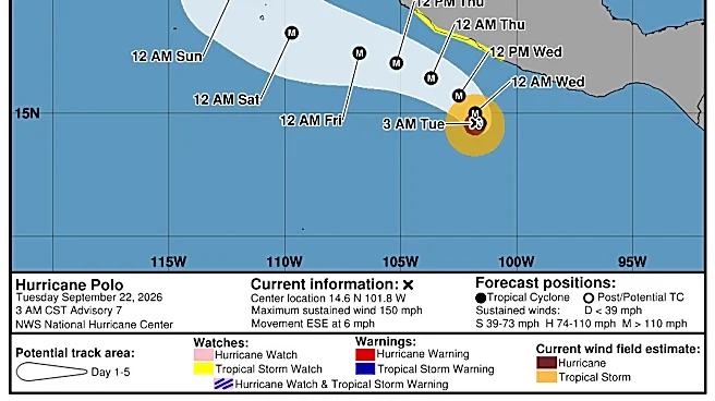
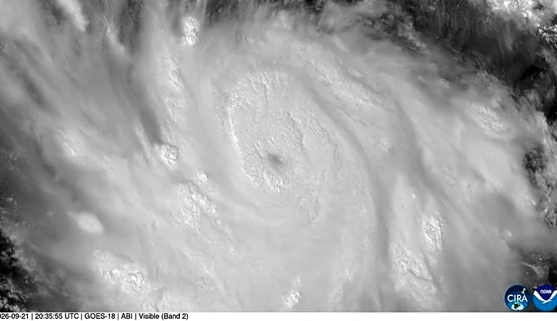
“It’s not unusual this time of year, especially with this strong El Niño that we’ve had developing,” Grzywacz said. “There’s a lot of moisture out there, and it promotes hurricane development in the Pacific basin off the coast of Mexico.”
Some of that tropical moisture is streaming north from Mexico and contributing to the heavy-rain threat across the region. In normal monsoon pattern, much of the heaviest rain is expected overnight and into the morning hours, when flooded roads can be more difficult to see.
Grzywacz warned drivers not to attempt to cross water-covered roadways. The storms can also be hit or miss, with rainfall totals varying significantly across short distances.
“These thunderstorms are the ones where it can rain at your house an inch or more, and you drive down the road half a mile and there’s nothing,” he said.
Summer temperatures were warm, but not the warmest
July and August were dry, which allowed the Sun City to get to the record streak for the number of 90-degree days.
The El Paso Weather Service said on Sept. 20 that a new record was set at 107 consecutive days, beating the previous record of 106 90-degree days in 2015.
Yesterday, with a high temperature at the El Paso Airport of 91 degrees, that set a new record for the most consecutive 90+ degree days at 107. The previous record of 106 days ended 9/9/2015. Looks like today we will hit 90 and maybe Tue, but the streak will end by Wed.
— NWS El Paso (@NWSElPaso) September 21, 2026
"(For) July and August, the average temperature in El Paso ranked as the fifth warmest. The top two were 2023 and 2024," Grzywacz said.
Natassia Paloma may be reached at npaloma@gannett.com, @NatassiaPaloma on X, natassia_paloma on Instagram, and Natassia Paloma on Facebook.
This article originally appeared on El Paso Times: Heavy rain, booming thunder: What’s fueling El Paso storms?