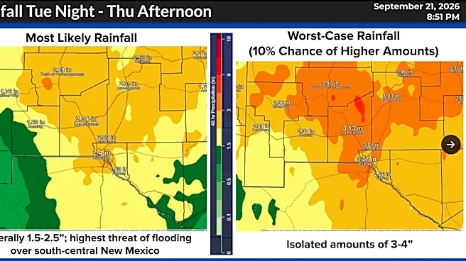








El Paso could see more than two inches of rain across the region over a two-day period, with isolated areas potentially receiving up to four inches.
A flood watch will be in effect for El Paso and parts of Southern New Mexico from noon Tuesday, Sept. 22, through 7 p.m. Wednesday, Sept. 23, as abundant moisture moves into the region bringing scattered to widespread showers according to the National Weather Service.

Rain chances are expected to peak beginning around 6 p.m. Tuesday and continue overnight, with El Paso facing a 90% chance of rain, according to the National Weather Service.
Multiple rounds of storms are possible, increasing the risk of flash flooding, according to the National Weather Service. Parts of El Paso, Las Cruces, Hatch and
Truth or Consequences are under a moderate risk for flash flooding on Sept. 22, meaning there is about a 40% chance of flooding in those areas.
The risk drops down to at least a 15% chance on Wednesday, Sept. 23.

Scattered showers and thunderstorms are expected to continue across southwestern New Mexico through Friday. Quieter weather is forecast for the weekend before rain and thunderstorm chances return late Monday, Sept. 28.
This article originally appeared on El Paso Times: Flood watch issued as El Paso could see up to 2 to 4 inches of rain