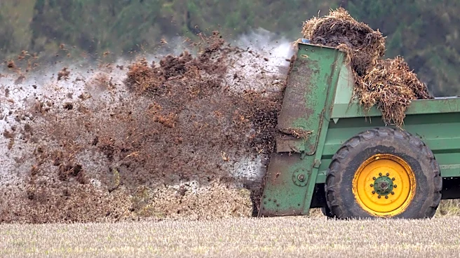






Winter farming practices limited or banned by regulators that pollute waterways can now be seen from a different perspective: outer space.
A new technological tool developed by the nonprofit Environmental Law & Policy Center with University of Wisconsin researchers uses publicly available satellite imagery to uncover a difficult-to-monitor source of agricultural water pollution — manure spread on frozen ground from industrial-scale livestock operations. A computer model scans the free, open-source satellite images to identify likely winter manure applications.

"Winter waste-spreading is one of the most dangerous practices" for water quality, said Katie Garvey, a senior attorney with ELPC.
"There is nowhere for the waste to go if it's frozen and
snow-covered ground; the nutrients and waste aren't going to be absorbed by plants — there are no plants growing in the ground. So there is just a lot of runoff and seepage and discharges related to this practice."
Michigan bans large livestock and poultry producers from spreading manure on fields from Jan. 1 through March 19; also prohibited during this time period: hauling waste to third-party lands. Other Great Lakes states also prohibit winter manure-spreading to varying degrees of strictness, most stringently against so-called Concentrated Animal Feeding Operations, or CAFOs, the largest factory farms.
Building on a similar model developed at Stanford University's Regulation, Evaluation and Governance lab in 2022, the ELPC model uses free imagery from the Landsat and Sentinel-2 satellites, processed through Google Earth Engine. The system analyzes visible and nonvisible wavelengths of light to identify potential manure applications on snow-covered fields.
Though the program was tested evaluating Wisconsin farmland, it could be useful anywhere else with snow-covered farm fields in winter and potential waste-spreading, said Aaron Suiter, a University of Wisconsin doctoral researcher who worked with ELPC to develop the model.
"Different states have different rules, different landscapes and different water quality challenges, but the basic problem is widespread: Frozen ground cannot absorb livestock waste, especially in liquid form; regulators cannot be everywhere to stop it; and self-reporting alone cannot provide a complete picture," he said. "Satellite technology can help fill that information gap."
For the research, EPLC analyzed three regions of Wisconsin containing 17 counties in the winters of 2024-25 and 2025-26, and identified 1,094 total detections of livestock waste-spreading.
"We put together a team of grassroots, basically ground-truthers around the state," Garvey said. "If the model identified, we think there might be a [winter waste] application; here's the location, they would go out and take a look. They would stay on public roads, take photos, record their observations and then say yes or no."
With time, data and honing, the computer analysis got better at weeding out false positives such as shadows or groves of trees, Garvey said.
The analysis, published in the peer-reviewed reviewed journal Remote Sensing Applications: Society and Environmentin August 2026, found:
- 729 detections, or 66.6%, fell within impaired watersheds.
- 344 detections, or 31.4%, overlapped with at least one mapped water quality risk factor, including proximity to surface water, shallow bedrock or slope.
- 71 detections overlapped with two or more of those water quality risk factors.
- 95 detections, or 8.7%, overlapped within known nutrient management plan fields for large, permitted CAFOs.
"One of the biggest takeaways from the report that really stood out to me is that two-thirds of the detections were in places that already have an established Total Maximum Daily Load," Garvey said. "These are areas of the state that have already been identified as impaired, vulnerable and not meeting water quality standards."
The computer model gets new imagery every time the satellites pass.
"It just runs; it can run in free time, in real time," Garvey said. "And then it will be giving you output in real time. It's just a matter of, if you are the regulator, you can get a ding that says it looks like there might be a spread at such-and-such location, do you respond to it or not? The real decision maker as to whether it is viable is what you do with it."
ELPC will also provide tutorials on how to utilize the model for watershed groups and others who want to track local water pollution.
"There are a lot of people who live in frontline communities near CAFOs that know what is happening, and they see the impacts on their waters, but they don't necessarily have the tools to get the regulators to step in and help," Garvey said. "This could be a tool to say, 'We are not imagining it; look; this is what's happening.'"
Garvey said she is sensitive to any thoughts that ELPC is picking on farmers, or using so-called Big Brother to spy on their activities.
"The satellite imagery that is used by this model is not new, is not secret," she said. "Landsat has been photographing every acre in the United States since 1972, and Europe's Sentinel-2 satellites pass over the Earth about every five days. This is imagery and information that farmers, agronomists, seed companies and the USDA use for other purposes, like identifying crop health and making yield estimates. So this isn't Big Brother watching; it's the same satellite imagery that's been out there for decades and has been used by the ag industry itself."
The images are also "very course," Garvey said. "This isn't like Google Earth where you can drop your little person and you can turn around and see a mailbox if you want to," she said. "Each pixel is like 10 to 30 meters; the images don't show people, equipment, it barely even identifies buildings in any detail."
Ultimately, the tool could be useful to regulators with limited staffs and budgets in helping them prioritize when and where to intervene in potential pollution from winter farm waste-spreading, Garvey said.
"It's not as if right now you have some regulator driving around 24-7 through all of the acres in the state — that's unrealistic," she said. "Using this tool is free, is open-source and it helps a regulator like the DNR do the job that it is legally obliged to do, which is hard when you are understaffed."
For more information about the tool, visit elpc.org/WisconsinWinterWaste.
Contact Keith Matheny: kmatheny@freepress.com.
This article originally appeared on Detroit Free Press: Poop patrol from outer space: Satellites spot winter manure spreading