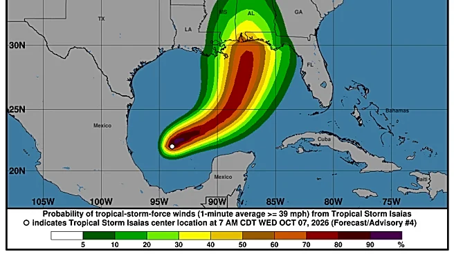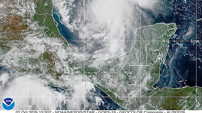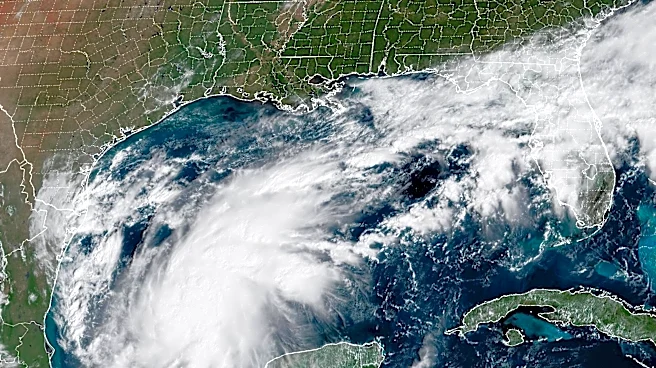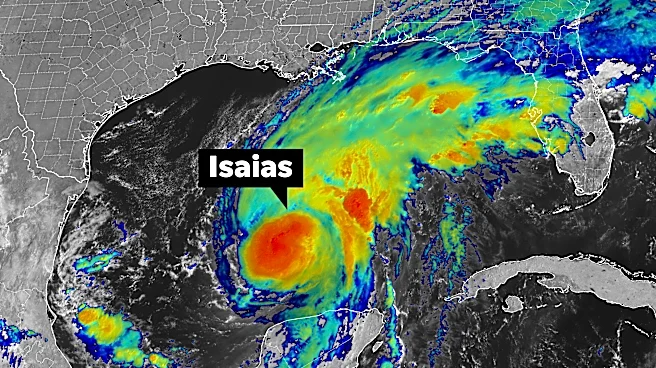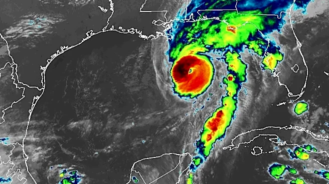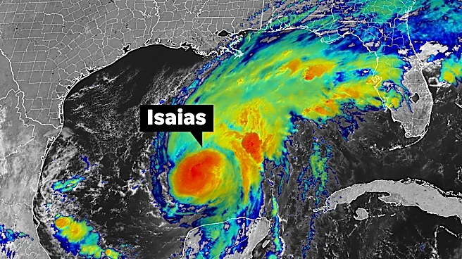

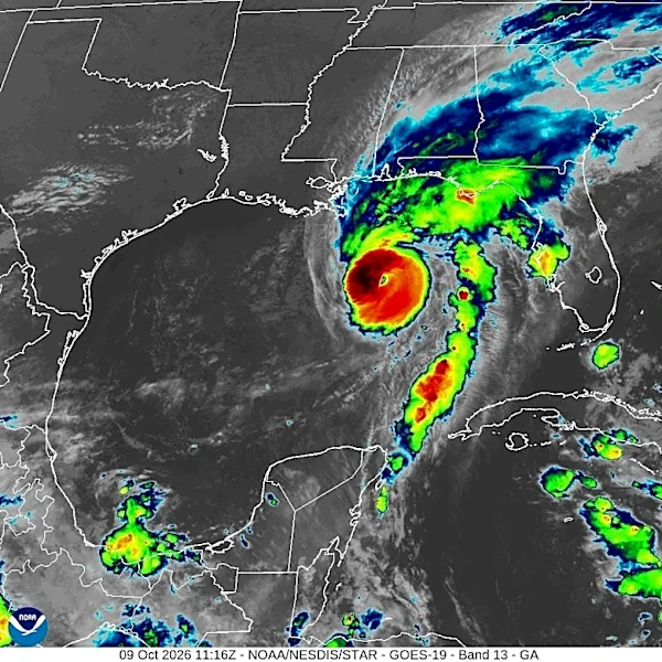


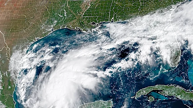


Hurricane Isaias strengthened as it moved toward the U.S. Gulf Coast Thursday night, with landfall expected late Friday or early Saturday. The potentially dangerous hurricane threatens life-threatening storm surge, damaging winds and heavy rain, according to the National Hurricane Center.
While the storm’s most significant impacts are forecast for the Gulf Coast and Southeast, forecasters are also watching whether its remnants could bring rain and gusty winds to parts of the Northeast, including New York.
Here’s what to know about the latest forecast and what it could mean for the Empire State.
Hurricane Isaias continues to strengthen in the Gulf
As of 5 a.m. ET Friday, Isaias had maximum sustained winds of 110 mph, making it a Category 2 hurricane. The National Hurricane Center forecast the storm
could reach Category 3 strength, with winds of 115 mph, on Friday before weakening slightly ahead of landfall.
Isaias was centered about 200 miles south of the mouth of the Mississippi River at 5 a.m. ET. The storm was moving at 15 mph, up from 13 mph on Thursday.
The storm is expected to turn north as it approaches the coast, although its exact track and intensity could still change.
Hurricane warnings issued
Hurricane warnings are in effect for portions of the northern Gulf Coast, while storm surge warnings cover parts of the coastline from the mouth of the Mississippi River to the Suwannee River in Florida.
The National Hurricane Center warned that Isaias could bring life-threatening storm surge, damaging winds and heavy rainfall to areas near where it makes landfall. Additional strengthening remains possible before the storm reaches the coast.
Officials in potentially affected areas are urging residents to monitor forecasts closely and prepare for changing conditions.
Will Isaias impact New York?
Isaias’ remnants could bring rain and gusty winds to parts of New York, though the extent of the impact remains uncertain.
After making landfall, the storm is expected to weaken as it moves inland across the Southeast. Its remnants could then track northward, bringing periods of rain and gusty winds to parts of the Northeast.
Rain is expected in New York on Sunday and into Monday morning, said National Weather Service meteorologist Liz Jurkowski. Heavier rain is expected closer to the New York-Pennsylvania border, while northern New York is forecast to receive less rain, she said.
The rain is expected to taper off early Monday morning, Jurkowski said, meaning “the holiday weekend won’t be a complete washout.”
The extent of Isaias’ impact on New York will depend on the storm’s eventual track, how quickly it weakens and how much tropical moisture remains as the system moves inland.
New York forecast outlook
National Weather Service forecasts show an increased chance of showers across much of New York on Sunday and Monday.
Albany, Binghamton, Buffalo, New York City, Poughkeepsie, Rochester, Syracuse, Utica, Watertown and White Plains all have rain in the forecast during that period. In most locations, showers are expected Sunday and could continue into Monday.
New Yorkers should continue monitoring forecasts through the weekend as the hurricane approaches the Gulf Coast and moves inland.
Here’s the National Weather Service forecast for Sunday, Oct. 11, and Monday, Oct. 12:
- Albany: Sunday, showers likely, with a high near 63; Monday, showers likely early in the day, followed by mostly cloudy skies, with a high near 67.
- Binghamton: Sunday, showers likely, with a high near 62; Monday, a chance of showers and cloudy skies, with a high near 68.
- Buffalo: Sunday, showers, with a high near 65; Monday, mostly cloudy, with a high near 68.
- New York City: Sunday, showers, with a high near 67; Monday, showers likely early in the day, followed by partly sunny skies, with a high near 70.
- Poughkeepsie: Sunday, showers, with a high near 64; Monday, showers likely early in the day, followed by mostly cloudy skies, with a high near 70.
- Rochester: Sunday, showers, with a high near 64; Monday, mostly cloudy, with a high near 67.
- Syracuse: Sunday, a chance of showers, with a high near 64; Monday, a chance of showers and mostly cloudy skies, with a high near 68.
- Utica: Sunday, showers, with a high near 64; Monday, showers likely early in the day, followed by mostly cloudy skies, with a high near 68.
- Watertown: Sunday, showers likely, with a high near 65; Monday, mostly cloudy, with a high near 65.
- White Plains: Sunday, showers, with a high near 65; Monday, showers likely early in the day, followed by partly sunny skies, with a high near 69.
Contributing: USA TODAY Network
This article originally appeared on Rochester Democrat and Chronicle: Will Hurricane Isaias impact New York? What forecasters are saying