

When can Rochester expect to see its first snow this winter? The National Weather Service says Rochester's average date for the first measurable snowfall is Nov. 8, based on updated climate data. That doesn't mean snow will arrive on that exact date this year, but it provides a historical benchmark for when the season's first measurable snow typically occurs.
The Farmers' Almanac also has a broader prediction for when New York communities typically see their first snowfall.
When will Rochester see its first snowfall?
According to National Weather Service climate data, Rochester's average first measurable snowfall date is Nov. 8.
That's the average date, not a prediction that Rochester will see snow on Nov. 8 this year. Actual snowfall can vary significantly from year to year depending on temperatures
and storm patterns.
Rochester also sits near Lake Ontario, making lake-effect snow an important factor during the colder months. Lake-effect snow doesn't have a set start date. It can develop when increasingly cold air moves across the relatively warm Great Lakes in late autumn.
When does snow typically arrive elsewhere in New York?
Rochester's Nov. 8 average falls roughly in the middle of the range for several New York communities.
According to National Weather Service data, average dates for the first measurable snowfall include:
- Saranac Lake — Oct. 23
- Binghamton — Nov. 1
- Syracuse — Nov. 5
- Buffalo — Nov. 8
- Rochester — Nov. 8
- Albany — Nov. 16
- Poughkeepsie — Nov. 30
- Central Park in New York City — Dec. 7
- Islip — Dec. 14
Northern New York, particularly the Adirondacks, typically sees its first snow earlier than much of the state.
What does the Farmers' Almanac predict?

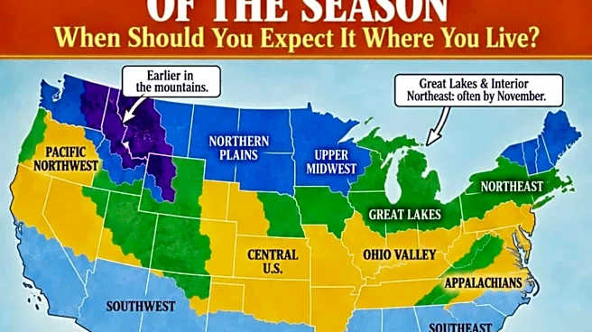
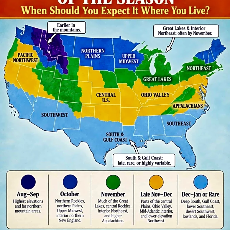
The Farmers' Almanac's first snowfall map shows the typical timing of the first snowfall across the United States.
For New York, the Almanac says northern portions of the state, including much of the Adirondack region, could see their first snow in October. Much of the rest of the state typically sees its first snow in November.
The Almanac cautions that its map is a climatological guide rather than a prediction for a specific snowstorm.
Could Rochester see lake-effect snow before then?
Yes. Rochester's proximity to Lake Ontario means lake-effect snow can develop whenever the right atmospheric conditions are in place.
The National Weather Service notes that lake-effect snow season begins as increasingly cold air crosses the still-warm Great Lakes during late autumn.
That means Rochester could see snow earlier or later than its Nov. 8 historical average.
What does this winter's forecast say?
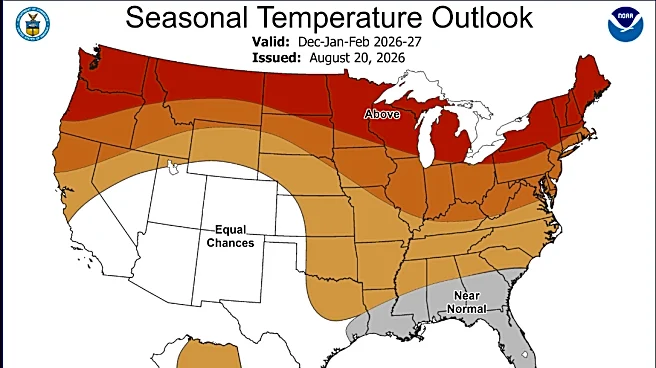
According to the Farmers' Almanac's 2026-27 winter forecast, the Northeast could see a mix of rain, sleet, ice and heavy wet snow this winter.
The Almanac expects inland areas of the Northeast to see several rounds of heavy, wet snow, particularly in January and February. However, individual storm forecasts become more useful as winter approaches.
For Rochester, the Nov. 8 average first-snow date is a useful historical marker — but residents will need to watch the actual forecast for the first measurable snow of winter 2026-27.
This article originally appeared on Rochester Democrat and Chronicle: When will Rochester see its first snowfall this winter?