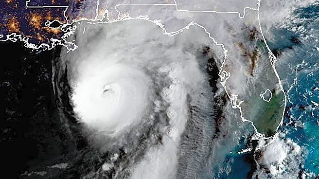







Augusta residents can expect a stretch of warm, dry weather this week following weekend rain, gusty winds and isolated severe weather associated with the outer bands of Hurricane Isaias.
"Right now, there's nothing really going on in the Atlantic after this past weekend," said Drew Hickok, a meteorologist with the National Weather Service in Columbia, South Carolina. "We had some impacts from the storm's outer bands here, including rain, thunderstorms and tornadoes. But heading into the week, we're not seeing much additional activity in the Atlantic."
Forecast for the Augusta area
Tuesday: High 86, low 61.
Wednesday: High 88, low 62.
Thursday: High 88, low 64.
Friday: High 88, low 56.

"This week will
be completely different in the sense that it should be dry most of the week," Hickok said. "It'll get quite warm, especially by midweek. Beginning Wednesday, temperatures should climb into the upper 80s and approach 90 degrees."
Hickok said several atmospheric and oceanic conditions can either support or suppress tropical storm development.
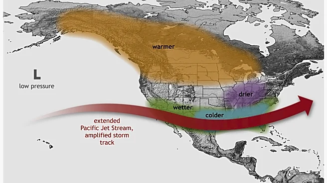
"The main feature helping suppress Atlantic activity this season has been El Niño in the Pacific," Hickok said. "Sea surface temperatures in the central Pacific are well above normal, which generally creates stronger wind shear across parts of the Atlantic. That's one reason we've had a quieter season up to this point."
Atlantic hurricane season runs from June 1 through Nov. 30. According to the National Oceanic and Atmospheric Administration, warmer ocean waters provide the heat and moisture tropical systems need to form, organize and intensify.

According to NOAA, the Environmental Defense Fund and the Center for Climate and Energy Solutions, climate change can influence hurricanes in several ways:
- Warmer ocean waters
- Heavier rainfall rates
- Higher storm surge impacts due to sea-level rise
- Slower storm movement in some cases
- Changes in storm intensity and season characteristics
Hickok said temperatures and rainfall in Augusta have been near normal over the past week.
"Heading into next week, temperatures are expected to be above normal," he said. "For reference, the normal high temperature in Augusta this time of year is around 80 degrees. We could see temperatures near 90 by the middle to latter part of the week. The record high for this period is 91 degrees, and our forecast currently calls for 89. That would put us within a few degrees of a record."
This reporting content is supported by a partnership with Journalism Funding Partners.
Erica Van Buren is the climate change reporter for The Augusta Chronicle, part of the USA TODAY Network. Connect with her at EVanBuren@usatodayco.com or on X: @EricaVanBuren32.
This article originally appeared on Augusta Chronicle: Highs near 90 degrees expected after weekend storms