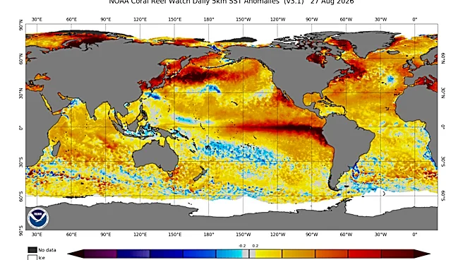

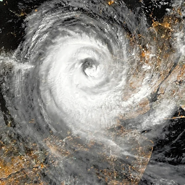





The current El Niño, dubbed a "super El Niño" by some forecasters due to its projected strength and potential to rank among the most powerful on record, is expected to significantly suppress tropical activity for the remainder of the Atlantic hurricane season.
In its updated outlook, AccuWeather predicts eight to 11 named storms, including three to four hurricanes and one to two major hurricanes during the 2026 Atlantic hurricane season.
While El Niño develops in the Pacific Ocean, its effects extend far beyond the region, influencing weather patterns worldwide.
During Atlantic hurricane season, El Niño typically increases wind shear across parts of the basin. These stronger and more frequent disruptive winds can hinder storm formation and make
it more difficult for tropical systems to strengthen into hurricanes, AccuWeather reported.
Shop for your storm preparedness kit
"That gives us greater confidence in lowering the total number of named storms, but it does not eliminate the risk of a damaging hurricane strike in the United States," said AccuWeather Lead Hurricane Expert Alex DaSilva. "It only takes one storm to define a hurricane season."
Here's what to know in Tennessee.
What is El Niño? How long does it last?
El Niño is the warm phase of the El Niño-Southern Oscillation (ENSO), a naturally occurring climate pattern driven by warmer-than-average sea surface temperatures in the central and eastern tropical Pacific Ocean.
According to the National Oceanic and Atmospheric Administration (NOAA), El Niño develops on average every two to seven years and typically lasts nine to 12 months, with its strongest impacts occurring during the Northern Hemisphere winter when it often brings milder conditions to the northern United States and wetter weather across the South.
El Niño means "little boy" in Spanish.
South American fishermen first identified unusually warm Pacific waters centuries ago and named the phenomenon “El Niño de Navidad,” or “the Christ Child,” because it typically reaches its peak around December.
El Niño vs La Niña
La Niña is essentially the opposite phase of the same climate cycle.
During La Niña, stronger-than-normal trade winds push warm water toward Asia, allowing colder, nutrient-rich water to rise to the surface in the eastern Pacific.
Those cooler ocean temperatures can shift weather patterns worldwide, often bringing drier conditions to the southern United States, wetter weather to the Pacific Northwest and a more active Atlantic hurricane season, according to NOAA.
Winters during La Niña tend to be warmer across the South and cooler across the northern U.S.
How a 'super' El Niño could impact Tennessee
Historically, strong El Niños have brought milder and wetter-than-normal conditions to the state during the fall and early winter, with December temperatures averaging several degrees above normal and increased chances for rainfall.
As winter progresses, however, the pattern often shifts, wrote the National Weather Service in an email to The Tennessean.
January and February have typically been cooler than average during past strong El Niño years, while precipitation has trended lower. By spring, both temperatures and rainfall have generally increased across the region.
The weather service advised that these outlooks are based on historical averages from previous strong El Niño events and are not a forecast of exactly what will occur this year. "Instead we use it as a guide to give us an idea of potential conditions to expect," added the weather service.
How 'super' El Niño is expected to impact hurricane season
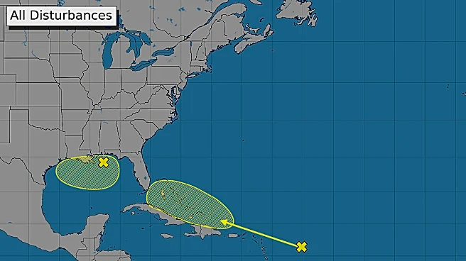
Hurricane forecasters say a developing "super" El Niño could help suppress tropical activity across the Atlantic during the second half of hurricane season. The climate pattern typically increases wind shear over the Atlantic, making it more difficult for storms to form and strengthen.
Even so, experts caution that fewer storms do not necessarily mean a less destructive season.
"While those atmospheric conditions can reduce the overall number of tropical storms and hurricanes, they do not eliminate the threat to the United States," DaSilva said.
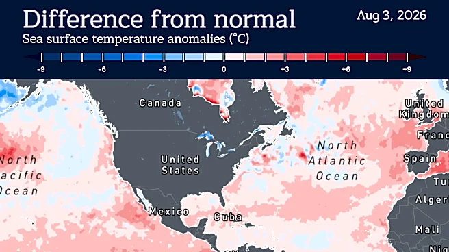
"Exceptionally warm waters near part of the U.S. coastline can provide fuel for tropical systems that develop close to land, raising concerns about rapid intensification and leaving people and businesses with less time to prepare."
Coastal residents from the Gulf Coast to the Atlantic seaboard are encouraged to remain vigilant, particularly along the northern and eastern Gulf Coast, the Carolinas and parts of the northeastern Caribbean, where the risk of direct storm impacts remains elevated.
With the Atlantic hurricane season historically peaking around Sept. 10, AccuWeather added that significant tropical development can continue well into the fall.
Some of the most damaging hurricanes in recent years have formed after the seasonal peak, including Hurricane Helene, which struck Florida's Big Bend as a Category 4 storm on Sept. 26, 2024, and Hurricane Milton, which made landfall near Siesta Key, Florida, as a Category 3 hurricane less than two weeks later on Oct. 9.
Diana Leyva covers trending news and service journalism for The Tennessean. Contact her at Dleyva@gannett.com.
This article originally appeared on Nashville Tennessean: A rare 'super' El Niño is taking shape. What it could mean for Tennessee
Our editors independently choose our recommendations. Some content is produced with paid support from a third party, however our editorial decisions remain independent. If you buy through our links, the USA TODAY Network may earn a commission. Prices and availability may change.