







Fall has settled into Tennessee, but the colder temperatures of winter will soon be on the way.
According toThe Farmers' Almanac, the winter solstice marks the first day of winter on Dec. 21. However, meteorological winter in the Northern Hemisphere begins Dec. 1 and ends Feb. 28.
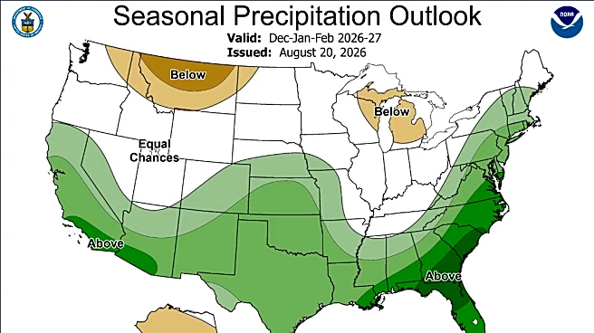
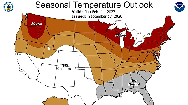
Ahead of winter, NOAA's Climate Prediction Center has released its forecast for December through February, predicting warmer-than-average temperatures across Tennessee and equal chances of above-, below- or near-average precipitation in Middle Tennessee.
Here's what else to know.
How cold will winter 2025 be in Tennessee? What to know about NOAA forecast
The center's forecast covers the months of December, January and February, a period known as meteorological winter.
Shop Amazon for weather essentials
According to the outlook, Tennessee has a 33%
to 40% chance of experiencing warmer-than-average temperatures this winter. When it comes to precipitation, West and Middle Tennessee are forecast to see equal chances of above-, below- or near-average rainfall, while some parts of East Tennessee have a 33% to 40% chance of seeing above-average precipitation.
Here are the monthly averages for Nashville, Memphis and Knoxville, perNational Weather Service data:
Nashville: December brings an average temperature of 43 and around 4.43 inches of precipitation to the Nashville area. January cools slightly to an average of 40, with about four inches of precipitation. By February, temperatures rise back to an average of 43, accompanied by 4.47 inches of precipitation.
Memphis: December sees an average temperature of 45 and 5.50 inches of precipitation across the Memphis area. January dips to 42 with 4.14 inches of rain, while February warms to 46 and receives approximately 4.55 inches of precipitation.
Knoxville: Knoxville experiences colder conditions overall, with December averaging 39.3 F with 3.76 inches of precipitation. January is the coldest month, averaging 36.4 F with 3.65 inches of rain. February sees a slight increase to 40 F, with 3.81 inches of precipitation.
What do other winter forecasts say? What to know about Farmers' Almanac prediction
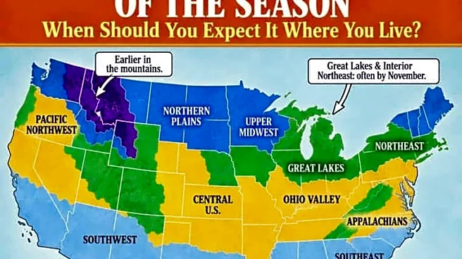
According to The Farmers' Almanac snowfall map, West and Middle Tennessee could see their first snowfall sometime between late November and December, while East Tennessee could see snowflakes as soon as early November, though the exact timing varies.
The almanac noted that latitude alone does not determine when the first snow arrives. Factors such as elevation, storm tracks and local weather patterns can impact the date.

"This is a climatological guide rather than a forecast for one particular storm," the almanac wrote. "Elevation, latitude, nearby bodies of water and the weather pattern in a particular year can move the first snow considerably earlier or later."
The almanac also highlighted that the definition of a "first snow" can differ.
In some cases, it may refer to the first snowflakes observed falling, even if they melt immediately without accumulating. Others consider it the first measurable snowfall, defined as at least 0.1 inch of accumulation, the threshold commonly used by the weather service.
According toclimate records from the National Weather Service office in Nashville, Middle Tennessee typically sees its first measurable snowfall between mid- and late December.
Diana Leyva covers trending news and service journalism for The Tennessean. Contact her at Dleyva@gannett.com.
This article originally appeared on Nashville Tennessean: Tennessee winter outlook: NOAA vs. Farmers' Almanac predictions
Our editors independently choose our recommendations. Some content is produced with paid support from a third party, however our editorial decisions remain independent. If you buy through our links, the USA TODAY Network may earn a commission. Prices and availability may change.