


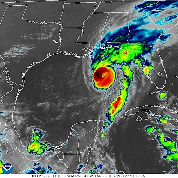



The remnants of Hurricane Isaias will move through Middle Tennessee this weekend, bringing rainfall, strong winds and a low potential for spin-up tornadoes.
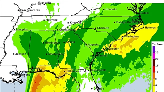
According to the National Weather Service office in Nashville, Middle Tennessee is expected to receive between one to three inches of rain. A flood watchis in place for several Middle Tennessee counties, including Bedford, Cheatham, Coffee, Davidson, Dickson, Giles, Grundy, Hickman, Humphreys, Lawrence, Lewis, Marshall, Maury, Perry, Rutherford, Wayne, and Williamson.
The watch is in effect from 1 a.m. Oct. 10 to 7 a.m. Oct. 11.
Today would be a good day to secure any loose outdoor objects or inflatable Halloween decorations. Remnants of Hurricane Isaias will move through this weekend, bringing
windy and rainy conditions to all of Middle TN. pic.twitter.com/JZy1rCLLvq
— NWS Nashville (@NWSNashville) October 9, 2026
Here's what else to know in Tennessee as Isaias prepares to make landfall.
When will the remnants of Hurricane Isaias move into Tennessee?
Rain and thunderstorm activity is expected to increase during the morning of Oct. 10, with the greatest chance for widespread rainfall occurring through the afternoon and evening, the weather service wrote in its Oct. 9 morning discussion.
Shop storm survival essentials on Amazon
The highest rain totals are projected along and south of Interstate 40.
In addition to heavy rain, the system is forecast to bring wind gusts of 30 to 40 mph. The strongest winds are expected during the afternoon and evening hours of Oct. 10, with southern Middle Tennessee facing a 30% to 60% chance of gusts exceeding 45 mph.
The weather service is warning of downed trees and branches as well as local power outages.
"If you haven't already, now would be a good time to secure any loose or inflatable Halloween decorations!" the weather service wrote Oct. 9.
Projected rain totals from Hurricane Isaias in Middle Tennessee
- Waverly: 1 inch
- Waynesboro: 1-1.5 inches
- Clarksville: 0.5-1 inches
- Nashville: 1-1.5 inches
- Columbia: 1-1.5 inches
- Lafayette: 1-1.5 inches
- Smithville: 1-1.5 inches
- Tullahoma: 2-3 inches
- Jamestown: 0.5-1 inch
- Crossville: 1-1.5 inches
Will Isaias bring tornadoes to Tennessee?
As of the morning of Oct. 9, the tornado threat from Isaias in Tennessee is low. However, tornadoes from tropical systems can be "tricky," the weather service said, and may develop quickly, even from showers with no lightning.
A brief spin-up tornado cannot be ruled out from the afternoon of Oct. 10 through the evening of Oct. 10.
When will Isaias move out of Tennessee?
According to the weather service, the remnants of Isaias will move out of Middle Tennessee on Oct. 11, with rain chances ending from southwest to northeast.
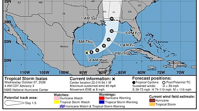
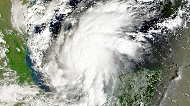
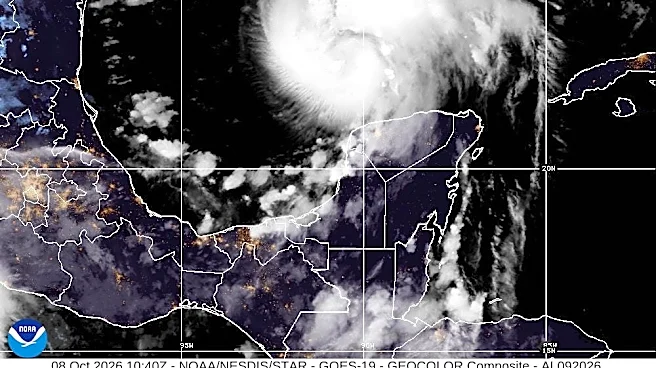
Where is Hurricane Isaias? Follow the storm's path into Tennessee
This forecast track shows the most likely path of the center of the storm. It does not illustrate the full width of the storm or its impacts, and the center of the storm is likely to travel outside the cone up to 33% of the time.
Hurricane Isaias spaghetti models
The illustration includes an array of forecast tools and models, and not all are created equal. The hurricane center uses only the top four or five highest-performing models to help make its forecasts, and not all of them are publicly available
Diana Leyva covers trending news and service journalism for The Tennessean. Contact her at Dleyva@gannett.com.
This article originally appeared on Nashville Tennessean: Hurricane Isaias moves into Tennessee Saturday. Track the storm's path as it makes landfall
Our editors independently choose our recommendations. Some content is produced with paid support from a third party, however our editorial decisions remain independent. If you buy through our links, the USA TODAY Network may earn a commission. Prices and availability may change.