


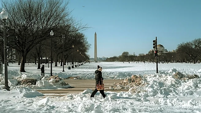


This winter could bring a clash between two major weather systems, and little is known about how they will affect Tennessee.
Right now, the polar vortex is taking shape over the North Pole, and it is starting the season stronger than normal. At the same time, a very strong El Niño is developing in the tropical Pacific, and the two atmospheric patterns could shape how the winter unfolds.
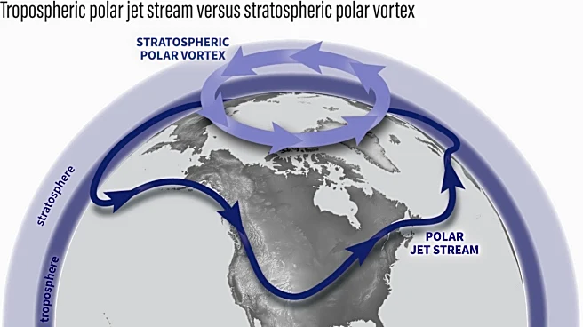
The polar vortex is a circulation of cold air and strong winds that forms over the Arctic each winter. A strong vortex keeps cold air confined to the pole, while a weakened vortex can let Arctic air move south into the United States and other parts of the Northern Hemisphere.
Here is what Tennessee could expect from these two patterns this winter.
What is the polar vortex?

The polar vortex
is a weather system that brings cold air and strong winds. According to the National Oceanic and Atmospheric Administration, it forms over the Arctic during winter in the Northern Hemisphere.
During this time of year, attention shifts to the polar vortex in the stratosphere, which forms as the Arctic stratosphere cools. Its circulation strengthens when the temperature difference between the cold polar regions and warmer areas to the south increases.
Think of the vortex as part of the system that keeps Arctic air contained in the atmosphere.
When the circulation is strong and stable, its winds help keep cold air close to the pole. When the vortex weakens, stretches, or moves, it lets cold Arctic air flow farther south.
A disrupted polar vortex does not automatically mean that it will get colder as far south as Tennessee. Similarly, a strong polar vortex does not guarantee warmer weather across the country.
What does a strong polar vortex mean for winter?
The polar vortex is getting stronger over the Arctic as the Northern Hemisphere heads into fall. For now, that's not necessarily bad news for Tennessee.
A strong, stable polar vortex helps keep the coldest Arctic air near the pole, preventing it from moving south. The key question for winter is whether this will change later in the season.
The polar vortex in the stratosphere is developing as expected for this time of year and is currently stronger than average, based on recent data. Long-term forecasts suggest the vortex could weaken later in the winter, especially around January and February.
Meteorologists will be watching for that potential shift.
When the vortex is strong and stable, it keeps cold Arctic air contained. However, if it weakens or gets disrupted, Arctic air can move more easily into the midlatitudes, including Tennessee.
When cold Arctic air meets a moisture-rich storm, it can create snowstorms and blizzards. This year, El Niño may contribute by increasing moisture flow. It does this by strengthening the southern jet stream and bringing more Pacific moisture into the U.S.
Why is the polar vortex getting stronger now?
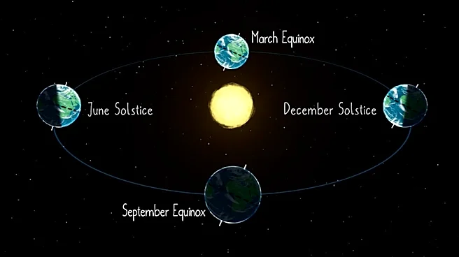
The polar vortex naturally develops during late summer and fall as sunlight decreases over the Arctic and the stratosphere begins to cool.
Recent observations indicate that the polar vortex for the 2026-27 season is strengthening as temperatures cool for the season. NASA data from mid-September showed that winds around 60 degrees north in the lower stratosphere are above average for this time of year, reflecting typical seasonal changes in the vortex.
Forecasts from the European model show that the vortex will become more organized by late September. However, it is expected to return to typical levels in October.
A stronger polar vortex in September does not mean that winter will be extremely cold. In fact, a strong vortex can keep the coldest Arctic air farther north, keeping it out of Tennessee altogether.
Could the polar vortex weaken this winter?
Severe Weather Europe has analyzed long-range seasonal forecasts and found that the stratospheric circulation may weaken in January and February. Another analysis of the same forecasts indicates a stronger vortex early in winter, followed by a decrease in wind strength during the middle and later parts of the season.
That is a seasonal signal, not a forecast for a polar-vortex collapse.
A sudden stratospheric warming is when temperatures in the stratosphere rise quickly. This event weakens or reverses the normal westerly winds of the polar vortex. These changes can affect the weather in lower parts of the atmosphere and may increase the chances of Arctic air outbreaks in the midlatitudes.
Surface effects can happen at different times and places. A forecast made in September cannot reliably predict whether a major sudden stratospheric warming will happen months later.
How does El Niño fit into the polar vortex?
This winter, another major atmospheric player is El Niño.
The NOAA Climate Prediction Center announced on Sept. 10 that El Niño is getting stronger. There is more than a 90% chance of a very strong El Niño in the Northern Hemisphere during the fall and winter of 2026-27. Additionally, NOAA reported a 75% chance that the period from October to December will reach levels seen in historic-strength events since records began in 1950.
Strong El Niño events can change how the atmosphere works and affect the jet stream. Research shows that El Niño can also influence stratospheric airflow by altering large-scale atmospheric waves.
Severe Weather Europe’s analysis shows that a strong El Niño could create conditions that disrupt the polar vortex in midwinter.
What will winter be like in Tennessee?

While winter is still a few months away, experts still expect a warmer-than-usual winter in Tennessee.
Outlook maps from the National Weather Service, released on Sept. 17, show that Tennessee has a 33%-40% chance of temperatures above normal from December to February.
Additionally, the eastern part of the state has a 33%-40% chance of above-normal precipitation this winter. The rest of the state will likely see normal precipitation amounts during that period.
According to the Farmers' Almanac, an active storm track will likely extend from Southern California through Texas and the Southeast, bringing frequent storms, muddy fields, and occasional cold-air surges.
With Tennessee in the northern part of the Southeast U.S., it sits between two predicted climate regions for the 2026-27 winter season.
The two regions are similar, with the northern area expected to see cold, snowy periods and the southern region expected to see a cool, wet and stormy season. Overall, the Farmers' Almanac predicts Tennessee will likely see a cold, wet winter, with most precipitation likely falling as rain.
USA TODAY contributed to this report.
Jordan Green covers trending news for The Commercial Appeal and Tennessee. She can be reached at jordan.green@commercialappeal.com.
This article originally appeared on Nashville Tennessean: Winter 2026 could include a polar vortex, El Niño hit on Tennessee