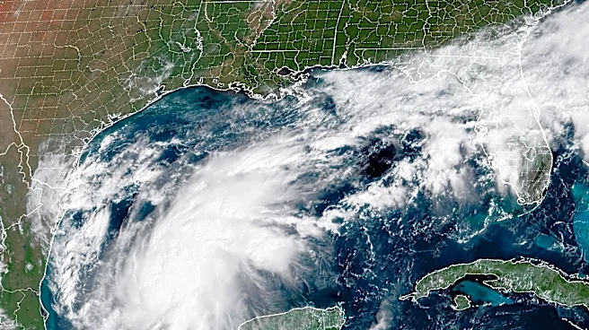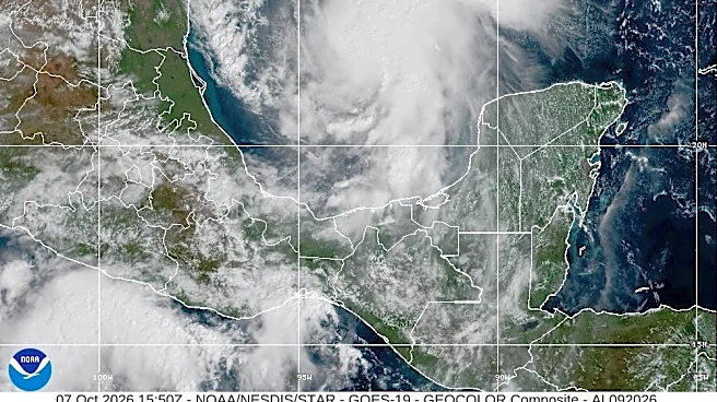



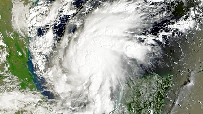
Hurricane Isaias is on the move.
The first hurricane of the 2026 Atlantic hurricane season is continuing its trek toward the U.S. Gulf Coast, where forecasters expect it to makelandfall late Oct. 9.
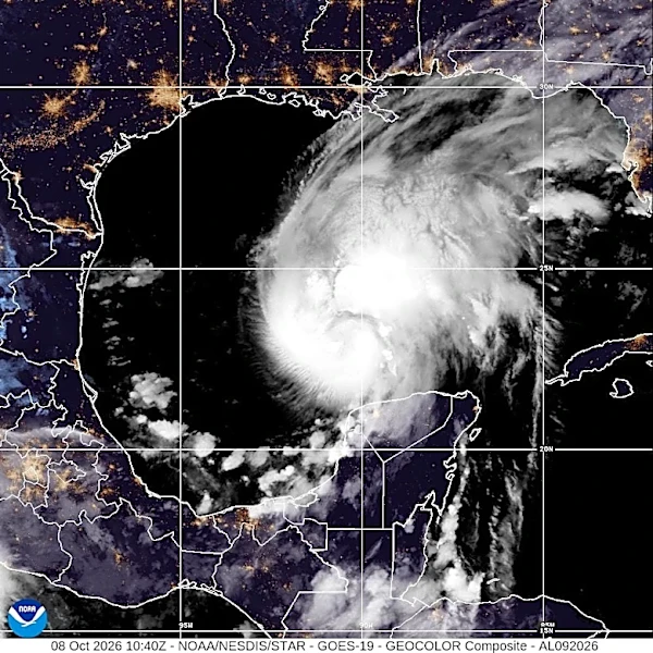
Isaias strengthened into a hurricane with maximum sustained winds of 75 mph less than 20 hours after becoming a tropical storm, the National Hurricane Center announced Oct. 7. Isaias continued to intensify the morning of Oct. 8.
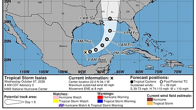
The hurricane center warned Isaias is likely to continue a period of rapid strengthening before reaching the coast somewhere between Pascagoula, Mississippi, and Panama City Beach, Florida, the evening of Oct. 9. Isaias could have winds of over 100 mph as it approaches the U.S. coast, then dramatically weaken, the hurricane center said.
It's forecast to peak before making landfall, USA TODAY reported.
Be ready: Shop storm essentials on Amazon
The remnants of the hurricane are expected to bring rainfall and gusty winds to Middle Tennessee throughout the weekend. Rainfall is anticipated to bring relief to the drought-stricken region, though the National Weather Service office in Nashville is not expecting any "significant" impacts.
Here's what else to know.
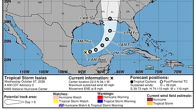
Where is Hurricane Isaias? Follow path tracker
This forecast track shows the most likely path of the center of the storm. It does not illustrate the full width of the storm or its impacts, and the center of the storm is likely to travel outside the cone up to 33% of the time.
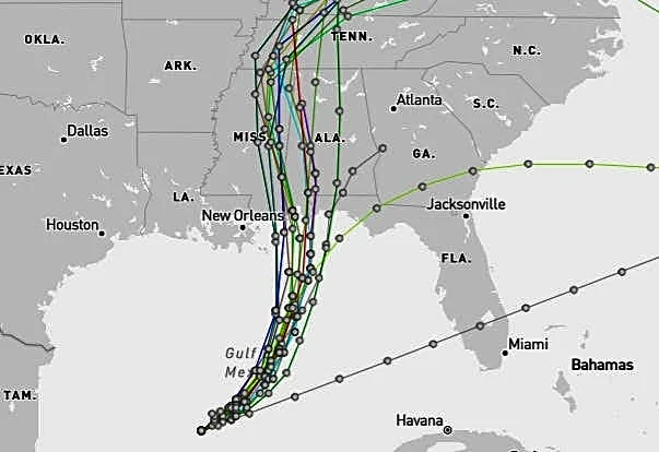
Hurricane Isaias spaghetti models
The illustration includes an array of forecast tools and models, and not all are created equal. The hurricane center uses only the top four or five highest-performing models to help make its forecasts, and not all of them are publicly available.
Hurricane Isaias forecast: When to expect landfall
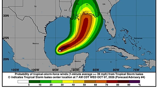
Forecasters said Isaias is expected to pass to the north of the Yucatan PeninsulaOct. 8 and make landfall along the northern Gulf coast of the U.S. late Oct. 9 or early Oct. 10.
Isaias could have winds of over 100 mph by Oct. 9 as it approaches the United States, according to the center's hurricane specialists. It's forecast to peak before making landfall, but could still be a "significant" hurricane when it reaches the coast, with strong winds and flooding rain, the hurricane center said.
It should then weaken dramatically.
"We are expecting multiple dangerous, life-threatening impacts along portions of the northern Gulf coast on Friday," Mike Brennan, National Hurricane Center director, said Oct. 7. Those impacts could include storm surge, heavy rainfall, flooding and hurricane-force winds.
From Oct. 9 through the weekend, Isaias is expected to produce rainfall totals between 3-7 inches, with localized totals up to 10 inches, across the central U.S. Gulf coast extending from far southeastern Louisiana to the Florida Panhandle, with the Tennessee Valley and the Carolinas seeing anywhere from 1-5 inches of rain as well.
What category is Isaias?
Hurricane Isaias is expected to continue strengthening as it approaches the U.S. Gulf Coast, but there is still some uncertainty about how strong it will get.
Forecasters with the National Hurricane Center said the intensity forecast is "somewhat tricky," the morning of Oct. 8. Significant intensification is expected despite wind shear working against the storm. It could peak and experience some weakening before making landfall, but forecasters said it should still be a strong hurricane when it reaches land.
The hurricane center expects it to reach a Category 2 on the Saffir-Simpson Hurricane Wind Scale, peaking with maximum sustained winds of about 110 mph the morning of Oct. 9, making it just shy of a major hurricane (a Category 3 or higher, wind speeds of at least 111 mph).
"There is a chance the storm peaks as a Category 3, or major hurricane, while over the central Gulf," AccuWeather Chief Meteorologist Bernie Rayno said.
Isaias impact on Middle Tennessee
The remnants of Isaias are expected to bring widespread rain, gusty winds and much-needed moisture to drought-stricken Middle Tennessee this weekend.
According to the weather service, rain chances will increase significantly beginning Oct. 10 as the weakening storm system moves north from the Gulf Coast. Widespread rainfall is forecast across Middle Tennessee from Oct. 10 into Oct. 11, with the heaviest precipitation expected Oct. 10.
Most areas are set to receive between one and three inches of rain. At this time, significant relief from the drought is not anticipated, though forecasters continue to monitor the potential for thunderstorms.
Wind gusts of 30 to 40 mph are also possible on Oct. 10. The remnants of Isaias are expected to move northeast and exit the region by Oct. 12.
Contributing: USA TODAY
Diana Leyva covers trending news and service journalism for The Tennessean. Contact her at Dleyva@gannett.com.
This article originally appeared on Nashville Tennessean: Hurricane Isaias' spaghetti models show storm's path into Tennessee
Our editors independently choose our recommendations. Some content is produced with paid support from a third party, however our editorial decisions remain independent. If you buy through our links, the USA TODAY Network may earn a commission. Prices and availability may change.