




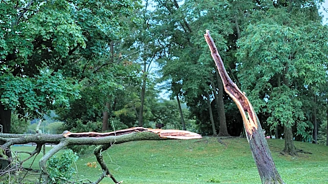
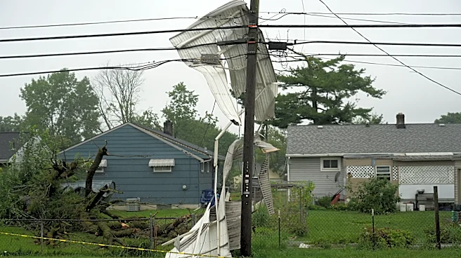

The National Weather Service has determined that six tornadoes touched down across Ohio on Aug. 11 during intense and destructive storms that battered central Ohio, triggering widespread flooding and causing significant property damage throughout the region.
All of the tornadoes ranged between an EF0 and EF2 on the Enhanced Fujita Scale, according to the National Weather Service in Wilmington. Three of the tornadoes touched down in Clark County, while one each touched down in Franklin, Madison and Champaign, counties, according to the weather service. All of the tornadoes touched down on the morning of Aug. 11.

The weather service previously announced that an EF1 tornado touched down on Columbus' South Side and caused significant damage. That
tornado touched down at 10:05 a.m. between East Morrill and East Hinman avenues, uprooted several trees and caused roof damage to several residences farther east toward Parsons Avenue, according to the weather service. Reeb Avenue was hit particularly hard by damaging winds before the twister crossed Lockbourne Road and damaged more trees and multiple businesses, the weather service said.
The tornado traveled nearly 2 miles before dissipating at 10:09 a.m., according to the weather service.
The team evaluated damage from East Hinman Avenue to Fairwood Avenue, including Barack Community Center and a portion of Parson's Avenue. Trees were damaged, and some of the homes and businesses had damaged roofs, the weather service said.
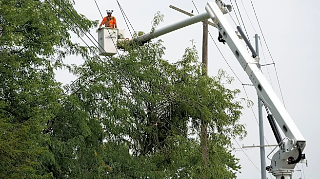
The damage was in a "convergent pattern," meaning the damage did not extend in the same direction as damage from straight-line winds, like those that are believed to have struck the Berliner Park area, and knocked down more than 30 utility power poles near the east side of Interstate 71 by the park.
The National Oceanic and Atmospheric Administration's Storm Prediction Center said preliminary data shows that most of the storms that moved through the Midwest that day were a derecho, a type of large, severe thunderstorm with widespread destructive winds. The winds can surpass 80 mph and resemble those of hurricanes or tornadoes.
Tornado wind speeds peaked at 115 mph in Clark County
A total of three tornadoes touched down in Clark County in west central Ohio within minutes of each other, according to the weather service.
The strongest of the tornadoes touched down at 9:33 a.m. just south of the village of Catawba, east of Springfield, with peak winds estimated at 115 mph, according to the weather service.
Weather service crews noted damage along Vernon Asbury Road, where several trees were downed. As the tornado moved east, it began gaining strength and caused additional tree damage as well as damage to two outbuildings. The most significant damage occurred at a home that had its roof ripped off, and an attached garage was destroyed. The tornado dissipated shortly after at 9:38 a.m., according to the weather service.
Meanwhile, in Springfield, two tornadoes touched down back-to-back, with one of them reaching peak winds of 100 mph while the other one traveled for nearly 10 miles before dissipating, according to the weather service.
Those two tornadoes registered as an EF1 on the Enhanced Fujita scale. The first tornado touched down at 9:24 a.m. and traveled for 4.4 miles before dissipating at around 9:30 a.m., according to the weather service. Video evidence shows the tornado moving through a parking lot at a manufacturing and trucking facility on Urbana Road, according to the weather service. The tornado caused tree damage, and it reached a maximum wind speed of 80 mph before dissipating.
The second tornado touched down a minute later at 9:31 a.m. and traveled for 9.1 miles before it petered out, according to the weather service. The peak winds reached 100 mph, and the weather service recorded tree damage and reports of trees falling on top of houses.
Two barns were also heavily damaged, and sheet metal was blown into adjacent fields, according to the weather service. That tornado reached peak wind speeds of 100 mph before dissipating at 9:40 a.m., according to the weather service.
Tornadoes recorded in Madison, Champaign counties
An EF1 tornado touched down in Urbana, located in Champaign County in west-central Ohio, at 9:30 a.m. and traveled for 3.6 miles, reaching wind speeds of 110 mph before dissipating, according to the weather service.
The tornado damaged a residence on Pisgah Road that had a portion of its roof lifted off, and a nearby barn was also destroyed, according to the weather service.
The tornado continued southeast, where it also damaged a residence on Hurst Road that saw a section of its roof removed. A nearby barn was also destroyed as the tornado continued moving southeast, causing damage at a home on Hurst Road, where a large section of the roof was also removed. Wind speeds peaked at 110 mph, according to the weather service.
An EF1 tornado, possibly a reformation of one from neighboring Champaign County, then touched down in Madison County in central Ohio at 9:44 a.m. and traveled for less than a mile before dissipating at 9:45 a.m., the weather service said. The tornado touched down on the northeastern side of Choctaw Lake. The majority of the damage consisted of fallen trees, including one tree that fell on top of a car, according to the weather service.
Reporter Shahid Meighan can be reached at smeighan@dispatch.com, at ShahidMeighan on X, and at shahidthereporter.dispatch.com on Bluesky.
This article originally appeared on The Columbus Dispatch: 6 tornadoes struck the Buckeye state Aug. 11, 2 in central Ohio. See where