




After drenching much of central Ohio with several inches of rain and causing widespread flooding, the weather pattern is beginning to settle down for now.
National Weather Service meteorologist Logan Clark said an exiting low-pressure system could bring a light shower or sprinkle through the rest of Aug. 20 and into the night. However, any rainfall is expected to be light and should not produce meaningful accumulation.
Will it rain tonight in Columbus?
The National Weather Service forecast calls for partly cloudy skies overnight Aug. 20 to 21 with patchy fog developing after 5 a.m. Temperatures are expected to fall to around 64 degrees.
A stray sprinkle remains possible, but widespread rain is not expected.
Aug. 21 looks even drier, with patchy morning fog giving way to mostly sunny
skies and a high near 82 degrees.
The next appreciable chance for showers and thunderstorms arrives Aug. 22 in the afternoon and evening, when rain chances increase to 70%.
Is flooding expected overnight?
Flooding concerns are expected to continue in some locations because of the enormous amount of rain that has already fallen, but forecasters say the risk of additional flash flooding overnight is low.
The National Weather Service's latest Hazardous Weather Outlook says there is a low probability for widespread hazardous weather through the rest of tonight.
Some rivers, creeks and low-lying areas may continue to experience high water as runoff works its way through area waterways.
Officials continue to remind motorists to avoid driving through flooded roads, warning: "Turn around, don't drown."
How much rain fell in Columbus?
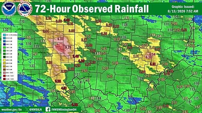
The latest storm dropped 2.87 inches of rain at John Glenn Columbus International Airport, according to National Weather Service data provided by Clark.
Before that, John Glenn Columbus International Airport had recorded 7.04 inches of rain in August. The additional 2.87 inches that fell Aug. 19 brought the month's total to 9.91 inches.
Some locations across central Ohio received even more rain, with Clark saying localized rainfall totals exceeded 10 inches.
The latest deluge comes just over a week after severe thunderstorms and tornadoes swept through central Ohio, leaving behind flood damage, downed trees and saturated ground that made the region more vulnerable to flooding from this week's storms.
Columbus weather forecast for the rest of the week
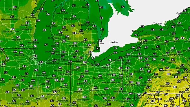
- Thursday, Aug. 20: A slight chance of showers or thunderstorms through late afternoon. There will be a high near 81 degrees.
- Thursday night: Partly cloudy with patchy fog developing late. There will be a low around 64 degrees.
- Friday, Aug. 21: Mostly sunny with a high near 82 degrees.
- Saturday, Aug. 22: Showers and thunderstorms become likely during the afternoon and evening. There will be a high near 81 degrees and a 70% chance of rain.
- Sunday, Aug. 23: Sunny and cooler with a high near 76 degrees.
Trending reporter Amani Bayo can be reached at abayo@dispatch.com.
This article originally appeared on The Columbus Dispatch: Will it rain tonight in Columbus? Latest flooding, forecast