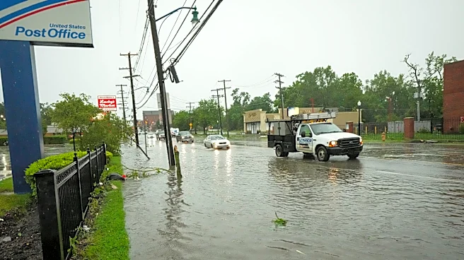







Columbus and other parts of central Ohio are again under flood watch as another round of heavy rainfall moves through the region just days after the Aug. 11 derecho.
The National Weather Service's Wilmington office issued a hazardous weather outlook in the early hours of Aug. 15, alerting that a flood watch will be in effect for central Ohio – among other parts of the Buckeye State and eastern Indiana – from noon Aug. 15 through the morning of Aug. 16. The notice warned of storms that could become severe the afternoon and evening of Aug. 15, with "damaging winds" noted as the main concern.
Potentially heavy rainfall from those thunderstorms could cause flash flooding, according to the alert. It also said "an isolated tornado cannot be ruled out."
Additional storms are possible the afternoon and evening of Aug. 16, though the flood watch is currently expected to lift at 8 a.m. that day, according to the NWS.
This weekend's alert follows a flood watch notice Aug. 13-14 after severe storms just days prior. The National Weather Service previously said a preliminary survey of damage indicates an EF1 tornado touched down in Columbus' South Side on Aug. 11.
That day's storms caused widespread damage in Franklin County and other parts of central Ohio, even prompting Columbus Mayor Andrew Ginther to declare a Mayor's Emergency and Upper Arlington City Schools to twice delay its start date.
As for this weekend's flood watch, the National Weather Service advised that people in the area pay attention to the weather and be prepared for "immediate action" should heavy rains or flooding occur. Avoid low-lying areas, and use caution when navigating highway dips and underpasses, according to the alert.

What's the weather forecast for this weekend?
The National Weather Service has issued the following forecast for the rest of the weekend:
Aug. 15 (day): A chance of showers and thunderstorms, mainly between 4-5 p.m. Mostly cloudy, light winds and 30% chance of precipitation. High near 85 degrees.
Aug. 15 (night): Showers and thunderstorms, some of which could produce heavy rainfall. Chance of precipitation if 90%, with up to two inches of rainfall possible. Low near 72 degrees.
Aug. 16 (day): A chance of showers and thunderstorms, particularly after 5 p.m. Partly sunny with west wind gusts as high as 23 miles per hour and 60% chance of precipitation. High near 88 degrees.
Aug. 16 (night): Showers and thunderstorms likely before 8 p.m. Mostly cloudy with west wind gusts as high as 20 miles per hour and 60% chance of precipitation. Low near 71 degrees.
Reporter Emma Wozniak can be reached at ewozniak@dispatch.com or @emma_wozniak_ on X, formerly known as Twitter.
This article originally appeared on The Columbus Dispatch: Flood watch issued for central Ohio after storms, 'damaging winds' forecast