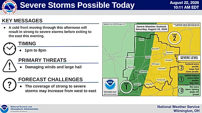







A cold front moving through central Ohio the afternoon of Aug. 22 will bring strong to severe storms, according to the National Weather Service in Wilmington.
The weather service predicts scattered storms and rain from 1 p.m. to 8 p.m. The main threats from the storms will be damaging wind and hail, according to a hazardous weather outlook.
The chance of precipitation throughout the day is 80%, and ⅒-¼ inch of rain is expected, but more could fall if there are thunderstorms, according to the weather service.

Central Ohio continues recovering from torrential rainfall Aug. 19 and 20 that sent a river surging over a highway and caused widespread flooding east of Columbus. This is the second-rainiest August on record in Columbus so far, and this month
had the second-rainiest start to any month in the city's history, according to the weather service.
Rain remains possible for the rest of the weekend. There is a slight chance of showers and thunderstorms after 3 p.m. Aug. 23, otherwise it will be mostly sunny with a high near 75. The chance of precipitation Sunday is 20%, according to a weather service forecast.
Transportation and neighborhoods reporter Nathan Hart can be reached at NHart@dispatch.com, @NathanRHart on X and nathanhart.dispatch.com on Bluesky.
This article originally appeared on The Columbus Dispatch: Strong to severe storms in the forecast for central Ohio for Aug. 22