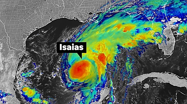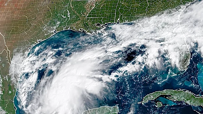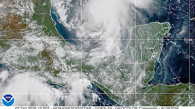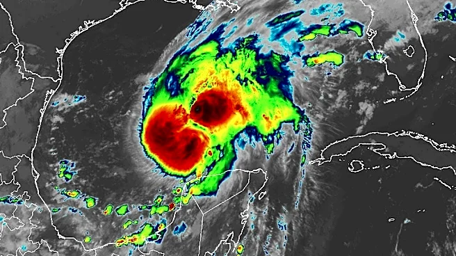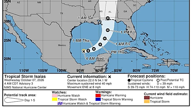



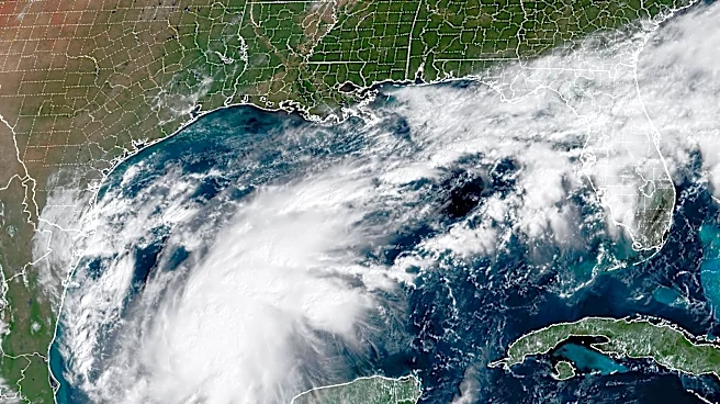
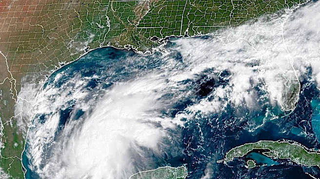
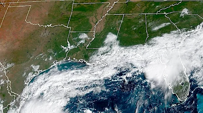
Isaias strengthened to a hurricane and is forecast to rapidly intensify as it heads toward U.S. landfall on Oct. 9, the National Hurricane Center said.
Isaias became a hurricane less than 20 hours after becoming a tropical storm. It's the first hurricane of the 2026 Atlantic hurricane season, and the ninth named storm of the season.
Isaias could have winds of over 100 mph by Friday as it approaches the United States, according to the center's hurricane specialists. It's forecast to peak before making landfall, but could still be a "significant" hurricane when it reaches the coast, with strong winds and flooding rain, the hurricane center said. It should then dramatically
weaken.
The greatest concern for storm surge is the area from Ocean Springs, Mississippi, to Indian Pass, Florida, Mike Brennan, National Hurricane Center director, said Wednesday. "This is where we could see 5 to 7 feet of inundation above ground level somewhere in this area, likely near and to the right of where Isaias crosses the coast."
As of 11:30 p.m. ET Wednesday, Isaias was about 460 miles south-southwest of the mouth of the Mississippi River, with maximum sustained winds of 75 mph. Here's how Hurricane Isaias could impact Ohio this weekend.
Is Hurricane Isaias going to hit Ohio?

Ohio won't feel the brunt of Hurricane Isaias' weather, but heavy rain from remnants of the storm can also spread into the Ohio Valley as far north as Kentucky and West Virginia before moving eastward into the Carolinas and Southern Virginia. The rain may reach Cincinnati and other parts of the Ohio Valley.
Along the coast close to landfall, the storm is forecast to bring widespread wind gusts of 40-60 mph, according to AccuWeather.
Some of the heaviest rain, totaling 8-12 inches, is expected across southern Alabama and southern Mississippi, near where the storm is expected to make landfall, AccuWeather said. Bands of 4-8 inches are forecast across much of Alabama and the Florida Panhandle as the storm tracks north toward the Appalachians.
The rain and wind can lead to power outages, property damage, widespread flooding and mudslides in higher elevations of the Appalachians.
Isaias continues to strengthen
Isaias continues to strengthen, forecasters said Wednesday afternoon. Its structure became symmetrical during the day, and its central barometric pressure, an indication of storm intensity, continued to drop.
Even though it is experiencing some wind shear, the storm remains in a favorable warm water environment and is forecast to continue strengthening, Eric Blake, a senior hurricane specialist at the center, noted in a 5 p.m. Wednesday discussion.
Isaias is forecast to reach winds of 110 mph, a strong Category 2, on Friday afternoon. Forecast models indicate it could be a Category 1 or 2 hurricane at landfall, Blake wrote.
Could Isaias rapidly intensify?

The internal structure of Isaias continued to get better organized Wednesday morning, increasing the possibility that the storm could undergo rapid intensification, taking advantage of near-record water temperatures as it’s moving through the Gulf, Eric Blake, a senior hurricane specialist, wrote in a forecast discussion.
Rapid intensification means a storm’s maximum sustained winds increase by 35 mph or more within 24 hours. It has occurred more often in recent Gulf hurricanes, and the phenomenon is expected to become more likely in the warming climate, National Oceanic and Atmospheric Administration scientists previously told USA TODAY.
The official track forecast calls for Isaias' winds to strengthen to 75 mph within 24 hours, and then to 110 mph within 48 hours.
Initial storm surge forecast models from the hurricane center show a greater than 6-foot surge possible from the Mississippi-Louisiana state line eastward into parts of Mobile Bay, and also a greater than 6-foot surge across shore where Florida’s Panhandle meets the peninsula south of Tallahassee, from Alligator Point to Horseshoe Beach.
Storm surge – a sudden rise of water topped by large and battering waves – is one of the more deadly aspects of a hurricane. It can sweep homes off foundations and flood low-lying areas miles inland along rivers and streams.
A storm surge is one of "the most underestimated hurricane hazards," said Jonathan Belles, a senior meteorologist for for The Weather Channel App. "It's driven by more than just wind, and it can devastate areas well outside the eye of the storm," including areas hundreds of miles from the storm's center, he added.
A key factor in surge heights is the speed of a storm, USA TODAY previously reported. When approaching an open coast, a fast-moving hurricane produces higher surge, but if it’s moving toward an enclosed bay, a slower storm produces a bigger surge.
When considering evacuation, emergency management officials always advise those within the potential path of a storm to hide from the wind, but flee from the water.
Warm water helps fuel storms
Seasoned hurricane veterans know that when a potential system is looming in the Gulf, water temperatures can be important because warmer waters help fuel storms. In this case, average daily sea surface temperatures in the Gulf are still warmer than normal and breaking daily records.
But the temperatures have dropped nearly 2 degrees since mid-September, according to the Climate Reanalyzer by the University of Maine’s Climate Change Institute.
Who is in Isaias' path?
The cities of Gulfport, Mississippi; Mobile, Alabama; and Pensacola, Florida are within the storm's forecast path, as of Wednesday morning.
Forecasters say Isaias' exact track is not yet certain, but people across the Gulf Coast should prepare themselves for impacts from the storm.
This article originally appeared on USA TODAY: Is Hurricane Isaias going to hit Ohio? Forecast as storm approaches US