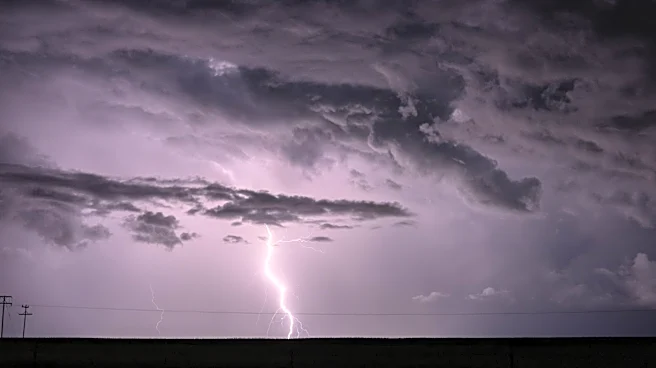








Strong to severe thunderstorms could impact the Cincinnati area Monday afternoon and evening, with damaging winds and large hail posing the greatest threats.
After a foggy start to July 27, attention is turning to a developing storm system that could bring hazardous weather to parts of the region. Forecasters from the National Weather Service in Wilmington say the highest risk appears to be areas west of Greater Cincinnati, where atmospheric instability is expected to be strongest.
A complex of thunderstorms is expected to affect the area this afternoon into this evening. These storms will be capable of producing damaging wind gusts, which may blown down tree limbs or cause isolated power outages. Additionally, large hail and heavy rain will be possible.
pic.twitter.com/UE8Umo1WSL
— NWS Wilmington OH (@NWSILN) July 27, 2026
A large ridge of high pressure over the Rockies and Plains is helping steer disturbances southeast through the Great Lakes and Ohio Valley. One of those disturbances is expected to trigger a cluster of thunderstorms, known as a mesoscale convective system, that could move into the region Monday afternoon and evening.
The primary concern is damaging straight-line winds, but some storms may also produce large hail. Locally heavy rainfall is possible in the strongest storms, according a hazardous weather outlook issued by the weather service.
Additional showers and thunderstorms may redevelop Monday night into early Tuesday ahead of an approaching surface low and cold front. Forecast confidence remains lower regarding the exact coverage and location of those storms.
Flooding and 58-plus mph winds are possible as well due to multiple rounds of expected storms, said meteorologist Christine Aiena.
"It almost looks like a train of storms − there's just one after another after another," Aiena said.
Earlier Monday, areas of fog developed under light winds, clear skies and increasing moisture. The most significant fog was expected along and southeast of the I-71 corridor, though visibility should improve quickly after sunrise.
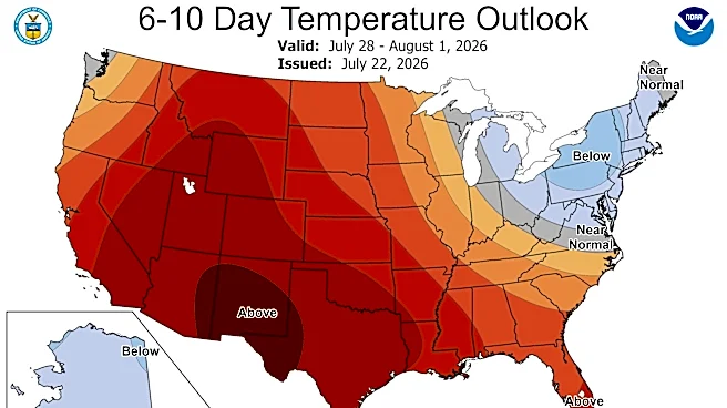
The cold front will push through the area Tuesday, bringing temperatures back to near seasonal norms. Cooler air will settle into the Ohio Valley for the remainder of the week, with highs expected to run slightly below late-July averages.
Detailed Cincinnati forecast
Monday: Areas of fog before 9 a.m. Otherwise, mostly sunny, with a high near 92. Heat index values as high as 101. Calm wind becoming west around 6 mph in the afternoon.
Monday night: A chance of showers and thunderstorms before 2 a.m., then showers and possibly a thunderstorm between 2 a.m. and 5 a.m., then a chance of showers and thunderstorms after 5 a.m. Low around 74. Southwest wind around 6 mph becoming southeast after midnight. Chance of precipitation is 80%. New rainfall amounts between a quarter and half of an inch possible.
Tuesday: A chance of showers before 7 a.m. Partly sunny, with a high near 88. Southwest wind 7 to 10 mph becoming north in the afternoon. Winds could gust as high as 20 mph. Chance of precipitation is 30%. New precipitation amounts between a tenth and quarter of an inch possible.
Tuesday night: Partly cloudy, with a low around 66. North wind 3 to 8 mph.
Wednesday: Sunny, with a high near 85. Light north wind increasing to 5 to 10 mph in the morning.
Wednesday night: Mostly clear, with a low around 63.
Thursday: Sunny, with a high near 87.
Thursday night: Mostly clear, with a low around 65.
Source: National Weather Service in Wilmington
This article originally appeared on Cincinnati Enquirer: 'Train of storms' could bring flooding, high winds Ohio, Indiana