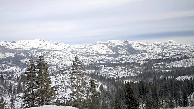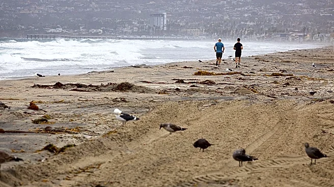








California is seeing a sharp temperature contrast this week, with frost threatening plants in parts of the state's north as unseasonable heat builds across Southern California.
Temperatures dropped as low as 33 degrees in parts of Northern California early Wednesday, Oct. 14, prompting a National Weather Service frost advisory. Meanwhile, Southern California is preparing for a significant warmup, with temperatures expected to climb into the upper 80s and low 90s later this week.
The difference reflects changing weather patterns across the state, but is El Niño behind it?
Where is California seeing frost and heat?
The National Weather Service's Eureka office issued a frost advisory through 8 a.m. Wednesday for portions of Trinity, Humboldt, Mendocino and Lake counties.
Farther south, the National
Weather Service's Los Angeles/Oxnard office forecasts a strong Santa Ana wind event beginning Thursday, Oct. 15. Offshore winds, combined with atmospheric conditions that favor warming, are expected to push temperatures higher across coastal and valley communities.
Highs could reach the upper 80s and low 90s across much of the coast and valleys Thursday, with some areas running 10 degrees above normal. Coastal communities in Los Angeles and Ventura counties could see temperatures 15 to 18 degrees above normal.
The warmup is expected to persist into Saturday before cooler weather arrives next week.
Is El Niño to blame?
The contrasting temperatures alone do not establish a connection to El Niño. The immediate forecast points to different regional weather patterns, including Santa Ana winds in Southern California and colder overnight conditions in Northern California.
El Niño is a climate pattern involving warmer-than-average sea surface temperatures in the central and eastern tropical Pacific Ocean. Its effects on weather vary by season and region, and any connection to California's current conditions would need additional climate analysis to support it.
When will Southern California cool down?
Southern California's heat is expected to ease gradually over the weekend, with additional cooling early next week as the offshore flow weakens and winds turn onshore, according to the National Weather Service.
The Los Angeles/Oxnard forecast office expects a stronger cooldown Tuesday into Wednesday as a cold upper-level low moves through the state. The system is expected to bring gusty westerly winds and lower temperatures by 5 to 10 degrees, although significant rainfall is not currently expected.
In Northern California, the Eureka forecast office expects temperatures to cool over the weekend as onshore winds strengthen and a potential cold front approaches. Forecasters put the chance of measurable rain along the North Coast at about 50% around Monday.
El Niño could bring a wetter winter to California
California could see an active winter storm season as a strengthening El Niño shifts the odds toward a more active Pacific storm track, potentially bringing more precipitation and opportunities for significant snowfall in the Sierra Nevada.
El Niño develops when sea surface temperatures in the central and eastern tropical Pacific warm above average, influencing atmospheric circulation and the position of the Pacific jet stream. That can favor winter storms across California and other parts of the southern United States, although the effects vary by region and from one year to the next.
How will El Niño impact California's winter?
El Niño could bring a wetter winter to much of California in 2026-27, with the potential for significant mountain snowfall, heavy rain and periods of flooding. The latest October seasonal forecast points to an active Pacific storm track, with the Sierra Nevada among the areas showing a strong signal for above-average snowfall.
- Northern California could see repeated rounds of Pacific storms, bringing rain to lower elevations and snow to the mountains when temperatures are cold enough. Precipitation amounts will depend on individual storm tracks and how much moisture each system carries.
- Central California could also see periods of heavy rain and mountain snow, including across the Sierra Nevada. An active storm track could replenish reservoirs and build snowpack, but intense rainfall could increase flood risk, especially in areas with saturated soils.
- Southern California could see more opportunities for winter storms and precipitation, including rain across coastal and inland areas and snow at higher elevations. The latest seasonal outlook suggests an active pattern across the Southwest, although the timing and strength of individual storms remain uncertain.
The latest October forecast indicates a broader shift toward a more amplified winter pattern across North America, with stronger low pressure over the United States and higher pressure over Canada compared with the early October outlook. That pattern could support an active storm track and increased precipitation across parts of California and the broader West.
El Niño does not guarantee a wet winter everywhere in California, nor does increased precipitation automatically mean more snow. Temperatures, elevation, and the storm track will determine whether it falls as rain or snow. Heavy rain can also increase the risk of flooding and mudslides, especially when soils are saturated or intense precipitation falls over a short period.
Brandi D. Addison covers weather nationwide as the Weather Connect reporter for the USA TODAY Network and contributes to Texas Connect coverage statewide. She can be reached at baddison@usatodayco.com. Follow her on Facebook here.
This article originally appeared on Palm Springs Desert Sun: California sees extreme heat and freezing temps. Is El Niño to blame?