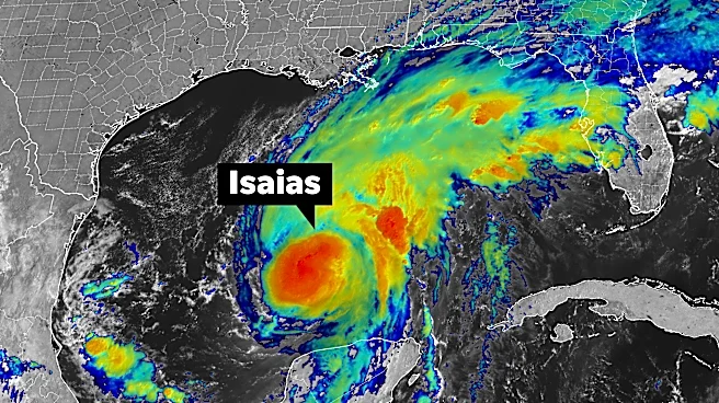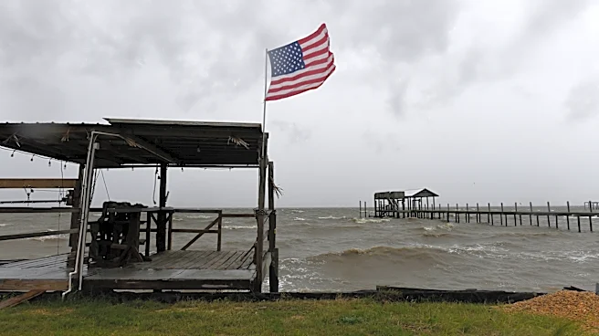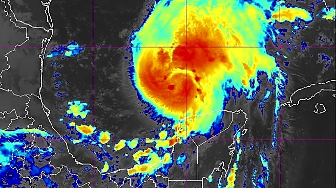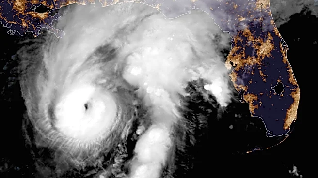






Isaias is no longer a hurricane, but it still packs a punch.
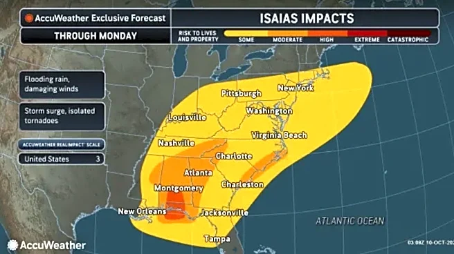
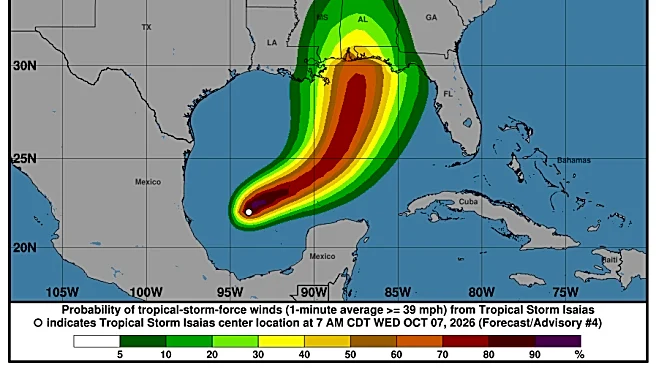
After churning over the warm, deep waters of the Gulf of Mexico, Isaias, now classified as a post-tropical cyclone, made landfall in Florida overnight. By 4 a.m. Oct. 10, the center of the storm was in central Alabama with maximum sustained winds of 35 mph, according to the National Hurricane Center.
Isaias was moving northeast and was expected to track across Alabama and into the Tennessee Valley through Oct. 11.
Although Isaias is not expected to move through North Carolina, forecasters warned that residents of Southeastern North Carolina could still experience heavy rain, flooding, dangerous surf conditions, severe thunderstorms and the possibility of tornadoes through the weekend.
The National Hurricane Center said a risk of tornadoes would persist across the Carolinas through the morning and afternoon of Oct. 10, recalling a significant impact of Hurricane Isaias in 2020.
Although the remnants of Isaias are expected to remain well west of Southeastern North Carolina, the National Weather Service warned of coastal and surge flooding, rainfall flooding, severe storms, including tornadoes, and dangerous marine and surf conditions this weekend.
Isaias briefly strengthened to a Category 3 hurricane early Oct. 9 before making landfall in Florida as a Category 2 storm.
The American Red Cross said disaster workers were positioned in multiple states and ready to respond. The organization said North Carolina emergency response vehicles would be deployed to assist with relief operations.
The Red Cross also said it would have a presence Oct. 10 at 1103 S. 16th St. in Wilmington.
The storm shares a name with a hurricane that many Wilmington-area residents may remember.
Hurricane Isaias made landfall at Ocean Isle Beach in August 2020, damaging coastal communities and spawning several tornadoes. Two men in Wilmington were killed after being struck by lightning associated with the storm.
The World Meteorological Organization chose not to retire the name Isaias. Tropical cyclone names are typically retired when a storm's impacts are considered so destructive or deadly that reusing the name would be inappropriate.

Will Hurricane Isaias impact Wilmington?
The greatest areas of concern for this storm are along the Gulf Coast, but the Wilmington area won’t be without impacts.
The National Weather Service in Wilmington warned of a marginal risk of severe storms with damaging winds over 60 mph and tornadoes possible the night of Oct. 10 through Oct. 11, opening the possibility of downed trees and power lines and property damage.
A flood watch was issued for southeast North Carolina coastal counties, with total rainfall amounts of 2-4 inches likely through the night of Oct. 11, although locally higher amounts up to 8 inches are possible, per the National Weather Service.
Travel in the area could be hazardous. A 15% chance of locally heavy rainfall producing flash flooding exists, according to the National Weather Service.
A gale warning was issued for Oct. 10, indicating hazardous marine navigation.
Minor tidal flooding along the lower Cape Fear, including downtown Wilmington, is to be expected, with flooding for low-lying roads and minor to moderate beach erosion during high tides, the National Weather Service said.

Weather forecast in Wilmington
Here’s the forecast for this weekend from the National Weather Service.
• Saturday: Showers and possibly a thunderstorm. High near 76. East wind 11 to 18 mph, with gusts as high as 31 mph. Chance of precipitation is 90%. New rainfall amounts between three quarters and one inch possible.
• Saturday night: Showers and possibly a thunderstorm. Some of the storms could produce heavy rainfall. Low around 72. East wind 9 to 14 mph, with gusts as high as 29 mph. Chance of precipitation is 100%. New rainfail amounts between 1 and 2 inches possible.
• Sunday: Showers and possible a thunderstorm, mainly before 3 p.m., then a chance of showers and thunderstorms after 3 p.m. High near 83. South wind 10 to 16 mph, with gusts as high as 29 mph. Chance of precipitation is 80%. New rainfall amounts between a quarter and half an inch possible.
• Sunday night: A chance of showers before 7 p.m. Partly cloudy, with a low around 65. West wind 7 to 10 mph, with gusts as high as 23 mph. Chance of precipitation is 30%. New precipitation amounts of less than a tenth of an inch possible.
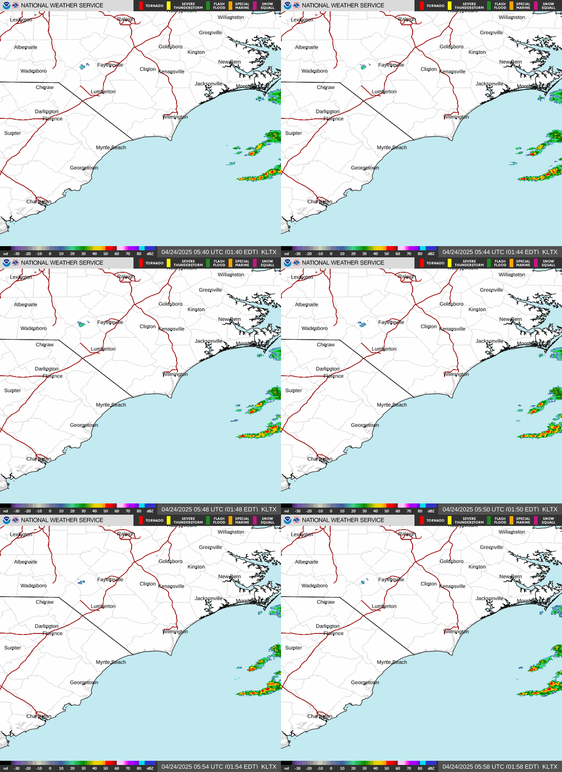
North Carolina weather radar
The 2020 Hurricane Isaias
Some residents may remember the destruction caused by the last Hurricane Isaias when it made landfall as a Category 1 hurricane six years ago in 2020.
The storm caused tens of millions in damage across coastal Brunswick County and left over 350,000 people in southeastern North Carolina without power during peak outages.
According to the National Hurricane Center, 17 people died in connection to Isaias, including the two Wilmington men who were struck by lightning. Despite the deaths and widespread damage, the name was not retired.
Atlantic hurricane names are reused every six years unless one is retired. Some of the storm names that have recently been retired include Florence, Ian and Helene.
North Carolina severe weather watches and warnings
What is flash flooding?
Flash flooding usually begins within six hours, but often within three hours, of heavy rain or mass amounts of water accumulating in an area, according to the National Weather Service.
This type of flooding usually happens very quickly and catches people off guard. It can be caused by a number of things, but is often due to extremely heavy rainfall from thunderstorms.
"The intensity of the rainfall, the location and distribution of the rainfall, the land use and topography, vegetation types and growth/density, soil type, and soil water-content all determine just how quickly the flash flooding may occur, and influence where it may occur," writes the National Weather Service.
This article originally appeared on Wilmington StarNews: Isaias weakens but still poses threats to Wilmington area