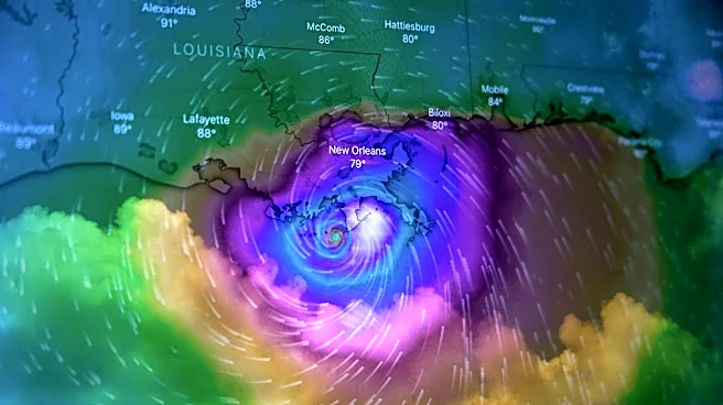



The 2026 hurricane season has been a snoozer, which has been good for Wilmington-area beaches and coastal property owners.
According to the National Hurricane Center, this is the first time since 1914 that the Atlantic basin has seen no hurricanes through late September.
But that same weather pattern saw North Carolina's drought that started in mid-2025 extend into August 2026, causing much of North Carolina to see the lack of rain prompt watering restrictions, lawns turn brown, and farmers' fields on the cusp of failing.
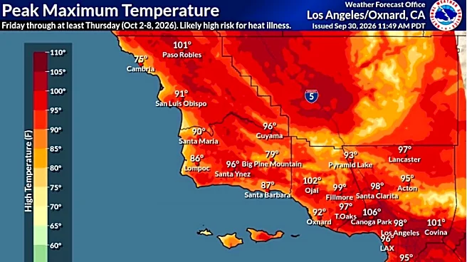
And let's not forget the searing heat that saw electricity bills rise as much as the mercury as temperatures pushed into the 90s − and the heat index into triple figures − for weeks at a time this summer.
Blame El Niño, a climate
pattern half a world away.
But as summer turns to fall, and temperatures start to drop, what could El Niño mean for the weather in late fall and winter? And, if as expected, a "super" El Niño does form, would that be good or bad for Southeastern North Carolina?

What is El Niño?

El Niño is a natural climate pattern in which surface sea water temperatures in the central and eastern tropical Pacific are warmer than normal.
Meaning Little Boy in Spanish, El Niño was originally recognized by fishermen off the coast of South America with the appearance of unusually warm water in the Pacific around Christmas.
The opposing phase of the El Niño-Southern Oscillation cycle is called La Niña, Little Girl in Spanish, where winds push more warm water in the Pacific toward Asia, allowing cold water to swell up from the deep and shift east toward the Americas. That often leads to above-average hurricane activity in the Atlantic and increased dryness in the U.S. South. The two cycles trade off with each other every few years, with a neutral phase often occurring between them.

What is a 'super' El Niño?
Technically, there is no such meteorological term.
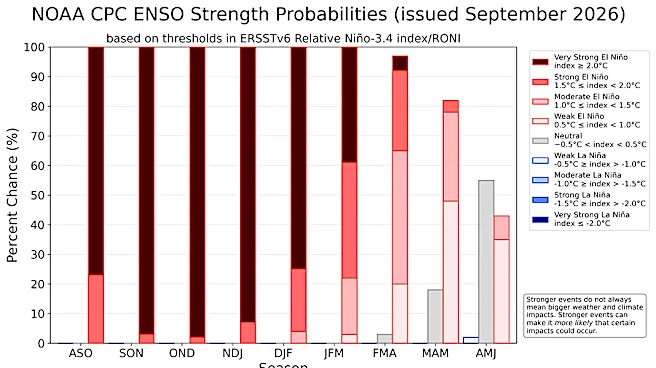
But colloquially it refers to a strong phase of the El Niño-Southern Oscillation, when sea surface temperatures in the central and eastern equatorial Pacific become significantly warmer than average, typically more than 2 degrees Celsius (3.6 degrees Fahrenheit) above normal.
If a super El Niño does develop, it could supercharge weather events across the world. For the U.S. South, that could mean wetter conditions with more heavy rainfall events. In a world already cooking hotter than normal thanks to climate change, the weather pattern also could amplify extreme heat already baking much of the world. According to the World Meteorological Organization, 2025 was the third warmest year on record, only trailing 2024 and 2023, with sea-surface temperatures also setting records despite cooling La Niña weather patterns.

Has a super El Niño formed?
According to the National Weather Service's Climate Prediction Center, there's more than a 90% chance of a very strong El Niño forming later this year. The agency also states that there's a roughly 75% chance that this El Niño would exceed previous events dating back to World War II.
Meteorologists say we are well on our way to seeing that weather phenomenon form.
This month equatorial Pacific sea surface temperatures hit 3 degrees Celsius, or 5.5 Fahrenheit, above normal levels. That's the highest temperature for any El Niño since records began, according to the National Oceanic and Atmospheric Administration (NOAA).

What does this mean for Wilmington's weather?
At the least, the impact is likely to mean a wetter winter for the Port City, meteorologists say.
But one giant unknown remains: When will the impacts of this growing El Niño hit the Cape Fear region?
Corey Davis, the state's assistant state climatologist, said that's the million-dollar question.
"We know it's active in the atmosphere because it's having a big role in suppressing tropical activity across the Caribbean, but we haven't seen the usual jet stream impacts in our part of the country so far," he said.
Recent heavy rain events and similar wet fall weather in 2015 and 1982, also strong El Niño years, could be a forebearer for what we could expect to see in the latter part of 2026 and into 2027.
"That does tell us that any time in the next two months is fair game for those sorts of impacts to begin this year," Davis said. "For now, we're playing the waiting game."
But there are already signs that the wet weather is coming. August 2026 was the second-wettest August on record for Wilmington, with the Port City seeing nearly 15 inches of rain fall.
After spending most of 2026 in a significant rainfall deficit, the Cape Fear region is slowly clawing its way back thanks to that late-summer drenching. According to the National Weather Service, Wilmington has seen 39 inches of rain this year through Sept. 28. That compares to a normal amount of nearly 48 inches.
Reporter Gareth McGrath can be reached at GMcGrath@usatodayco.com or @GarethMcGrathSN on X/Twitter. This story was produced with financial support from Journalism Funding Partners. The USA TODAY Network maintains full editorial control of the work.
This article originally appeared on Wilmington StarNews: A 'super' El Niño could bring weather chaos. What to expect in Wilmington