




Editor’s Note: Jack Becker is the editor of Caprock Chronicles and is a Librarian Emeritus from Texas Tech University. He can be reached at jack.becker@ttu.edu. Today’s article is the eighth of an extended monthly series about Route 66 by Lubbock attorney Chuck Lanehart and Lubbock photographer Mark Umstot.
"Sixty-six, a highway speaks Of deserts dry Of cool green valleys Gold and silver veins Of the shining cities..."
"In this heartland" —U2/Bono
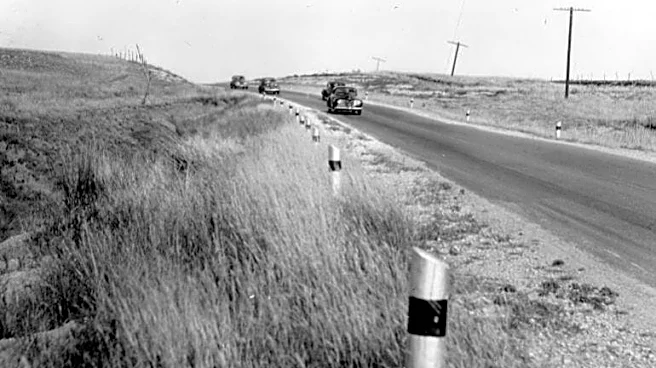
For motorists traveling west on Route 66 in Texas beyond Shamrock and McLean, travelers soon reached Jericho in Donley County. A trail first used by bison and Native Americans had become a mail coach stop in the 1880s.
In 1894, a deadly malaria outbreak swept through the small gathering of settlers, which
was later traced to stagnant water at the local spring. The tragic epidemic led to the establishment of Jericho Cemetery, which remains one of the only active structures left at the site today. When the Choctaw, Oklahoma and Texas Railroad came through the area in 1902, the townsite of Jericho—a name taken from the Bible—was laid out.

The town supported a vibrant regional agricultural community, and when Route 66 arrived in the mid-1920s, Jericho was blessed with a bit of prosperity, as travelers passing through sustained a service station, a garage and a tourist court.
Nearby, a treacherous and muddy stretch of Route 66 was nicknamed the “Jericho Gap,” and residents made extra money extricating vehicles from the muck.
Jericho’s population never exceeded 100 residents, and after the town was bypassed by Interstate 40, the railroad tracks were abandoned, the post office closed, and the old town vanished.
Blair Shaeffer is a Potter County Commissioner and fireman in Amarillo with family ties to Jericho when it was in its heyday. He and his wife Blanca own land near Jericho, and they are attempting to revitalize the area. “Right now we have our little farm that we're running here. I
t's about a 20,000 square foot market garden. We’ll do six fields of vegetables and flowers this year (2025). We've got about 30 chickens that I'm hoping to use to control the grasshoppers, because the grasshoppers out here are just atrocious.”
Blair and his wife Blanca have obtained grants to help their effort to restore some of Jericho’s abandoned buildings, including a tourist court. “Me and Blanca, we just saw this as a pure little gem. This is just a hidden gem, and we're doing everything we can to polish it up and just bringing its memories back.”
Groom, Carson County, was the next stop on Route 66. In 1881, an Englishman, Charles G. Francklyn, formed a syndicate which invested in 631,000 acres of land in the Texas Panhandle and Oklahoma. Francklyn hired a Kentucky cattle breeder, B.B. Groom, to manage cattle ranches on the prairie.
After only five years, the operation went bankrupt. The succeeding company, White Deer Lands Trust, attracted settlers who bought acreage for small farms and ranches in the Panhandle.
In 1902, one of the landowners, W.S. Wilkerson, founded the village of Groom along the route of the new Chicago, Rock Island and Gulf Railway. He named the town after the Kentucky cattleman, B.B. Groom. The town was incorporated as a city in 1911.

By the mid-1920s, agriculture, ranching and an oil boom helped the village economy, and with the designation of Route 66 through Groom in 1926, the population grew to 564 citizens by 1930.
Travel-related businesses popped up. Motels included the State, 66 Courts, Golden Spread, La Motel and Dixie.
There were service stations like Homer’s and Reed’s and restaurants like the Ranch House, Longhorn Café, Golden Spread Grill and the N-B Drive Inn.

Groom’s population peaked at about 800 in 1970, but soon, Interstate 40 had bypassed the town to the north, and most of the travel-related businesses began to fade. None are still in operation.
Two landmarks erected after Interstate 40 bypassed Groom stand near the town and draw many visitors. “The Leaning Tower of Britten”—sometimes called “The Leaning Tower of Texas”—stands north of town The tower seems in jeopardy of toppling over at any moment, but in reality, it only leans about ten degrees, and its three legs are firmly planted in concrete. Ralph Britten, a Groom native and Army Air Corps engineer, erected the tower in 1980 to draw the attention of passersby to his adjacent truck stop and tourist information center, now closed.
The second landmark is a 190-foot cross erected in 1995. Billed as the second-largest cross in the Western Hemisphere, the cross stands just off Interstate 40 and can’t be missed. It weighs two million pounds, lights up at night, and features a visitor’s center, gift shop and amphitheater, as well as religious art for the faithful.
Donated by Panhandle oilman Steve Thomas—father of NFL Hall of Famer Zach Thomas—the steel structure was fabricated in nearby Pampa, took eight months to assemble and required the talents of more than 100 welders.

“I like to do big things, big projects. And I’ve always wanted to do one for the Lord,” Thomas said. “So my wife came in my office one day and laid down a picture of a cross about half this size in Central Texas."
Thomas thought, “I can do that!”
By 2020, Groom’s population had dwindled to about 500 citizens.
Part nine of this extended series, “Conway and Amarillo,” will be published next month.
This article originally appeared on Lubbock Avalanche-Journal: Caprock Chronicles 'Kicks on Route 66' series continues in Jericho, Groom