




Rainy, gloomy and windy conditions continue across Jacksonville Tuesday, Oct. 6, with strong and persistent northeast winds expected to bring marine, coastal and tidal flooding impacts from today through at least Friday.
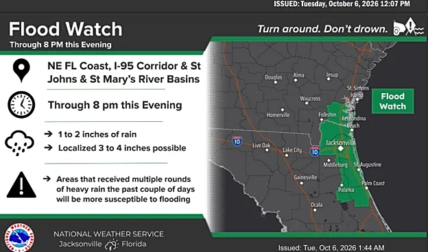
Aflood watch remains in effect through 8 p.m. Tuesday for the Northeast Florida coast, the I-95 corridor, and the St. Johns and St. Marys River basins. We’re expecting around 2 inches of rain, with some areas potentially picking up as much as 4 inches.
Meanwhile, we’re also watching the tropics. The National Hurricane Center says Invest 92L is expected to become a tropical depression soon, while AccuWeather is forecasting that it could strengthen into a named storm by Thursday, Oct. 8.
If that happens, it would become the ninth
named storm of the Atlantic hurricane season and take the name Isaias.
Whether the invest will become a tropical storm remains uncertain, but Jacksonville residents should keep a close eye on Invest 92L and be the prepared for heavy rain.
Flood Watch in effect across Jacksonville in effect until 8 p.m. Oct. 6, 2026

North'Eastern winds impact expected through Friday in Jacksonville
Northeast winds will strengthen today, with coastal gusts reaching 25 to 35 mph. That will mean rougher surf, a high risk of dangerous rip currents and some beach erosion. Minor tidal flooding is also possible around high tide Tuesday and Wednesday, especially along the coast, Intracoastal Waterway and St. Johns River.
With Tropical disturbance threat, here's what to expect
We’re also watching a disturbance in the Bay of Campeche with an 80% chance of becoming a tropical depression over the next two days. While the track remains uncertain, Jacksonville could see heavy rain and localized flooding later this week.
Rain forecast for Jacksonville this week. Chances of rain per day

Temperature this week are expected to stay in the mid to high 70s. Here's how much rain to expect each day.
- Tuesday: High 75, low 70 with a 100% chance of rain this afternoon, 80% chance of rain by night
- Wednesday: High 80, low 69 with a 30% chance of rain, mainly early
- Thursday: High 80, low 69 with a 40% chance of rain
- Friday: High 79, low 69 with a 70% chance of rain, with thunderstorms possible; by night there's a 60% chance of rain
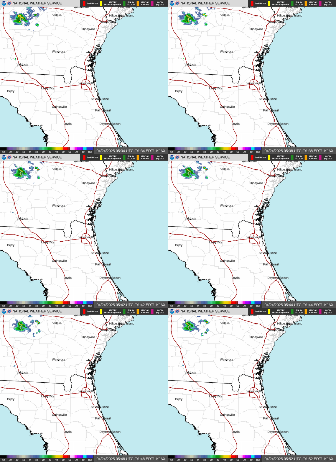
NWS Jacksonville Radar
➤ Track Invest 92L
➤ Weather alerts via text: Sign up to get updates about current storms and weather events by location
Where is Invest 92L?
Showers and thunderstorms are showing signs of organization in association with a broad area of low pressure located over the southwestern Gulf of America.
Continued development of this system is expected, and atropical depression is anticipated to form over the next day or so while it drifts eastward.
The low-pressure area could bring gusty winds and areas of heavy rain to the western portions of the Yucatan Peninsula of Mexico in a couple of days.
The disturbance is expected to turn to the north or northeast toward the northern Gulf Coast by the end of the week.
It is still too early to determine specific impacts to the northern Gulf Coast, but residents from the Florida Panhandle to Louisiana should closely monitor the progress of this system.
The NOAA Gulfstream is scheduled to sample the environment over the Gulf later today and an Air Force reconnaissance aircraft is scheduled to investigate the system Oct. 7.
- Formation chance through 48 hours: high, 90 percent
- Formation chance through 7 days: high, 90 percent
See spaghetti models for Invest 92L
Special note about spaghetti models: Spaghetti model illustrations include an array of forecast tools and models, and not all are created equal. The Hurricane Center uses only the top four or five highest performing models to help make its forecasts.
Is there a hurricane in the Gulf coming toward Florida?
As of its 8 a.m. Oct. 6 forecast, the National Hurricane Center said Invest 92L is expected to strengthen and a tropical depression is anticipated to form over the next day or so.
Both AccuWeather and Lanza said there is a low possibility the invest could become a hurricane.
"As this storm organizes and begins to drift north-northeastward, increasing wind shear may limit the amount of strengthening and could lead to the storm becoming distorted," said AccuWeather lead hurricane expert Alex DaSilva.
"Because of this, there is about a 15% chance of the storm becoming a hurricane."
Matt Lanza, Houston-based meteorologist on theeyewall.com,put the chances of a hurricane developing a little higher but warned models "diverge wildly" as of Oct. 6.
"Still a chance nothing comes of this, but also a 30 percent chance of a hurricane, or perhaps a 5 percent chance of a major hurricane."
Where could Invest 92L make landfall?
AccuWeather is predicting landfall to be near the Alabama/Mississippi border Oct. 10.
Lanza is predicting "the likely track" to be between southeast Louisiana and the Florida Panhandle.
The National Weather Service Mobile posted on X the exact track and intensity are unknown as of early Oct. 6.
Could tropical system in Gulf impact Florida?
The National Hurricane Center said residents along the northern Gulf Coast should closely monitor the system, especially those from the Florida Panhandle to Louisiana.
"Regardless of track, there is an increasing potential of heavy rainfall late this week," the National Weather Service Tallahassee said.
"There is an increasing potential of heavy rainfall late this week," the National Weather Service Mobile said. "It is too early to determine other potential impacts at this time."
"As of this morning, we have begun tracking this development as a tropical rainstorm in the southern Gulf, said Nick Arman, AccuWeather meteorologist of forecasting operations, via email Oct. 6.
"We expect this storm to slowly organize over the next couple days, becoming a named storm by Thursday (Oct. 8).
"We expect this to turn northward and head toward the northern Gulf Coast later this week, bringing heavy rain and gusty winds from eastern Louisiana into northern Florida.
"The biggest impacts will be expected closest to where the storm makes landfall, which we expect to be near the Alabama/Mississippi border Saturday (Oct. 10) morning. Rain can then spread well inland into the mid-Atlantic and Ohio Valley."
"The likely track aims to between southeast Louisiana and the Florida Panhandle," Lanza said.
"I don’t want to overlook the heavy rain impact of this system because that’s going to happen whether this is a tropical storm, hurricane, or nothing at all," Lanza said. "So, from that point of view, we’re looking at a potential for some areas of flash flooding on parts of the Gulf Coast this week."
When could Florida feel impacts from tropical system in Gulf?
For the United States, impacts would likely be from Friday (Oct. 9) through Sunday (Oct. 11) for the Gulf Coast, Arman said.
Flood watches, warnings, advisories issued for parts of Florida
Florida weather radar for Oct. 6, 2026

Countdown clock to end of 2026 Atlantic hurricane season
Stay informed. Get weather alerts via text
What's next?
We will continue to update our tropical weather coverage to bring you the most current information you need to protect your home and family.
Doris Alvarez is a Breaking and Trending Reporter for The Florida Times-Union. You can get all of Jacksonville’s best content directly in your inbox each weekday by signing up for the free Daily Briefing and News Alerts newsletters at jacksonville.com/newsletters
This article originally appeared on Florida Times-Union: Invest 92L, Nor'easter bringing heavy rains to Jacksonville
Our editors independently choose our recommendations. Some content is produced with paid support from a third party, however our editorial decisions remain independent. If you buy through our links, the USA TODAY Network may earn a commission. Prices and availability may change.