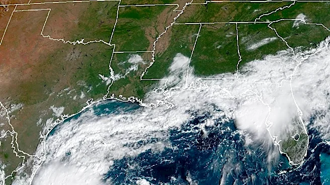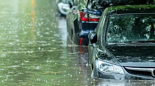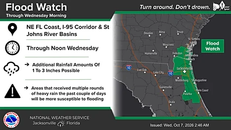






It’s been a rainy and unsettled week across Florida, and the flooding threat continues across Northeast Florida. Jacksonville is under a flood watch for a third consecutive day this week, after 3 to 8 inches of rain fell across Duval County and parts of St. Johns County in the past 24 hours.
On Wednesday, more rain is expected, especially along the I-95 corridor, with flooding possible near creeks and around high tide.
Meanwhile, Tropical Storm Isaias is strengthening in the Gulf and could become a hurricane by Thursday. The latest forecast calls for a powerful Category 2 storm with winds up to 110 mph.
In anticipation of Florida impacts from Isaias, Gov. Ron DeSantis Oct. 6 declared a state of emergency in 25 North Florida counties, from Escambia
to Baker.
Here’s what Jacksonville can expect and the latest on Tropical Storm Isaias.
What’s the latest on Tropical Storm Isaias? Local impacts Jacksonville can expect
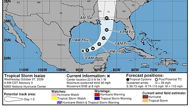
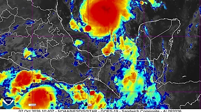
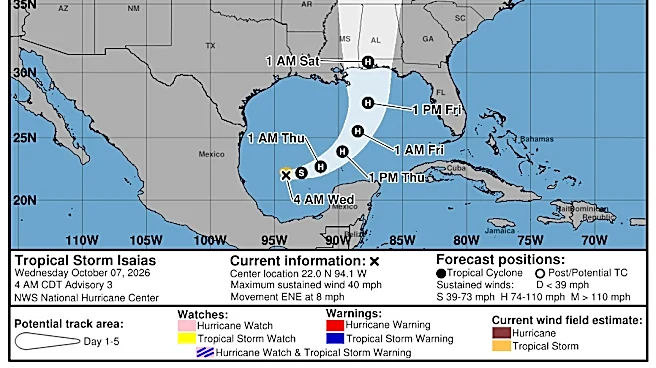
According to the National Weather Service and NOAA, Tropical Storm Isaias formed in the southern Gulf of America Wednesday morning. The system is expected to move east before turning north toward the northern Gulf Coast Friday night, while strengthening to hurricane intensity.
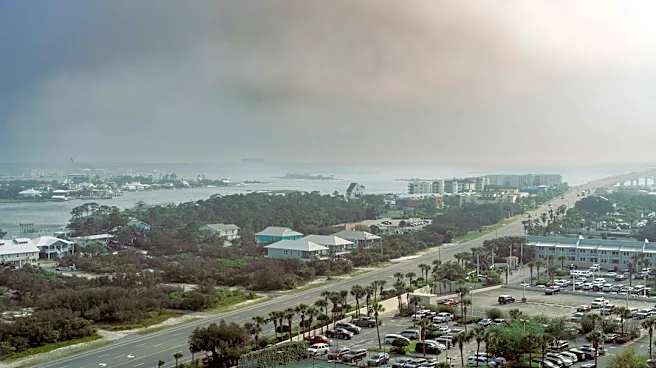
For Jacksonville, the main concerns are heavy rain, coastal wind gusts of 25 to 35 mph and rough surf. Dangerous rip currents, high surf and beach erosion are also possible.
Minor tidal flooding could develop around high tide along the Atlantic coast, the Intracoastal Waterway and possibly the St. Johns River through Thursday morning. Tidal flooding along the St. Johns River could linger into the weekend.
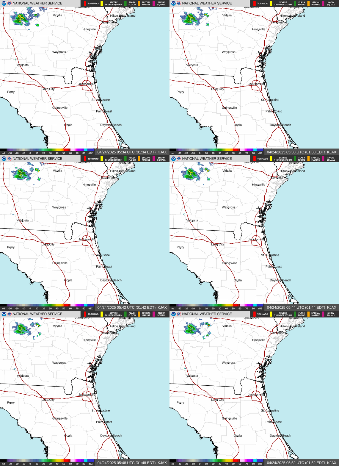
Flood watch through Wednesday morning in Jacksonville area

NWS Jacksonville radar
Where is Tropical Storm Isaias?
- Location: about 580 miles southwest of the mouth of the Mississippi River; 721 miles southwest of Pensacola
- Winds: 40 mph
- Movement: east-northeast at 8 mph
- Pressure: 1004MB
At 5 a.m. ET, the center of Tropical Storm Isaias was located near latitude 22.0 North, longitude 94.1 West.
Isaias is moving toward the east-northeast near 8 mph. A continued east-northeastward motion is expected today, followed by a turn toward the northeast and north on Thursday and Friday.
On the forecast track, Isaias is expected to pass to the north of the Yucatan Peninsula on Thursday and approach the U.S. northern Gulf Coast on Friday.
Maximum sustained winds have increased to near 40 mph, with higher gusts. Tropical-storm-force winds extend outward up to 45 miles from the center.
Rapid strengthening is forecast over the next day or two, and Isaias is expected to become a hurricane by Thursday.
The estimated minimum central pressure is 1004 mb
See graphics of Tropical Storm Isaias for path, rain potential impacts
See spaghetti models for Tropical Storm Isaias
Is there a hurricane coming toward Florida?
Yes. Tropical Storm Isaias is expected to strengthen quickly and become a hurricane by Thursday, Oct. 8.
Maximum sustained winds are forecast to hit 110 mph within 48 hours, making it a very strong Category 2 hurricane. A Category 3 hurricane has maximum sustained winds of 111 mph.
Gulf Coast residents from the Florida Panhandle to Louisiana were advised to closely monitor Isaias and prepare for impacts later this week and into the weekend.
What impacts could Isaias have on Florida?
The National Weather Service offices in Mobile and Tallahassee said residents could see high winds, heavy rainfall leading to flash flooding, storm surge and the possibility of tornadoes associated with Isaias.
From Friday through the weekend, Isaias could bring 3-6 inches of rain across the northern Gulf Coast, from southeastern Louisiana to the Florida Panhandle, according to the National Hurricane Center.
"The most substantial impact from the brewing storm will be from heavy rainfall," AccuWeather said.
The worst of the wind damage and coastal storm surge flooding are expected near and just east of where it makes landfall, according to AccuWeather.
"Based on the storm becoming a hurricane prior to landfall, wind gusts of 100-120 mph are forecast near and just east of the center."
"Another hazard from the storm will be the risk of severe thunderstorms, including tornadoes and waterspouts," AccuWeather Chief On-Air Meteorologist Bernie Rayno said. "The bulk of the severe weather is likely near and east of the center, but that risk can extend for hundreds of miles to the east this weekend."
See latest weather watches, warnings issued for Florida
Stay informed. Get weather alerts via text
Doris Alvarez is a Breaking and Trending Reporter for The Florida Times-Union. You can get all of Jacksonville’s best content directly in your inbox each weekday by signing up for the free Daily Briefing and News Alerts newsletters at jacksonville.com/newsletters
This article originally appeared on Florida Times-Union: Tropical Storm Isaias forms in Gulf. See Jacksonville impacts