



Had enough of what seems a nightly bombardment of downpours, lightning and heavy winds? According to some prognosticating services, a different type of weather bombardment could be here in a few months.
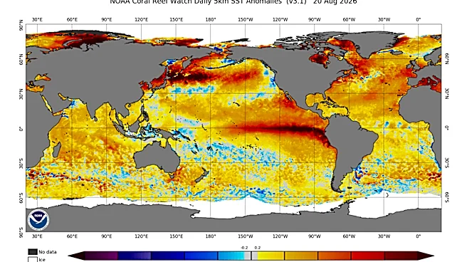
A strengthening El Niño is expected to play a major role in shaping winter 2026-27, and forecasters are increasingly using strong language about what could be ahead. NOAA says there is a greater than 90% chance El Niño becomes a very strong event this fall and winter, with a 69% chance it reaches historic strength.
At the same time, the Old Farmer's Almanac winter forecast and snow map are generating buzz among readers eager to know whether Pennsylvania could see a snowier winter than last year.
The answer, at least for now, is that the ingredients
for an active winter are there, but a snowy Pennsylvania winter is far from guaranteed.
What does NOAA predict for winter 2026-27?
The strongest signal from NOAA isn't a specific snowfall forecast for Pennsylvania.
Instead, NOAA says El Niño is strengthening, with a greater than 90% chance of becoming a very strong event during fall and winter 2026-27. The agency also estimates a 69% chance the event reaches historically strong levels.
"El Niño is strengthening, with a greater than 90% chance of a very strong event during the Northern Hemisphere fall and winter 2026-27," the Climate Prediction Center said in its latest ENSO discussion.
NOAA's broader winter outlook favors warmer-than-normal conditions across much of the northern United States while also favoring wetter-than-normal conditions across parts of the East Coast, California and the southern U.S.
What does the Old Farmer's Almanac predict for Pennsylvania?
The Old Farmer's Almanac points to the developing El Niño as one of the primary drivers of winter 2026-27 and generally favors a milder winter across much of the country. The publication says some regions could still see cold and snowy periods, but its forecast contains relatively few areas projected to be colder than normal.
For Pennsylvania, the Almanac's forecast suggests winter weather remains possible, but it stops short of predicting a blockbuster snow season.
Will El Niño bring more snow to Pennsylvania?
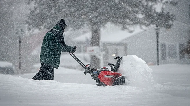
Possibly. The classic strong El Niño pattern often creates more opportunities for East Coast storms and nor'easters. That's why weather enthusiasts tend to get excited when a major El Niño develops.
But there is a catch.
Strong El Niño winters also tend to favor warmer-than-normal temperatures across parts of the northern U.S. That means Pennsylvania storms can sometimes arrive as rain instead of snow if cold air isn't in place.
Weather forecasters often describe strong El Niño winters this way: fewer snow events, but a better chance for bigger snowstorms when everything lines up correctly.
How much snow does Pennsylvania typically get?
The answer depends on where you live. Based on NOAA climate normals:
- Philadelphia averages about 23 inches of snow annually.
- Harrisburg averages about 24 inches.
- Allentown averages about 33 inches.
- State College averages nearly 44 inches.
- Scranton/Wilkes-Barre averages about 45 inches.
- Erie averages more than 100 inches thanks to lake-effect snow.
Pennsylvania as a whole averages roughly 24 inches of snow annually.
How did last winter compare?
The National Weather Service says snowfall across central Pennsylvania during the winter of 2025-26 was generally near normal or below normal, with south-central Pennsylvania receiving less snow than average amid ongoing drought conditions.
That has many Pennsylvanians wondering whether a strong El Niño could help reverse the trend this winter.
Is this a Super El Niño?
Some seasonal forecasters are already using that phrase.
While NOAA officially refers to it as a very strong El Niño, long-range forecasts increasingly discuss the possibility of a historic event. NOAA currently estimates a 69% chance the system reaches historically strong levels this winter.
That is one reason winter forecasts are attracting unusual attention despite it only being September.
What is the bottom line for Pennsylvania?
If you're hoping for a blockbuster winter, forecasters aren't ready to make that call.
What they are saying is that one of the strongest El Niño events in years is developing in the Pacific Ocean, and that pattern has historically increased the chances for major East Coast winter storms.
The question isn't whether El Niño will influence winter. It's whether Pennsylvania can get enough cold air at the right time to turn those storms into snow.
Maria Francis is a Pennsylvania-based journalist covering trending and breaking topics across the Mid-Atlantic and Northeast regions for USA Today Network. Reach her at mfrancis@usatodayco.com.
This article originally appeared on Bucks County Courier Times: Is PA in for heavy snow this winter? See El Niño effect, predictions