


What is the story about?
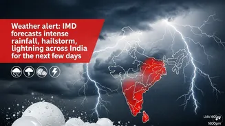
India is likely to experience a spell of intense weather activity over the next few days, with rainfall, thunderstorms, hailstorms and gusty winds expected across several regions, according to the India Meteorological Department (IMD).
An active western disturbance and multiple atmospheric systems are set to trigger widespread weather changes across northwest, central and eastern India from April 8 onwards, the IMD said in its weather bulletin.
The weather agency also noted that a fresh western disturbance is likely to influence the western Himalayan region from April 11, which may bring another round of weather activity.
Fairly widespread to widespread light to moderate rainfall accompanied by thunderstorms, lightning and gusty winds is expected over Jammu and Kashmir, Himachal Pradesh and Uttarakhand on April 8. Wind speeds could reach 40–50 kmph and gust up to 60 kmph in some areas, it added.
Punjab, Haryana, Chandigarh, Delhi, Uttar Pradesh and eastern Rajasthan are also likely to receive scattered rainfall with thunderstorms and gusty winds during April 8, the IMD said.
Also Read: Iran US Israel War LIVE Updates
The weather department added that isolated hailstorm activity may occur over Punjab, Haryana, Chandigarh, Delhi, western Uttar Pradesh, Himachal Pradesh and Uttarakhand on April 8, while heavy rainfall is likely at isolated locations in Himachal Pradesh the same day.
East and central India to see intense weather activity
Eastern India is also expected to witness active weather conditions. According to the IMD, isolated to scattered rainfall accompanied by thunderstorms, lightning and gusty winds with speeds of 30–50 kmph is likely over the region during the next three to four days.
The department warned of thundersqualls reaching wind speeds of 60–70 kmph, gusting to 80 kmph, over Gangetic West Bengal on April 8. Similar squally winds of 50–60 kmph are likely over Bihar, Sub-Himalayan West Bengal and Sikkim on the same day.
Hailstorm activity may occur at isolated places in Bihar on April 8, while Gangetic West Bengal could receive heavy rainfall during the day.
Central India is also likely to experience unstable weather. The IMD said Madhya Pradesh could witness scattered rainfall with thunderstorms and gusty winds on April 8, along with isolated hailstorms in parts of Madhya Pradesh and Chhattisgarh.
Delhi NCR rain forecast, temperature trends
Day temperatures across northwest, central and eastern India are expected to stay below normal to near normal for the next five days before gradually rising thereafter, the IMD said.
Also Read: US Iran ceasefire: What are Tehran's 10 points Trump has agreed to?
For Delhi and the National Capital Region (NCR), the IMD forecast generally cloudy conditions with spells of light rain, thunderstorms and gusty winds on April 8.
Maximum temperatures are expected to remain between 27-29 degrees Celsius, while minimum temperatures could range from 16-18 degrees Celsius.