


What is the story about?
A series of three western disturbances is expected to trigger a prolonged wet spell across the western Himalayan region over the next seven days, with isolated heavy rainfall and snowfall likely in parts of Kashmir and Himachal Pradesh, the India Meteorological Department (IMD) said.
According to the IMD's weather bulletin, the impact of these systems will be felt from January 20 onwards, peaking between January 22 and 24.
The weather agency said Kashmir Valley may witness isolated heavy rain or snowfall on January 22 and 23, while higher reaches of Himachal Pradesh could see similar conditions on January 23.
Rain and snowfall forecast for hill states
The IMD stated that light to moderate rain and snowfall is likely over Jammu, Kashmir, Ladakh, Gilgit-Baltistan and Muzaffarabad on January 20 and 21, followed by fairly widespread to widespread precipitation across the western Himalayan region from January 22 to 24.
A gradual reduction in intensity is expected on January 25, as per IMD.
Himachal Pradesh is likely to see isolated to scattered precipitation with widespread rain or snowfall between January 22 and 24.
Read more: At 45, Nitin Nabin set to become BJP’s youngest president
Uttarakhand may experience scattered precipitation starting January 22, intensifying during January 23 to 25, the IMD said.
Impact on northwest plains
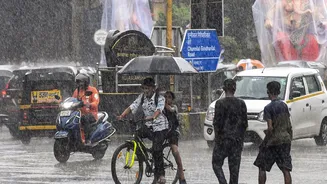
The IMD also warned of rainfall activity extending into the adjoining plains of northwest India. Punjab is expected to receive scattered to fairly widespread light to moderate rainfall between January 22 and 25.
Similar conditions are likely over Haryana, Chandigarh, Delhi, west Uttar Pradesh and parts of Rajasthan during the same period, with east Uttar Pradesh seeing rainfall mainly on January 23 and 24, the department said.
Thunderstorm activity accompanied by lightning and gusty winds has also been forecast. Gusts reaching 40–50 kmph are likely over Jammu and Kashmir on January 23, while winds of 30–40 kmph may affect Punjab, Haryana, Chandigarh, Uttar Pradesh and Rajasthan between January 22 and 24, it added.
Fog, cold wave and temperature outlook
Dense to very dense fog is expected to persist over parts of Punjab, Haryana, Chandigarh, Uttar Pradesh and Bihar over the next two to three days, the IMD said.
Cold wave conditions may prevail in isolated pockets of Himachal Pradesh on January 20 and 21.
Read more: Certain power supply from more forms of renewable energy, battery storage needed to cut emissions: Expert
The IMD added that there would be no significant change in minimum temperatures over northwest India during the next three days, followed by a gradual rise and subsequent fall later in the week.
Separately, the IMD also announced the cessation of northeast monsoon rains over southeast peninsular India from January 19, citing the prevalence of dry northerly winds and the absence of significant rainfall over the past two days.
According to the IMD's weather bulletin, the impact of these systems will be felt from January 20 onwards, peaking between January 22 and 24.
The weather agency said Kashmir Valley may witness isolated heavy rain or snowfall on January 22 and 23, while higher reaches of Himachal Pradesh could see similar conditions on January 23.
Rain and snowfall forecast for hill states
The IMD stated that light to moderate rain and snowfall is likely over Jammu, Kashmir, Ladakh, Gilgit-Baltistan and Muzaffarabad on January 20 and 21, followed by fairly widespread to widespread precipitation across the western Himalayan region from January 22 to 24.
A gradual reduction in intensity is expected on January 25, as per IMD.
Himachal Pradesh is likely to see isolated to scattered precipitation with widespread rain or snowfall between January 22 and 24.
Read more: At 45, Nitin Nabin set to become BJP’s youngest president
Uttarakhand may experience scattered precipitation starting January 22, intensifying during January 23 to 25, the IMD said.
Impact on northwest plains
The IMD also warned of rainfall activity extending into the adjoining plains of northwest India. Punjab is expected to receive scattered to fairly widespread light to moderate rainfall between January 22 and 25.
Similar conditions are likely over Haryana, Chandigarh, Delhi, west Uttar Pradesh and parts of Rajasthan during the same period, with east Uttar Pradesh seeing rainfall mainly on January 23 and 24, the department said.
Thunderstorm activity accompanied by lightning and gusty winds has also been forecast. Gusts reaching 40–50 kmph are likely over Jammu and Kashmir on January 23, while winds of 30–40 kmph may affect Punjab, Haryana, Chandigarh, Uttar Pradesh and Rajasthan between January 22 and 24, it added.
Fog, cold wave and temperature outlook
Dense to very dense fog is expected to persist over parts of Punjab, Haryana, Chandigarh, Uttar Pradesh and Bihar over the next two to three days, the IMD said.
Cold wave conditions may prevail in isolated pockets of Himachal Pradesh on January 20 and 21.
Read more: Certain power supply from more forms of renewable energy, battery storage needed to cut emissions: Expert
The IMD added that there would be no significant change in minimum temperatures over northwest India during the next three days, followed by a gradual rise and subsequent fall later in the week.
Separately, the IMD also announced the cessation of northeast monsoon rains over southeast peninsular India from January 19, citing the prevalence of dry northerly winds and the absence of significant rainfall over the past two days.