


What's Happening?
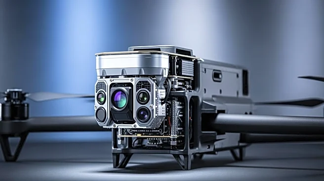
YellowScan has launched the Venturer, a new LiDAR system designed for missions requiring high precision, security, and adaptability. Unveiled at Geo Week 2026 in Denver, Colorado, the Venturer is engineered to prioritize data sovereignty and secure operational
access. It ensures all data remains under the operator's control through local data processing, eliminating the need for cloud-based offloading. The system is NDAA-compliant, featuring YellowScan's proprietary CloudStation software for local data handling. The Venturer is compatible with a wide range of UAVs and includes features like 360-degree adaptive angle scanning and dual global shutter cameras for comprehensive data capture. It also incorporates Trimble Applanix's APX-RTX IMU for superior positional accuracy, allowing operators to maintain full control of their data from capture to output.
Why It's Important?
The introduction of the Venturer LiDAR system by YellowScan marks a significant advancement in secure aerial mapping technology. By ensuring data sovereignty and eliminating external dependencies, the Venturer addresses growing concerns over data security and compliance in sensitive environments. This is particularly important for industries and government agencies that require high levels of data integrity and confidentiality. The system's compatibility with various UAVs and its advanced scanning capabilities make it a versatile tool for professional surveyors, enhancing their ability to deliver accurate and reliable results. The Venturer's focus on local data processing and high-grade internal components also maximizes return on investment, making it an attractive option for organizations looking to enhance their geospatial analysis capabilities.