


What's Happening?
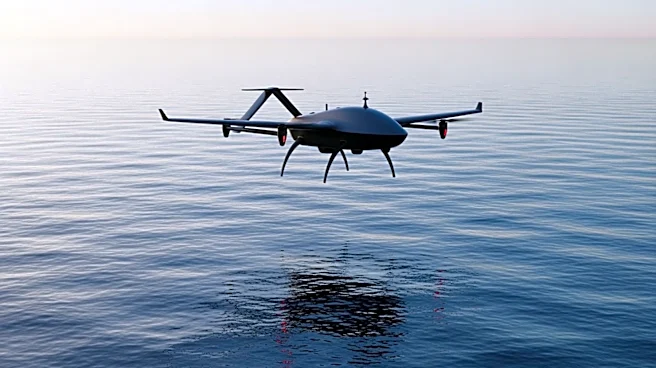
CHC Navigation has launched the AlphaAir 6, a new airborne LiDAR system designed for Unmanned Aerial Vehicle (UAV) mapping in high-relief environments. The system features a 2,100m ranging capability and prism scanning technology, enhancing data capture
efficiency at altitudes of 400 to 600m. It includes a high-grade inertial navigation system and an upgraded laser engine, improving trajectory accuracy and point cloud quality. The AlphaAir 6 supports real-time point cloud output and offers customizable imaging capabilities with single or dual-camera configurations. Its lightweight design reduces payload burden, extending UAV flight endurance.
Why It's Important?
The introduction of the AlphaAir 6 represents a significant advancement in aerial surveying technology, particularly for complex terrains. By improving data accuracy and efficiency, CHC Navigation enhances the capabilities of geospatial professionals, potentially leading to more precise mapping and surveying outcomes. This innovation could benefit industries such as construction, environmental monitoring, and urban planning, where detailed topographical data is crucial. The system's compatibility with various UAVs also broadens its applicability, making it a versatile tool for diverse surveying needs.