Hidden within the expansive 530,000-acre Nantahala National Forest in southwest North Carolina are many spectacular waterfalls. The appropriately-named Waterfall Byway takes drivers through "the land of
waterfalls" between the towns of Franklin and Highlands, where cascades of water pour down from the Blue Ridge Mountains. It's the perfect setting for a casual day trip in the car, or a wonderous hiking adventure.
Sitting just 50 miles south of Pigeon Forge, one of Tennessee's best mountain towns, the Cullasaja River fuels the raging falls. This scenic waterway flows from the North Carolina highlands, eventually finding its way to the Gulf of Mexico (renamed the Gulf of America in 2025 by U.S. President Donald Trump). Along the way, it creates spectacular waterfalls, fills pools full of fish, and carves overlooks giving visitors unprecedented views of North Carolina's mountains.
Nature lovers can access these views through a 61-mile section of Highway 65, which could easily be viewed as one of the most stunning and storied routes for a perfect U.S. road trip. There are multiple areas to pull your car aside along the Waterfall Byway to appreciate the splendor of the views or even wade into the Cullasaja River. It's important to use extreme caution, however, since the water levels and currents can be dangerous near the falls or during high waters.
Read more: 12 Destinations And Attractions That Should Absolutely Be Considered Wonders Of The World
Don't Miss These Stops Along The Waterfall Byway
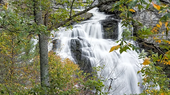
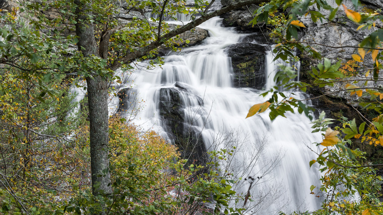
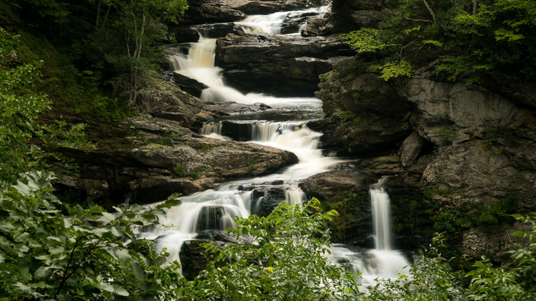
While the Cullasaja River fuels many falls along the byway, there are at least three that visitors shouldn't miss. The largest is the 250-foot Cullasaja Falls, about 10 miles southeast of Franklin, a small mountain town known as the "Gem Capital of the World." There is no sign marking the falls, but there is a small area to pull your vehicle aside to take in the scenery.
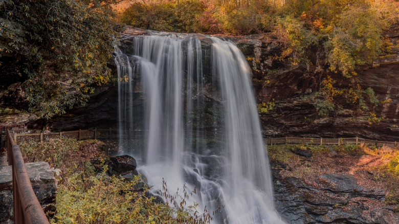
Just over 5 miles down the road is another popular stop: dazzling Dry Falls. Appropriately named because visitors can walk behind the falls without getting wet, this waterfall flows over a 75-foot cliff. A small area nearby provides space for several cars to pull to the side safely. If you're not too keen on walking behind a waterfall but still want the experience, you'll adore Bridal Veil Falls. This waterfall drops an amazing 120 feet, and the road winds behind it, giving drivers and passengers a view of the water from behind.
Visiting the waterfalls and pools of the Cullasaja River or any of North Carolina's magnificent waterfalls is a memorable experience, and easily accessible from the McGhee Tyson Airport in Knoxville, Tennessee, just 100 miles away. But visitors are encouraged to use caution. Roadways can be narrow, and curves should be navigated at appropriate speeds. If you do decide to stop for the views, you should ensure your vehicle is fully removed from the roadway. The Waterfall Byway is open year-round, weather permitting, but the peak viewing for spectacular fall colors is usually during the second week of October.
Beautiful Hiking Around Cullasaja Gorge
Viewing waterfalls from the comfort of your car is amazing. But for a truly spectacular experience, safely park your vehicle and explore the falls and the surrounding nature on foot. There are several stops along the byway that are perfect for exploring up close and giving your legs a chance to stretch.
Hikers will want to check out the Cliffside Lake Recreation Area, just over four miles from Highlands. In addition to a handful of short trails, the area features a lake for swimming and fishing, and a campground for overnight stays in a tent or RV. One waterfall in particular is worth a moderate hike that stretches just over two miles round-trip. Ranger Falls drops 35 feet into Skitty Creek at the end of this trail, and the moderate-difficulty path provides amazing photographic opportunities. A self-service pay station is available to collect a modest parking fee.
This area is just one of many hiking spots to explore in the Nantahala National Forest. Remember to stay safe when exploring the trails along the byway. Rangers recommend physical or downloaded maps, since GPS and cell signals are easily lost here. It's also important to watch your footing, since trails are not always maintained and can be impacted by weather.
Ready to discover more hidden gems and expert travel tips? Subscribe to our free newsletter for access to the world's best-kept travel secrets.
Read the original article on Islands.