

The Alaska Highway, originally constructed as a military supply route during World War II, has undergone significant transformations over the decades. Initially built to connect the United States with Alaska through Canada, the highway has evolved from a rough, challenging drive to a modern, fully paved roadway. This evolution reflects changes in engineering practices, geopolitical needs, and regional development.
Military Beginnings
The Alaska Highway was born out of
military necessity during World War II. Following the attack on Pearl Harbor and the Japanese threats to North America, the U.S. Army approved the construction of the highway in 1942. The route, known as Route C, was chosen for its strategic advantages, linking airfields and avoiding high mountain passes. The highway was completed in October 1942, serving as a crucial supply line during the war.
Initially, the highway was not open to the public and was primarily used for military purposes. The road was rough, with steep grades, poor surfaces, and few guardrails. Temporary log bridges were replaced with steel structures where necessary, and the highway was nicknamed the "oil can highway" due to the discarded fuel containers along its path.
Post-War Transition
After World War II, the Alaska Highway transitioned from a military asset to a public roadway. The original agreement between the U.S. and Canada stipulated that the Canadian portion of the highway be turned over to Canada after the war. In 1946, the U.S. Army transferred control of the road to the Canadian Army, Northwest Highway System. Canada assumed responsibility for its maintenance, and the highway gradually opened to civilian traffic.
The transition was not without challenges. Sections of the highway, particularly between Burwash Landing and Koidern, became nearly impassable due to permafrost thawing. Corduroy roads were built to restore the route, and modern construction methods were later employed to prevent permafrost damage. The highway was rerouted and straightened over the years, shortening its length and improving its quality.
Modern Developments
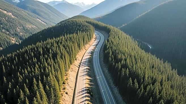
Today, the Alaska Highway is a fully paved, vital transportation route connecting British Columbia, Yukon, and Alaska. The highway has been realigned and improved, with historic mileposts marking significant locations along its path. The British Columbia government owns the first 82.6 miles, while the Yukon government manages the highway from Mile 630 to the U.S. border.
Rerouting continues to address ongoing challenges, such as frost heave and residential bypasses. The Shakwak Agreement between Canada and the U.S. has facilitated funding for upgrades, including the construction of new bridges. The highway's evolution from a military supply route to a modern roadway highlights its enduring importance in regional development and international cooperation.
The Alaska Highway remains a testament to engineering ingenuity and strategic foresight, serving as a crucial link between communities and a popular route for travelers exploring the rugged beauty of North America's northern landscapes.