


Lake Huron is one of the five Great Lakes of North America, shared by the Canadian province of Ontario and the U.S. state of Michigan. The lake's name is derived from early French explorers who named it for the indigenous people they knew as Huron (Wyandot) inhabiting the region. Hydrologically, Lake Huron comprises the eastern portion of Lake Michigan–Huron, having the same surface elevation as Lake Michigan, to which it is connected by the 5-mile-wide
(8.0 km), 20-fathom-deep (120 ft; 37 m) Straits of Mackinac. Combined, Lake Michigan–Huron is the largest freshwater lake by area in the world. The Huronian glaciation was named from evidence collected from the Lake Huron region. The northern parts of the lake include the North Channel and Georgian Bay. Saginaw Bay is located in the southwest corner of the lake. The main inlet is the St. Marys River from Lake Superior, and the main outlet is through the St. Clair River toward Lake Erie. Lake Huron has a fairly large drainage basin covering parts of Michigan and Ontario. Water flows through Lake Huron faster than the other Great Lakes with a retention time of only 22 years.
First Peoples & First Mentions
The name of Lake Huron is derived from early French explorers who named it for the indigenous people they knew as Huron (Wyandot) inhabiting the region. The French, the first European visitors to the region, often referred to Lake Huron as La Mer Douce, "the fresh-water sea". In 1656, a map by French cartographer Nicolas Sanson refers to the lake by the name Karegnondi, a Wyandot word that has been translated variously, as "Freshwater Sea", "Lake of the Hurons", or simply "lake". Generally, the lake was labeled "Lac des Hurons" (Lake of the Huron) on most early European maps.
Explorers, Missions & Colonial Outposts
The earliest written accounts of the Huron were made by the French, who began exploring North America in the 16th century. News of the Europeans reached the Huron, particularly when Samuel de Champlain explored the Saint Lawrence River in the early 17th century. Some Huron decided to go and meet the Europeans. Atironta, the principal headman of the Arendarhonon nation, went to Quebec and allied with the French in 1609.
From Empire to Nation: Transfers of Rule
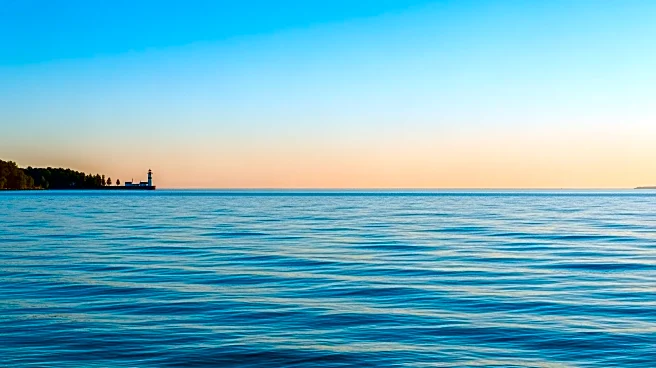
By the 1860s, many European settlements on the shores of Lake Huron were becoming incorporated, including Sarnia, the largest city on Lake Huron. On October 26, 2010, the Karegnondi Water Authority was formed to build and manage a pipeline from the lake to Flint, Michigan.
Rails, Roads & River Landings: Corridors That Sited Lake Huron
Lake Huron is separated from Lake Michigan, which lies at the same level, by the 5-mile-wide (8.0 km), 20-fathom-deep (120 ft; 37 m) Straits of Mackinac, making them hydrologically the same body of water. Aggregated, Lake Huron-Michigan, at 45,300 square miles (117,000 km2), "is technically the world's largest freshwater lake". Lake Superior, at 21 feet higher elevation, drains into the St. Marys River which then flows into Lake Huron. The water then flows south to the St. Clair River, at Port Huron, Michigan, and Sarnia, Ontario. The Great Lakes Waterway continues thence to Lake St. Clair; the Detroit River and Detroit, Michigan; into Lake Erie and thence – via Lake Ontario and the St. Lawrence River – to the Atlantic Ocean.