


The Great Plains is a vast expanse of flatland in North America, stretching from the eastern edge of the Rocky Mountains across the central United States and into Canada. This region is characterized by its prairie, steppe, and grassland landscapes. The Great Plains is a significant part of the North American Interior Plains, which also includes the mixed grass prairie and the Tallgrass prairie. This article delves into the geographical features and divisions
that define the Great Plains.
Physiographic Features
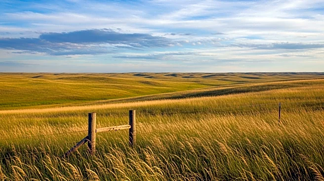
The Great Plains is a broad stretch of land underlain by nearly horizontal strata, extending from the 97th meridian west to the base of the Rocky Mountains. This distance ranges from 300 to 500 miles. The region extends northward from the Mexican boundary far into Canada. The altitude of the plains increases gradually from 600 feet on the east to 4,000 to 5,000 feet near the mountains. Despite this increase in altitude, the local relief is generally small, contributing to the region's flat appearance.
The semi-arid climate of the Great Plains excludes tree growth, allowing for far-reaching views across the landscape. The plains are not a simple unit; they are of diverse structure and various stages of erosional development. The region is occasionally interrupted by buttes and escarpments and frequently broken by valleys. However, a broadly extended surface of moderate relief often prevails, justifying the name "Great Plains."
Regional Divisions
The Great Plains can be divided into several sections based on geographical and climatic features. In the United States, the plains are divided into ten physiographic subdivisions. The northern section includes eastern Montana, eastern Wyoming, and parts of North and South Dakota. This area is characterized by Cretaceous or early Tertiary strata lying nearly horizontal.
The central section, covering eastern Colorado and western Kansas, is mostly a dissected fluviatile plain. This section was once covered with a gently sloping plain of gravel and sand, spread forward by rivers issuing from the mountains. The southern section, known as the Llano Estacado, lies in western Texas, eastern New Mexico, and western Oklahoma. It is a dissected fluviatile plain, standing as a table-land due to its strong relief from surrounding lower lands.
Climate and Boundaries
The climate of the Great Plains is semi-arid, with the 100th meridian roughly dividing the region into areas receiving more or less than 20 inches of rainfall annually. The eastern boundary of the plains in the United States is more climatic than topographic, marked by a gradual transition rather than a distinct line. In Canada, the eastern boundary is well-defined by the presence of the Canadian Shield.
The Great Plains is a region of significant geographical diversity, with its flat landscapes, varied climate, and distinct regional divisions. Understanding these features provides insight into the natural history and ecological significance of this vast area.