Roanoke Island, located in the Outer Banks of North Carolina, is a geographic marvel with strategic importance throughout history. Its unique location and natural features have played a crucial role in shaping
its historical narrative. This article examines the geographic significance of Roanoke Island, highlighting its impact on exploration, settlement, and military strategy.
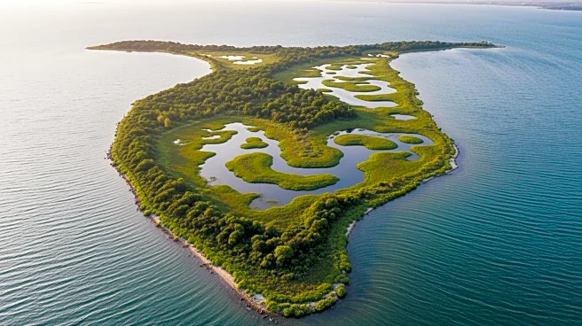
Natural Features and Formation
Roanoke Island is approximately 8 miles long and 2 miles wide, situated between the mainland and the barrier islands near Nags Head. It is bordered by Albemarle Sound to the north, Roanoke Sound to the east, and Croatan Sound to the west. The island's formation is a result of environmental changes that occurred around 400 A.D., when the sand dune of Roanoke became disconnected from the mainland by water.
The island's geological history is marked by the stabilization of the Outer Banks Barrier Islands around 6,000 B.C. This transformation created brackish ecosystems, turning freshwater sounds into the unique environment that defines Roanoke Island today. The island's natural features have influenced its human occupation, from Native American settlements to English colonization.
Strategic Location for Exploration
Roanoke Island's strategic location made it an ideal site for exploration and settlement. In the late 16th century, English explorers recognized the island's potential as a base for colonization. The island's proximity to the ocean and its relative isolation from Spanish patrols made it a suitable location for establishing a colony.
The island's geographic significance was further highlighted during the establishment of the Roanoke Colony in 1585. Although the colony faced challenges such as poor relations with Native American tribes and a lack of supplies, its location was considered advantageous for exploration and potential trade routes. The island's strategic importance continues to be a focal point in discussions about the Lost Colony.
Military Importance During the Civil War
Roanoke Island's geographic features played a crucial role during the American Civil War. In 1862, Union forces led by Brigadier General Ambrose E. Burnside captured the island from the Confederacy. The Battle of Roanoke Island was a significant victory for the Union, as the island's location allowed for control over the surrounding sounds and waterways.
The Union occupation of Roanoke Island provided a strategic advantage in controlling the North Carolina coast. The island's forts, renamed for Union generals, served as a base for military operations throughout the war. Roanoke Island's geographic significance during the Civil War underscores its role in shaping military strategy and regional control.