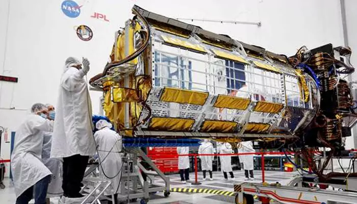
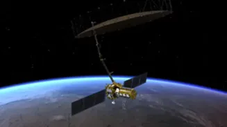
With an estimated total cost of US$1.5 billion, NISAR is the most expensive Earth-observation satellite in the world.
A wise person once asked a very intelligent
question, "(a+b)² mein extra 2ab aata hai ya nahi?" So, if we consider NASA as a, and ISRO as b (gave NASA a because it’s their birthday, I love ISRO more), then the 2ab is NISAR or the NASA-ISRO Synthetic Aperture Radar. It's an Earth observation satellite (EOS) equipped with dual-frequency synthetic aperture radar (SAR), launched this year.
As we celebrate NASA’s 67th anniversary, let’s take a moment to appreciate its incredible journey and look ahead at this exciting collaboration with ISRO.
NISAR: A Game-Changer in Earth Observation
Launched on July 30, 2025, from the Satish Dhawan Space Centre in Sriharikota, India, NISAR is the first satellite to carry a dual-frequency synthetic aperture radar system. This innovative design combines NASA’s L-band radar with ISRO’s S-band radar, allowing the satellite to observe Earth with unprecedented precision. The mission aims to monitor and measure changes in Earth's surface, including movements as small as a centimeter, providing valuable data for understanding natural hazards, climate change, and ecosystem dynamics.
NISAR's radar systems operate through a 12-meter deployable mesh antenna, the largest of its kind ever launched into space. This advanced technology enables the satellite to capture high-resolution images of Earth's land and ice-covered surfaces, even in challenging conditions such as cloud cover and dense vegetation. The dual-frequency approach enhances the satellite's ability to penetrate various surfaces, offering a comprehensive view of our planet's dynamic processes.
Collaborative Excellence: NASA and ISRO
The NISAR mission is a successful collaboration between NASA and ISRO, two of the world's leading space agencies. NASA contributed the L-band radar, high-rate telecommunication systems, GPS receivers, and a solid-state recorder, while ISRO provided the S-band radar, the satellite bus, and the GSLV Mk II launch vehicle. This partnership undoubtedly exemplifies the strength of international cooperation in advancing scientific research and technological innovation.
The joint venture not only strengthens ties between the United States and India but also sets a precedent for future collaborative efforts in space exploration. By pooling resources and expertise, NASA and ISRO have developed a mission that promises to deliver critical data for addressing global challenges such as climate change, natural disasters, and sustainable development.

Real-World Applications of NISAR Data
NISAR's data is expected to have a wide range of applications across various sectors:
Natural Disaster Monitoring: The satellite's ability to detect minute changes in Earth's surface can help monitor and predict natural disasters such as earthquakes, tsunamis, and landslides, enabling timely response and mitigation efforts.
Climate Change Research: By providing detailed observations of ice sheet dynamics, sea level rise, and vegetation changes, NISAR contributes valuable information for studying the impacts of climate change and informing policy decisions.
Agriculture and Water Resources: The satellite's high-resolution imaging capabilities can assist in monitoring crop health, soil moisture levels, and groundwater resources, supporting sustainable agricultural practices and water management strategies.
Urban Planning and Infrastructure Development: NISAR's data can aid in assessing land subsidence, infrastructure stability, and urban expansion, facilitating informed decision-making in urban planning and development.
NISAR is on track to begin science operations this fall!
The @NASA and @ISRO satellite will map Earth’s land & ice surfaces in unprecedented detail, tracking changes in forests, ice, infrastructure & even land motion from quakes & volcanoes. More: https://t.co/u9iksq0sbB pic.twitter.com/6FJQBVcKG0— NASA Science (@NASAScience_) September 6, 2025
(Credit: NASA Science)
The Future of Earth Observation
As NISAR continues its mission, the data it collects will be freely available to scientists, researchers, and policymakers worldwide. This open-access approach ensures that the insights gained from the satellite's observations can be used to address various global issues and promote sustainable development.
Also, the success of the NISAR mission underscores the importance of international collaboration in advancing our understanding of Earth's complex systems. By combining the strengths of NASA and ISRO, the mission sets the stage for future partnerships that will further enhance our ability to monitor and protect our planet.
A new milestone in Earth science from space! 🌍
— NASA 360 (@NASA360) August 18, 2025
Seventeen days after launch, NASA and the Indian Space Research Organisation (ISRO) successfully deployed a 39-foot antenna reflector on the NISAR satellite: https://t.co/mIeFgEXPnj pic.twitter.com/a4IJx0PhEP
(Credit: NASA 360)
And obviously, it represents a significant milestone in the field of Earth observation, showcasing the power of collaboration and innovation in addressing global challenges.


