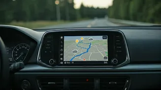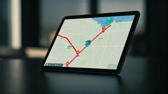


Your Everyday Navigation Apps
The simplest solution is often the one already on your phone. Apps like Google Maps and Waze have evolved from simple direction-givers into powerful, real-time information hubs. Their primary advantage is crowdsourced data. When a driver ahead of you hits
a standstill, reports a crash, or flags a flooded street, that information is almost instantly fed into the system, rerouting you around the delay. Waze is particularly known for its active community of users who report everything from potholes to police presence to impassable roads due to weather. Google Maps, which owns Waze, integrates much of this traffic and hazard data, making it a robust all-in-one choice. For daily commuting, enabling notifications and checking the route *before* you leave is the best defense against predictable headaches.
Hyper-Local Weather Trackers
While your phone's default weather app gives you a general forecast, specialized applications provide the granular detail needed to avoid a soaking. Apps like AccuWeather and The Weather Channel excel at hyper-local, minute-by-minute precipitation forecasts. They use your phone's GPS to warn you, “Rain starting in 15 minutes,” giving you just enough time to find cover or grab an umbrella from your car. For more severe conditions, they push critical alerts for thunderstorms, flash floods, and tornadoes directly to your screen based on National Weather Service (NWS) warnings. Another popular option, CARROT Weather, is known for its powerful data sources and snarky AI personality, but its core function is the same: to give you a precise, immediate understanding of the weather right where you are.
The Official Government Sources
When safety is the top priority, going straight to the source is essential. The FEMA App is a must-have for anyone living in an area prone to natural disasters. It provides real-time alerts from the National Weather Service for your area and up to five other locations—perfect for keeping tabs on family. It also offers crucial safety reminders and information on finding emergency shelters. Similarly, every state’s Department of Transportation (DOT) has a website, and most have a dedicated app or alert system (often called a '511' service). These are the authoritative sources for official road closures due to construction, accidents, or major weather events. Signing up for your local DOT’s email or text alerts ensures you get the definitive word on major route blockages.
Drive Weather and Specialty Apps
Planning a long road trip? Standard weather apps show you the forecast for your destination, but not for the 800 miles in between. This is where specialty apps like Drive Weather shine. The app shows you the weather forecast for your entire route, at the time you're expected to be driving through each point. This allows you to see if you're heading into a snowstorm in three hours or a major thunderstorm cell in the afternoon. It helps you decide whether to leave earlier, delay your trip, or take an alternate route to avoid dangerous driving conditions. It’s a paid service, but for frequent long-distance drivers or RV enthusiasts, it provides invaluable peace of mind.
Don't Forget the Low-Tech Backups
Technology is fantastic until the power goes out or cell service drops in a storm. That’s why having a low-tech backup is critical. A NOAA Weather Radio is a dedicated receiver that broadcasts NWS warnings 24/7. Many models have a battery or hand-crank backup, making them a lifeline in a widespread emergency. Likewise, your car’s AM/FM radio is still an incredibly reliable tool. Local news stations often provide continuous coverage during major weather events, broadcasting the latest closure information and official instructions from emergency managers. It might feel old-fashioned, but when your smartphone screen is dark, the familiar voice of a local radio host can be the most important guide you have.