


The Coastal Artery and Its Achilles' Heel
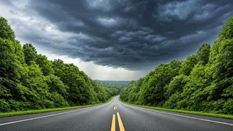
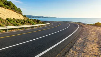
For anyone traveling in southeastern India, National Highway 16 (NH-16) is almost unavoidable. This major trunk road is part of the Golden Quadrilateral, linking major cities like Chennai, Vijayawada, and Visakhapatnam before continuing toward Kolkata.
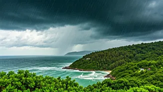
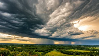
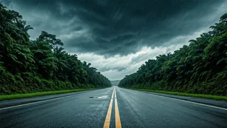
It’s the lifeline for commerce, logistics, and millions of daily commuters and travelers. The problem? For long stretches, it runs parallel to the Bay of Bengal, making it exceptionally vulnerable to the region’s volatile weather. During the monsoon and cyclone seasons, this proximity to the sea is its greatest weakness. Storm surges, extreme rainfall, and flash flooding can submerge sections of the highway, severing this critical link for days at a time. The 2023 impact of Cyclone Michaung, which brought life to a standstill in Chennai and southern Andhra, is a recent and powerful reminder of this recurring threat.
Understanding the Cyclone Calendar
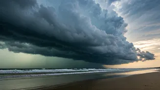
Smart travel planning in this region starts with understanding its weather patterns. While many associate India with the summer monsoon (June-September), the Andhra Pradesh coast faces its most significant threat from the northeast monsoon, which typically runs from October through December. This is the primary season for cyclonic storms forming in the Bay of Bengal. These aren't just heavy rains; they are powerful, organized weather systems that can make landfall with destructive winds and catastrophic flooding. Traveling along the coast during these months without checking forecasts is a serious gamble. Even if a cyclone doesn't make direct landfall where you are, its ripple effects can cause widespread disruption hundreds of miles away. Before any road trip between October and January, checking the India Meteorological Department (IMD) for cyclone warnings is not just advisable—it's essential.
Your Primary Backup: The Inland Detour
When the coast is compromised, your best bet is to move inland. Instead of hugging the shoreline on NH-16, a viable and often safer alternative involves piecing together a route through the interior of Andhra Pradesh and the Rayalaseema region. For a journey between Chennai and Vijayawada, for instance, this means forgoing the coastal route via Nellore and Ongole. Instead, you would head west from Chennai towards Tirupati, and then north through cities like Kadapa and Kurnool before cutting back east. This route relies on a network of other national highways, such as NH-40 and NH-44. While this detour is significantly longer and can add several hours to your drive time, it places a geographical buffer between you and the storm’s direct impact. During a weather event, a longer journey on a clear road is infinitely better than being stranded on a flooded one.
The Most Reliable Alternative: Indian Railways
For many travelers, the smartest backup route isn't a road at all. India’s railway network is one of the most extensive in the world and often proves more resilient than highways during severe weather. The main Chennai-Delhi rail line runs through this corridor, often on slightly higher ground and with infrastructure built to withstand significant stress. While trains can still be delayed or canceled in extreme conditions, the railway system has robust protocols for assessing track safety and resuming service. Booking a train ticket can be a far more predictable and secure way to travel between key cities like Vijayawada and Visakhapatnam when a cyclone is brewing. For business travelers or anyone on a fixed schedule, trading the flexibility of a car for the reliability of the train is often the most prudent choice.
Modern Tools for Ancient Roads
Navigating this complex situation is easier than ever with the right digital tools. Before setting out, use Google Maps or Waze not just for directions but for their real-time traffic and road closure features, which are surprisingly effective in India. Supplement this with local knowledge. Follow Indian news outlets and official government social media accounts (like state police or disaster management authorities) for the most current updates. If possible, having a local contact—a hotel concierge, a business associate, a hired driver—can provide invaluable on-the-ground intelligence that no app can match. Their ability to read the situation and communicate with local authorities can be the difference between a minor inconvenience and a major travel crisis.