


The Wettest Place on Earth
Tucked away in the northeastern Indian state of Meghalaya, the town of Cherrapunji—and its nearby rival, Mawsynram—vies for the title of the wettest place on the planet. This isn’t just a bit of seasonal drizzle; we're talking about an annual average
rainfall that can exceed 450 inches. For perspective, that’s about ten times more than Seattle gets in a year. The reason for this deluge is simple geography. During the monsoon season, which rages from roughly June to September, moisture-heavy clouds sweep in from the Bay of Bengal. They hit the steep, high cliffs of the Khasi Hills and have nowhere to go but up. As they rise, they cool and dump their staggering aquatic payload, turning the entire region into a water world. For the people who live here, this isn't an inconvenience; it's the engine of life, sculpting the very land they call home.
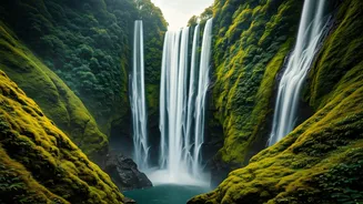
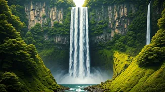
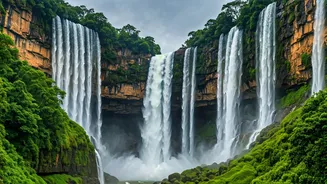
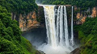
A Symphony of Liquid Thunder
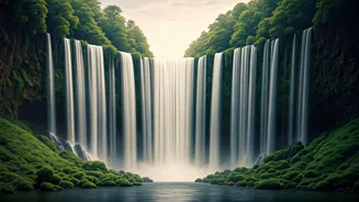
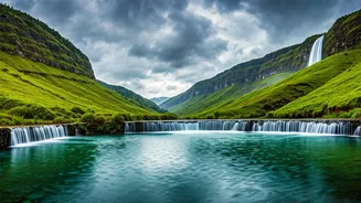
This colossal downpour feeds a network of waterfalls that, during the monsoon, become almost terrifyingly powerful. This is what “maximum volume” truly means. Chief among them is Nohkalikai Falls, India's tallest plunge waterfall. In the dry season, it’s a single, elegant cascade. But right now, it’s a raging torrent that plummets over 1,100 feet into a turquoise pool, its roar echoing for miles. The spray creates a permanent cloud of mist at its base. Then there are the Nohsngithiang Falls, better known as the Seven Sisters Falls. This seven-segmented cascade streams over the edge of a wide limestone cliff. During the peak monsoon, the segments merge into one massive, formidable curtain of water, a breathtaking display of raw natural power that seems to tear the sky open. It’s not just a sight; it's a full-body experience, with the ground seeming to vibrate from the sheer force of the water.
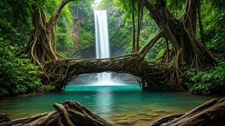
The Living Root Bridges
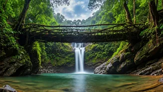
How do you build a bridge in a place where wood rots and steel rusts in months? For centuries, the indigenous Khasi and Jaintia people have had an ingenious solution: they don’t build bridges; they grow them. Using the aerial roots of the Ficus elastica tree, they guide them across rivers and streams, weaving them over years and even decades into sturdy, living structures. These double-decker root bridges, some over 100 feet long, are a stunning example of bio-engineering and a testament to patient, symbiotic living. They are strongest during the monsoon when they are most needed, their living structure easily withstanding the force of the swollen rivers below. These bridges are more than just infrastructure; they are a living, breathing symbol of how to adapt and thrive in one of Earth’s most extreme environments.
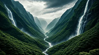
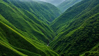
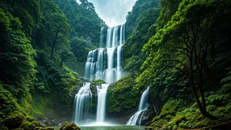
A Landscape Drenched in Green
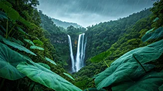
The result of all this water is a landscape of almost impossible vibrancy. The rain washes the air clean and saturates every color. The hills are cloaked in a shade of green so deep it’s almost surreal. This isn’t the muted green of a temperate forest; it’s a loud, electric, chlorophyll-fueled explosion of life. Moss covers everything—rocks, tree trunks, and old stone walls—giving the entire area a fantasy-novel feel. Beyond the waterfalls and bridges, the region is also home to a network of ancient caves, their limestone formations carved by millennia of dripping water. Exploring this world is to step into a place where water is not just an element but the dominant creative and destructive force, constantly shaping and reshaping a world that feels both ancient and intensely alive.