


Beyond the Postcard View
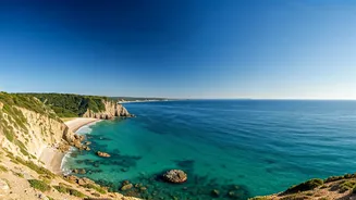
Imagine a coastline stretching for over 600 miles, dotted with fishing villages, ancient temples, and bustling port cities like Visakhapatnam (often called Vizag). This is the allure of Andhra Pradesh, a state that offers a less-traveled alternative to
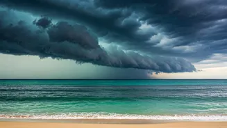
Goa for intrepid sun-seekers. Beaches like Rushikonda are magnets for their beauty, while RK Beach in the heart of Vizag pulses with local life. It's an intoxicating mix of natural wonder and cultural vibrancy. But for all its beauty, the Bay of Bengal is not the Caribbean. This is a powerful, dynamic body of water with a reputation that local communities respect deeply. For travelers, especially those accustomed to more placid coastlines, understanding this difference is the first and most crucial step in planning a safe and memorable trip. The stunning vista hides powerful forces that aren't always obvious to the untrained eye.
Understanding the Weather Calendar
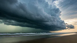
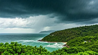
When you check the forecast for a beach day in the U.S., you're probably looking for sun, temperature, and maybe a chance of rain. In Andhra Pradesh, you need to think in seasons, not just days. The primary concern is the cyclone season. The Bay of Bengal is a major global hotspot for tropical cyclones. While they can occur at other times, the main season runs from October to December, coinciding with the northeast monsoon. This isn't just about a heavy downpour; it's about storm surges, destructive winds, and dangerously high seas that can make coastlines treacherous. Even a cyclone that makes landfall hundreds of miles away can generate massive swells and life-threatening rip currents along the entire Andhra coast. A sunny day can be deceptive if a storm is churning far out at sea. This is why a simple “sunny” icon on your app is dangerously incomplete information.
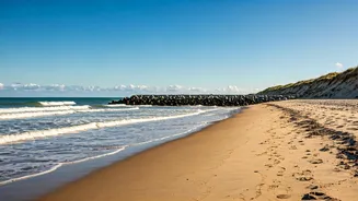
The Invisible Danger: Rip Currents
Even on a perfectly calm, cyclone-free day, the beaches of Andhra Pradesh present a hidden threat: rip currents. These powerful, narrow channels of fast-moving water can pull even the strongest swimmer away from the shore in seconds. They are a frequent cause of drowning incidents along this coast. Unlike big waves, rips can be hard to spot. They often appear as a calmer, choppier, or discolored patch of water, which inexperienced swimmers might mistakenly see as a safe spot. Local authorities and news outlets regularly issue warnings, and many popular beaches have designated safe swimming zones or display warning flags. Heeding these local signals is non-negotiable. Pay attention to red flags, listen to lifeguards, and talk to the staff at your hotel. They understand the daily and even hourly changes in sea conditions far better than any generalized forecast.
Your New Forecast Checklist
To travel smartly and safely, you need to upgrade your forecast-checking routine. Think of it as a pre-flight checklist for your beach day. First, expand your sources. Don't just rely on a default weather app. Check the official website of the Indian Meteorological Department (IMD), which provides detailed bulletins on cyclones and other severe weather. Second, look beyond temperature and rain. Search for the marine forecast, which includes wave height, swell period, and tide schedules. A long swell period, for example, can indicate powerful waves generated by a distant storm. Third, contextualize the forecast. If you're traveling between October and December, maintain a high level of vigilance for cyclone warnings, even if your trip is weeks away. Finally, once you're there, supplement digital data with analog observation. Talk to local people, look for posted signs, and always treat the ocean with profound respect. Never swim alone, and if in doubt, don't go out.