






The Bay of Bengal’s Volatile Engine
The state of Andhra Pradesh, with its 600-mile coastline, sits on the edge of one of the world's most dangerous bodies of water for tropical cyclones: the Bay of Bengal. While the Atlantic hurricane season gets more attention in the U.S., the storms that
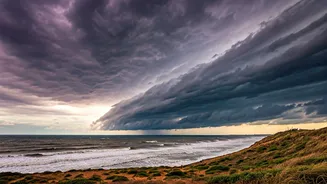
form here are historically among the deadliest. The bay’s shallow, warm waters act like a pressure cooker, rapidly intensifying weather systems, particularly during the post-monsoon season from October to December. Unlike the Arabian Sea on India's west coast, the Bay of Bengal is a far more active and ferocious cyclone basin. This annual period of meteorological anxiety is what insiders call “delay-watch season”—a time when port authorities, disaster management teams, and coastal residents hold their breath, tracking satellite images and weather bulletins with a familiar sense of dread. The question is never *if* a storm will form, but where it will make landfall and how strong it will be.
An Economic Powerhouse in the Crosshairs
Andhra Pradesh isn't just a stretch of coastline; it's an economic engine for India and a critical node in global supply chains. The state is home to major ports like Visakhapatnam and Krishnapatnam, which handle enormous volumes of cargo, from iron ore and coal to agricultural products. When a cyclone approaches, these ports shut down. Ships are ordered out to sea to ride out the storm, and all loading and unloading activities cease. These delays ripple outward, affecting shipping schedules and supply lines across Asia and beyond. But the biggest economic vulnerability lies in the water itself. Andhra Pradesh is known as “the shrimp bowl of India,” accounting for the majority of the country's farmed shrimp production. These aquaculture farms, vast grids of ponds located in low-lying coastal areas, are exquisitely vulnerable to storm surges and flooding. A single major cyclone can wipe out an entire season's harvest, devastating an industry that sends a significant portion of its product to dinner plates in the United States and Europe.
The Human Cost on a Crowded Coastline
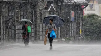
Beyond the economic statistics are the millions of people who call this vulnerable coast home. Densely populated fishing villages and agricultural communities line the shore. For them, a cyclone warning triggers a well-rehearsed but terrifying drill. Fishermen are ordered to secure their boats and stay ashore, cutting off their only source of income. Families in low-lying areas must pack what they can and evacuate to government-run shelters, often for days at a time. While India’s disaster preparedness has improved dramatically in recent decades, the disruption is immense. The psychological toll of living through repeated evacuations, losing homes, and rebuilding livelihoods is a constant feature of life here. The storms don't just destroy infrastructure; they wash away years of progress for the region's most vulnerable residents, trapping them in a cycle of recovery and risk.
A System Honed by Tragedy
This annual threat has forced Andhra Pradesh, and India as a whole, to become a world leader in a very specific skill: mass evacuation. The turning point was the 1999 Odisha “Super Cyclone,” which killed an estimated 10,000 people and exposed a catastrophic failure in early warning and response. Since then, the Indian Meteorological Department (IMD) has developed a sophisticated tracking and forecasting system, providing precise and timely alerts. State governments have built a robust network of cyclone shelters and honed their evacuation protocols. When Cyclone Hudhud, a Category 4 storm, bore down on Visakhapatnam in 2014, authorities successfully evacuated nearly half a million people, limiting the death toll to just over 100—a number that would have been tragically higher just a decade earlier. This system is tested every year, turning the “delay-watch season” into a massive logistical operation aimed at saving lives, even if property and livelihoods cannot always be protected.