


What's Behind This 'Monsoon' Weather?
While the term 'monsoon' might bring to mind the seasonal rains of South Asia or the U.S. Southwest, meteorologists are using it to describe the character, not the climatology, of this event. What the Northeast is experiencing is a stubborn weather pattern
where a stalled frontal boundary acts like a conveyor belt, pulling vast amounts of humid, tropical air northward from the Atlantic and the Gulf of Mexico. Unlike a typical summer thunderstorm that passes quickly, this setup leads to prolonged periods of moderate to heavy rain over the same areas. This training effect, where storm cells repeatedly move over one location, can dump several inches of rain in a short time, overwhelming drainage systems and saturating the ground. The result is a pattern of drenching, persistent rainfall that feels less like a familiar New England shower and more like a tropical downpour, justifying the dramatic 'monsoon' label in spirit, if not in a strictly scientific sense.
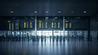
Airports Under Pressure
For air travelers, this weather pattern is a recipe for chaos. The Northeast corridor contains some of the nation's busiest and most delay-prone airports, including New York’s JFK, LaGuardia, and Newark, as well as Boston Logan and Philadelphia International. Heavy rain and low cloud ceilings severely reduce visibility, forcing air traffic control to increase the spacing between landing aircraft. This directly lowers the number of planes an airport can handle per hour, creating a ripple effect of delays. Furthermore, ground crews face hazardous conditions from lightning, leading to ground stops where planes can neither park at gates nor push back for departure. The cascading impact means that even if the weather clears at your departure city, your plane or crew might be stuck elsewhere. Travelers should expect delays and cancellations to be common and are advised to check their flight status obsessively, sign up for airline text alerts, and consider building extra buffer time into their itineraries.
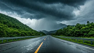
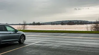
On the Road: A Deluge of Dangers
Driving during these conditions presents its own set of significant risks. The most immediate threat is flash flooding. When heavy rain falls on paved urban surfaces or already saturated soil, the water has nowhere to go, quickly turning roadways into rivers. Underpasses, low-lying highways, and areas with poor drainage are especially vulnerable. The National Weather Service’s warning, 'Turn Around, Don’t Drown,' is critical advice; it is nearly impossible to judge the depth of standing water, and just six inches can be enough to cause loss of control or stall a vehicle. A foot of water can float many cars. Beyond flooding, heavy rain dramatically reduces visibility and increases the risk of hydroplaning, where tires lose contact with the road surface. Drivers should reduce their speed significantly, increase following distance, ensure their tires have adequate tread, and be prepared to pull over or alter their route if conditions become too severe.
How to Stay Safe and Prepared
Whether you're traveling or staying home, a few preparations can make a major difference. If you must travel, have a backup plan. Know alternate driving routes and be mentally prepared for your flight to be canceled. Pack snacks, water, and charging banks in your carry-on, as you may be spending more time at the airport than planned. If you're at home, take a moment to ensure your storm drains and gutters are clear of debris to help prevent localized flooding. If you have a basement or sump pump, check that it's in working order. The most important tool, however, is information. Keep a close eye on forecasts from the National Weather Service and heed all alerts and warnings issued by local authorities. Having a weather app with real-time radar and push notifications for flash flood warnings can provide crucial, timely information that helps you make safe decisions for yourself and your family.