


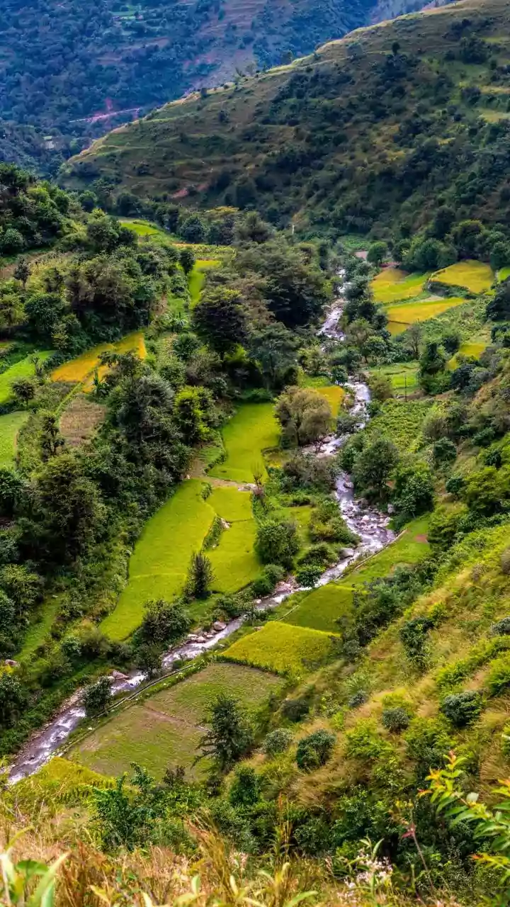


Mawsynram: India's Cloudburst Capital
Nestled within India's Meghalaya state, Mawsynram holds the prestigious title of the wettest place on Earth. This region consistently experiences an average
annual rainfall exceeding 11,000 mm. Its prime location within the Khasi Hills, directly in the path of the Bay of Bengal monsoon, makes it a natural funnel for intense precipitation. The landscape is a testament to this constant moisture, a vibrant panorama of lush, rolling hills adorned with numerous waterfalls and intricate living root bridges, a marvel of engineering and symbiosis crafted by the indigenous Khasi people over generations. This sustained deluge nourishes an environment of unparalleled greenery and ecological richness, showcasing the profound impact of extreme rainfall on natural and human landscapes. The sheer volume of water shapes daily life and the very essence of this unique locale, turning it into a natural wonder of the world where rain is not just a weather event, but a defining characteristic.
Cherrapunji: A Neighbor's Drenching
Just a stone's throw from Mawsynram, Cherrapunji, once crowned the wettest place on Earth, continues to register extraordinary rainfall figures. This location, also in Meghalaya, India, is renowned for its dramatic topography, featuring sheer cliffs that plunge into misty valleys, enigmatic caves, and breathtaking waterfalls like the majestic Nohkalikai Falls. Cherrapunji serves as a powerful illustration of how relentless rainfall can sculpt and define natural beauty. The constant flow of water over millennia has carved out its unique geological features, from the deep gorges to the impressive cascades. The surrounding environment is perpetually verdant, a consequence of the abundant moisture that sustains a rich and diverse flora. This constant precipitation creates a mesmerizing, often ethereal, landscape that draws visitors with its raw, untamed beauty and the sheer force of nature on display. It's a place where the elements have left an indelible mark, creating a spectacle of water and stone.
Tutunendo: Colombia's Rainiest Haven
In the vibrant Choco region of Colombia lies Tutunendo, recognized as one of South America's most rain-drenched inhabited areas. This locale consistently records rainfall surpassing 11,000 mm each year, experiencing precipitation on an almost daily basis. The relentless downpours are the lifeblood of the surrounding tropical rainforest, fostering an environment of exceptional biodiversity. This high level of consistent rainfall fuels an ecosystem teeming with an astonishing array of plant and animal life, making it a hotspot for conservation and ecological study. The dense vegetation and the sheer volume of water contribute to the unique climate and natural splendor of the region. Tutunendo is a prime example of how extreme wetness can cultivate unparalleled biological richness, creating a verdant paradise where life flourishes under a constant canopy of rain and mist. The daily rhythm of life here is intrinsically linked to the water cycle, shaping both the environment and the culture.
Debundscha: Cameroon's Coastal Downpour
Located at the foot of the imposing Mount Cameroon, Debundscha experiences significant rainfall, with annual averages reaching approximately 10,000 mm. This phenomenon is largely driven by moisture-laden winds originating from the ocean that are forced to ascend and cool as they encounter the mountain's slopes. Despite the challenges posed by such extreme weather conditions, the region is celebrated for its captivating coastal vistas and the dramatic volcanic backdrop provided by Mount Cameroon. The interplay between the ocean winds and the mountain's elevation creates a consistent pattern of heavy precipitation, nurturing the lush greenery that blankets the lower slopes and coastal areas. The stark contrast between the verdant, rain-soaked land and the imposing, often cloud-shrouded, volcanic peak offers a unique and striking scenic beauty that captivates visitors and residents alike. Life here is adapted to the constant presence of water, creating a distinct and resilient community.
Cropp River: New Zealand's Record Holder
The Cropp River area, nestled within New Zealand's Southern Alps, holds an impressive record for the highest rainfall recorded in a single year, exceeding an astonishing 18,000 mm. The region’s dramatic topography plays a crucial role in generating such intense and frequent precipitation. As moisture-rich winds sweep in from the Tasman Sea, the formidable mountain range compels them to rise rapidly. This rapid ascent causes the air to cool quickly, leading to the condensation of water vapor and consequently, extreme rainfall. The geographical configuration of the Southern Alps acts as a natural barrier, maximizing the collection of atmospheric moisture. The result is an environment characterized by relentless downpours, shaping the rugged and dramatic landscapes of this part of New Zealand. It's a powerful demonstration of how geological features can amplify meteorological patterns, creating a truly unique and exceptionally wet climate.